

Cactus actually grows along the beach at a State Park in Long Island, the southernmost point in New York State.
At 120 miles long and 23 miles at its widest point, Long Island is home to nearly 8 million people, making it the most populated island in the United States, but also has places wild and remote to hike and explore nature. This region is noted for its beaches, golf courses, arboretums and grand estates, containing 30 State Parks and two arboreta to enjoy. The eastern end of Long Island is forked, and at the end of each fork is a State Park: Montauk on the south and Orient Beach on the north.
Formed by glacial movement that ended some 10,000 years ago, Long Island readily exhibits its origins, from the rocky bluffs of the north shore, including giant boulders, called glacial erratics, to the fine grained, sandy beaches of the south shore, remnants of the glacial outwash plain. The region’s parks highlight many of these features, providing wonderful opportunities to get out and explore!
To start, any successful hike starts with a good map. Maps for hiking trails and a variety of other useful information on State Parks, including those in the Long Island region and other regions, are now available on the NYS Parks Explorer app. The free app, which is available for use on Android and iOS devices, is easy to download, user friendly and allows patrons to have park information readily available every State Parks facility across the state.
Trail maps are also available on each individual park website page at parks.ny.gov and at the main office of each park. Links to maps are also included in the trail descriptions in this post. Be sure to download maps ahead of time to your phone or tablet, and maybe even carry a paper copy as a back up to aid your hike.
As with all hikes, there are a few things to remember beyond carrying a mobile phone. Check the weather forecast before you go, and dress appropriately. Wear sturdy, yet comfortable shoes or boots, bring enough water and snacks, and perhaps carry a camera to capture what you see. Be mindful of wildlife and give it appropriate space, particularly in areas marked as protected, such as for shorebird nesting.
Always be aware of your surroundings and mindful of hikes on steep terrain or those that go near cliff tops. Having a small first-aid kit available in case of an emergency is never a bad idea.
Hiking poles are also useful on longer hikes and can transfer some of the stress of hiking from your knees and legs to your arms and back.
Hikers should plan their route in advance, know how long a trail is and how long it ought to take to finish. If weather conditions change for the worse, be prepared to turn back. Don’t let a desire to reach a specific destination make you press on. Since daylight is not an unlimited resource, even in spring and summer when days are longer, tossing a flashlight or headlamp into your backpack is a good form of insurance, should you unexpectedly find yourself on the trail as dusk approaches.
State Park facilities are carry-in, carry-out, so don’t leave trash behind. Follow Leave No Trace principles to keep trails clean for everyone.
Additionally, as incidents of tick-borne diseases surge in the state, it is always important to check yourself for ticks after being outside, even if it is only time spent in your own backyard.
Lastly, as the COVID-19 pandemic continues, remember to practice safe social distancing, particularly in parking lots and at trailheads, and use face coverings when a distance of six feet cannot be maintained, even if you have been vaccinated. To learn more about important COVID safety guidelines, click HERE.
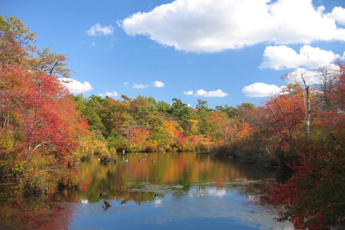
Hempstead Lake State Park, 100 Lake Drive, West Hempstead (516)766-1029: Situated in western Long Island, this park is a family-friendly facility that includes playgrounds and picnic areas. Within its 737 acres are several bodies of water: Hempstead Lake, the largest lake in Nassau County, as well as Northwest Pond, Northeast Pond, MacDonald Pond, Shodack Pond and South Pond. Popular for picnicking and fishing, this suburban park offers peaceful nature walks. A lovely green oasis surrounded by suburbia, it is a good spot for bird watching, and the colorful oak forests reflecting off the water are beautiful in the fall.
Some popular trails include:
- Blue: 1 mile – Located on the North side of the Southern State Parkway, starting near Eagle Ave, this secluded natural trail overlooks North West Pond and meets the Green Trail near Hempstead High School.
- Green : 1 mile – Also located on the North side of the Southern State Parkway, this natural trail runs parallel to the green trail. It has views of the Hempstead Golf and Country Club, connecting to the Blue Trail near Hempstead High School.
- Red: 3 mile – Located South of the Southern State Parkway, this natural trail overlooks Hempstead Lake. Parallel hiking trails exist along the shoreline on the East and West sides of Hempstead Lake.
- Bike trail: 2.4 mile – Mostly paved, this trail connects the parking fields, playgrounds, and walking paths throughout the park. Sections of the trail are on service drives with vehicular traffic.
Find a trail map here.
Getting there: Take exit 18 off the Southern State Parkway. Make a right off the exit and follow the road south to reach the parking lots.
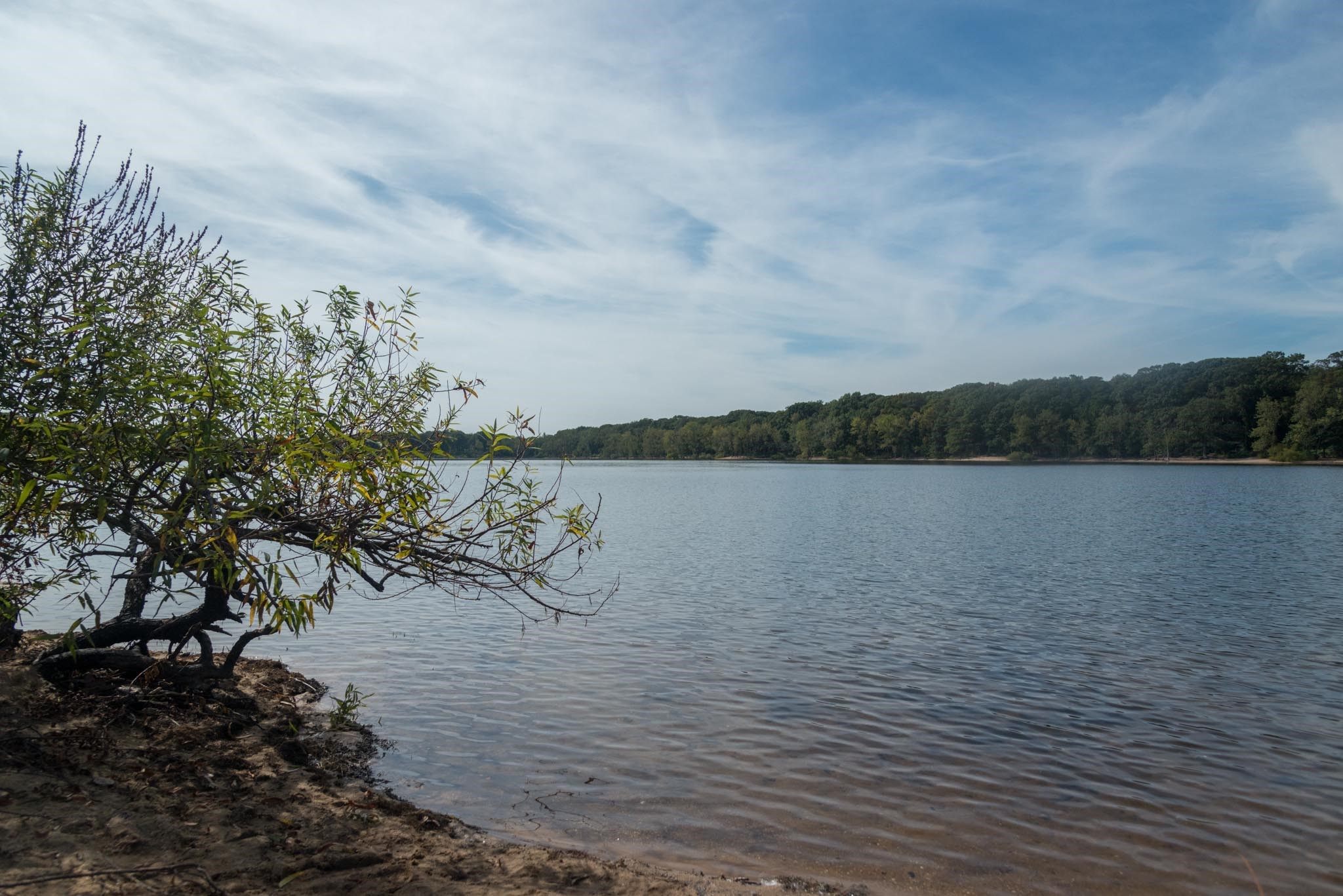
Connetquot River State Park Preserve, Oakdale (631) 581-1005: At 3,473 acres, this preserve on the South Shore is the largest State Park on Long Island. A former hunting and fishing club, the land has been protected from development for more than 150 years. As a result, it is a pristine area that is home many rare species. The Preserve had more than over 50 miles of trails, but there are five established marked trails.
Yellow: 1 mile long (2 miles round trip) an easy walk through oak forest that ends at the trout hatchery, where trout have been raised for over 100 years.
Red: 1.5 miles – travels on the east side of the river, the red trail weaves through pine and oak forest and also ends at the hatchery. Either the red or the yellow trails can be taken back to the parking lot.
Green: 3.6 miles – travels the north – south length of the park.
Blue: 8 miles – a long loop that goes through some of the less travelled areas of the preserve.
Greenbelt: 4.4 miles – the Greenbelt trail runs between the north and south shores of Long Island, and part of it travels through the preserve.
Find a trail map here.
Getting there: the only entrance to the Preserve is located on the westbound side of Sunrise Highway (Route 27) in Bohemia.
Camp Hero State Park, 1898 Montauk Highway, Montauk (631) 668-3781: Located on the tip of the south fork, this unusual facility covers 415 acres of woodlands and bluffs overlooking the Atlantic Ocean. It was once a U.S. military installation commissioned for coastal defense during World War II that was disguised to look like a fishing village.
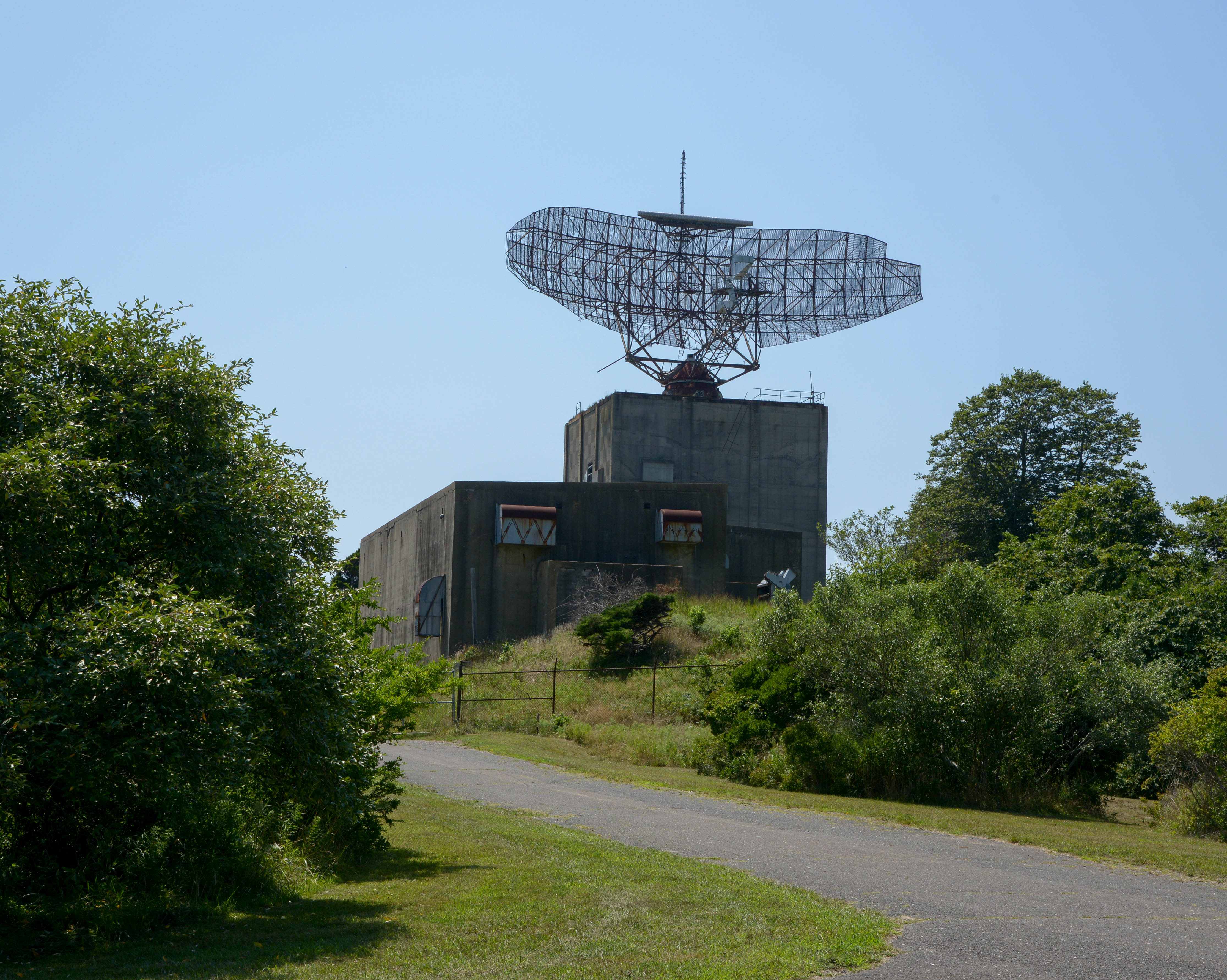
Listed as a National Historic Site, the park opened in 2002 and includes several trails, including the Paumonok Trail at 3.4 miles that travels around the park an and offers dramatic ocean views, as well as shorter trails of a half-mile or less that lead to the historic military buildings.
The bluffs here feature a geological formation called hoodoos, which are tall, thin spires of rock or hardened soil. Hoodoos typically consist of relatively soft rock topped by harder, less easily eroded stone that protects each column from the elements.
Find a trail map here.

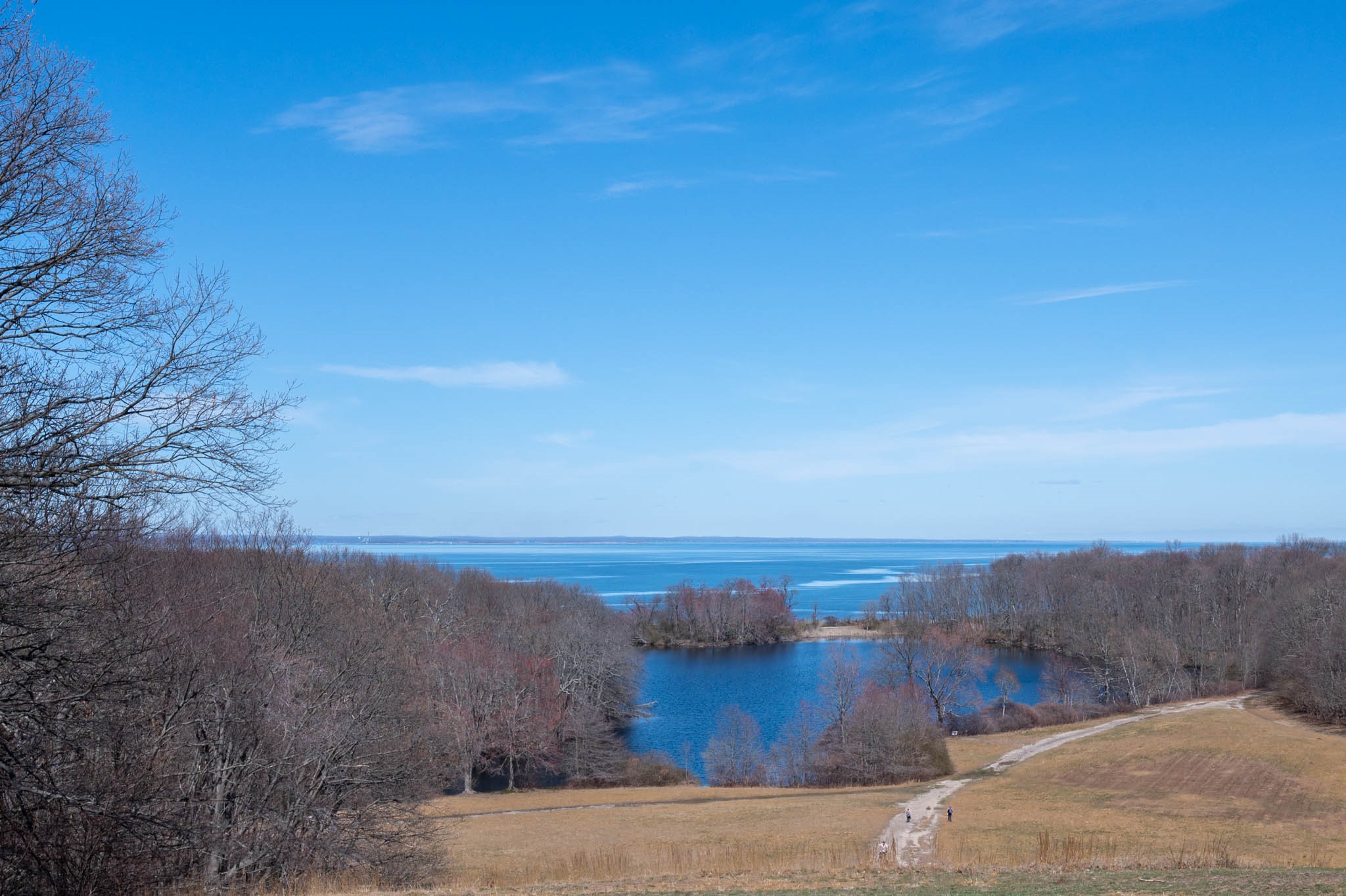
Caumsett State Historic Park Preserve, 25 Lloyd Harbor Road, Huntington (631) 423-1770): The park has roots in history, residing on the former grounds of the 1750-acre estate of investment banker and philanthropist Marshall Field III. Developed in 1921, it was a self-sufficient farm including its own water and electrical supply. Many of the structures still exist.
Earlier history can be found at the 1711 Henry Lloyd Manor house. The land has several different ecosystems including pine forests, a freshwater pond, tulip poplar forests, a saltwater marsh, and grasslands.
This large park has many trails for pedestrians, equestrians and cyclists. The most popular is the 2.4 mile paved loop trail, which is bicycle and stroller-friendly. The trail passes the Marshall Field III estate, which offers a beautiful vista of the Fresh Pond, the Long Island Sound, and Connecticut.
Find a map here.
Getting there: From Main Street in Huntington, take West Neck Road north for about 4.5 miles, where it will become Lloyd Harbor Rd. The entrance will be on the left in about .4 mile.
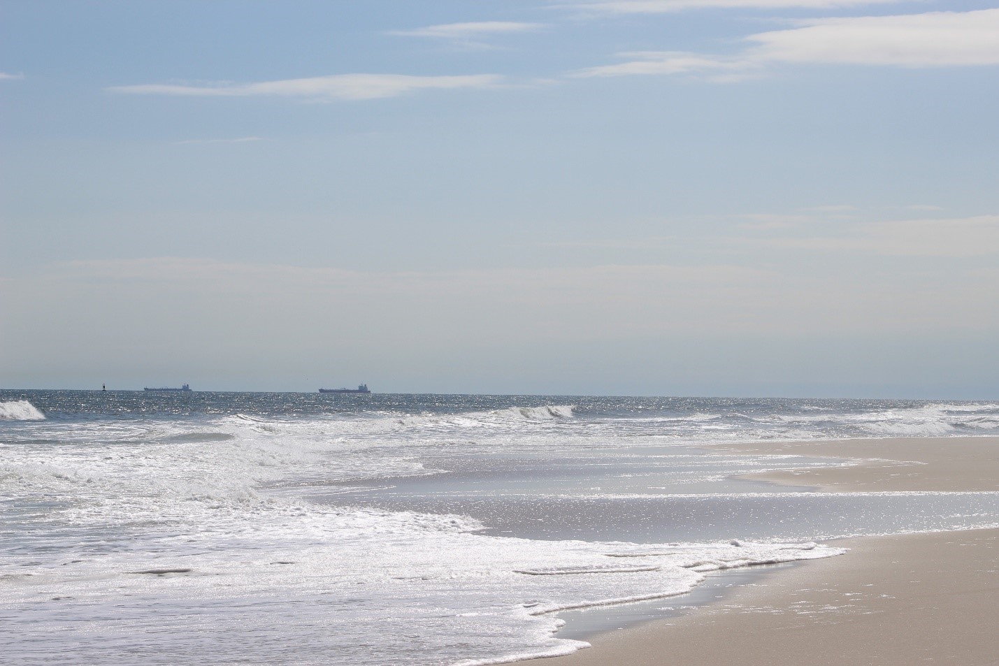
Jones Beach State Park, 2400 Ocean Parkway, Wantagh (516) 785-1600: With more than 2,400 acres of marine environment, the flagship park at Jones Beach is a unique spot located on the south shore bordering the Atlantic Ocean, offering seven miles of fine-grained white quartz-sand beachfront to enjoy. The pristine area of the West End includes more than 100 acres of coastal dune habitat. There are no established trails, but there are eight parking lots, each one provides access to the beachfront, and the ocean vistas are unrivalled.
Birders and those seeking a quieter experience can watch for a variety of shore birds, such as oystercatchers, terns, skimmers, plovers, and many more. Children can collect shells along the seashore and encounter large horseshoe crabs. A pleasant pastime is a long, leisurely walk on the beach to the east or west of the central part of the park, where fewer people will be encountered.
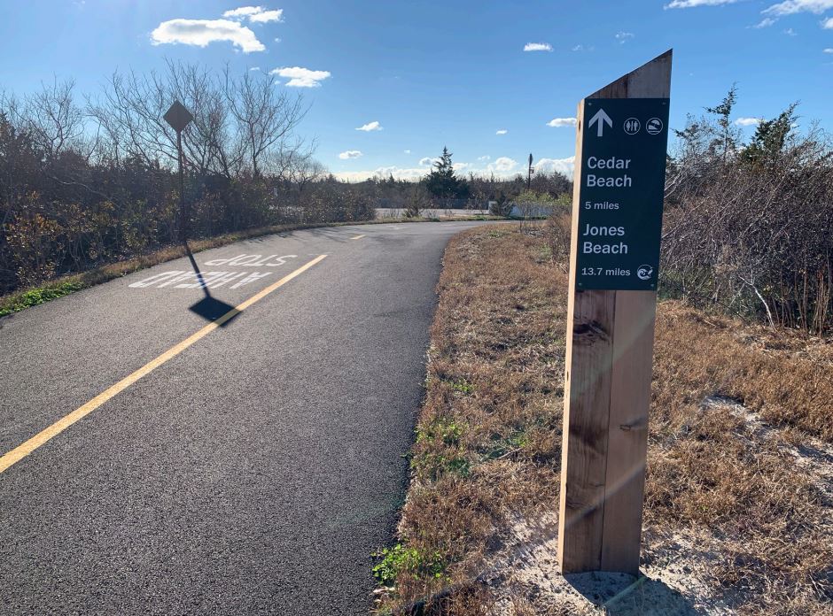
Those who wish to ride their bikes may do so year-round on our boardwalk. Glide along the beach on Long Island’s premier bike path, the Ocean Parkway Coastal Greenway, which begins at Cedar Creek Park in Seaford. From there it’s a 5.4 mile ride to Jones Beach’s East Bathhouse on the Boardwalk. There you can either lock up your bike for a stroll, or keep cycling to the food concessions.
Or stay on the extension on the north side of Ocean Parkway to pedal another 3.6 miles to Tobay Beach where there are more restaurants and a playground. The bike path extends even further east, 13 miles, to Captree State Park. Restrooms are available on the bikeway at mileage 5.4 to 9.
At Jones Beach, if you choose to stay the path of the two-mile boardwalk, the new multi-use path extends from the boardwalk at Field 1 to the West End area of the park for an additional 2.3 miles.
Find a map here.
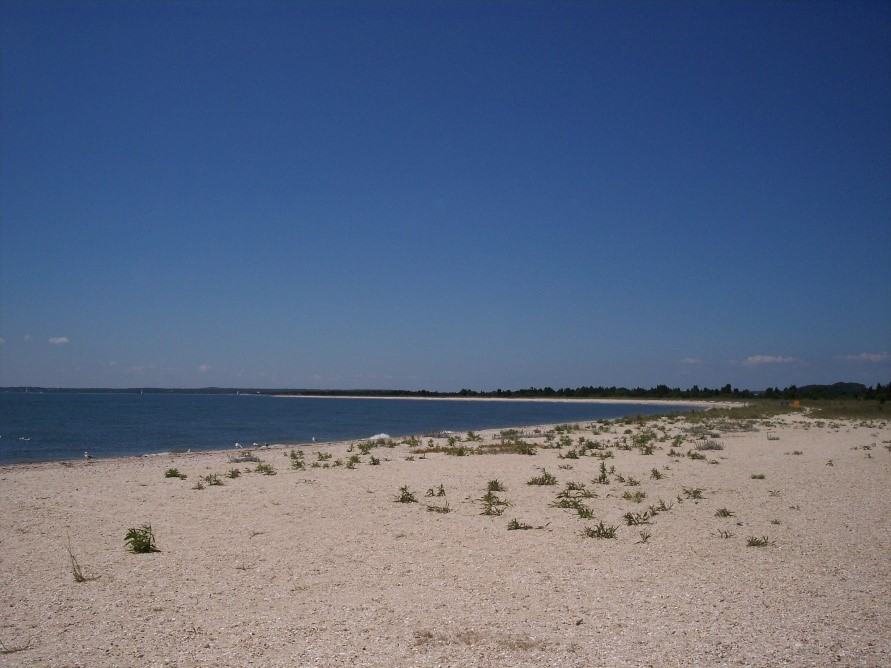
Orient Beach State Beach Park, 4000 Main Road (Route 25), Orient (631) 323-2440: Located on the eastern tip of the north fork of Long Island, this unique 363-acre park stretches southwest into Gardiners Bay. It has a playground, picnic areas, kayak rental and more than eight miles of waterfront beach.
A walk west on the beachfront goes along ‘Long Beach’, a rich ecosystem which was designated a “National Natural Landmark” in 1980. Native prickly pear cactus is abundant there. At only .3 miles, the Roy Lathan trail has interpretive signs that highlight the unique flora and other shore plants.
The park also is open for kayakers, with water routes around Hallock’s Bay and the Gardiner’s Bay side of Orient Point as described in this guide.
Find a trail map here.
Getting there: Head east on Sound Avenue, which will become Route 48 and then Route 25, which will take you to the end of the island. The entrance in on the right.
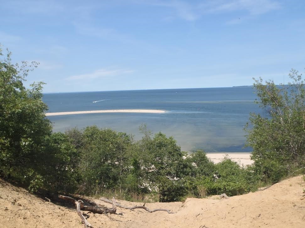
Sunken Meadow State Park: Rte. 25A and Sunken Meadow Parkway, Kings Park (631) 269-4333: Located on the north shore of Long Island, Sunken Meadow State Park has 1,287 acres and a variety of habitats, including woodlands, tidal creek, saltwater marshes and about 1.5 miles of beachfront. Amenities include swimming, kayak launch, playgrounds, ball fields, picnic areas, golf course, and a .75-mile boardwalk along the beach.
There are unmarked trails through the woodlands, many that are used for cross country track meets. Some of the more popular trails include:
Wetland trail: The trail is a 2.6 mile out-and-back trail that runs alng the saltmarsh, through woodlands and back along the creek to the inflow of fresh water near the southern border of the park.
Greenbelt Trail: This 32-mile trail spans the width of the island from Hecksher State Park on Great South Bay north to Sunken Meadow State Park being the northern most point. In the park, the Greenbelt Trail traverses 2.5 miles, and offers beautiful views from the bluff of the Long Island and Connecticut.
Get a trail map here.
Getting there: Head north on the Sunken Meadow Parkway, which ends at the park.
Cover Shot – Prickly pear cactus grows in the sandy soil at Orient Beach State Park. All photos by NYS Parks.
