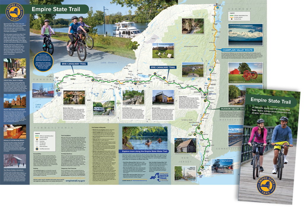
From New York City through the Hudson River and Champlain Valley up to Canada, and from Albany to Buffalo along the Erie Canal, New York State’s 750-mile Empire State Trail is the longest single-state multi-use trail in the United States. Weaving in and out of village main streets, urban centers, and rural communities across the state, the Empire State Trail provides a safe and scenic pathway for residents and tourists to experience New York’s varied iconic landscapes, rich history and diverse recreational offerings one mile at a time.
The Empire State Trail is also open year-round, including winter, welcoming bicyclists, walkers, cross-county skiers and snow-shoers of all ages and abilities. This National Trails Day, we celebrate this jewel of the New York State Parks system, which connects 20 regional trails to create a continuous statewide signed route –75 percent of which is off-road on a mix of gravel and paved paths.
In this first installment of our Empire State Trail itineraries series, we invite you to explore the Capital Region, Central New York, Mid-Hudson Valley, and Western New York. We’ll see you out there!
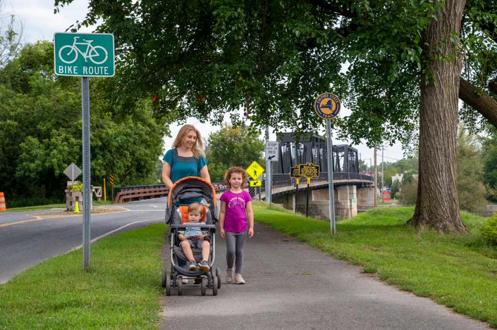
Capital Region
Albany sits at the crossroads of New York’s history. One of the first cities established by the colonial Dutch, and the origin point of the Erie Canal, the state’s capital has been the epicenter for some of the Empire State’s most foundational moments. Once a bustling center of trade, the city played a leading role in the growth of New York. On this ride, you’ll pedal along a route not too dissimilar to that of ships accessing the Erie Canal more than a century ago.
The first route offers a fun experience for riders of all ages and abilities. A mostly flat and paved off-road trail, this segment makes for an 8.5-mile round trip, best suited for families, trail walkers, and those looking for a casual riding experience. The second route is an 11-mile round trip journey best suited for experienced adult riders and features some unprotected on-road biking. Combining the two routes turns a casual excursion into a 22-mile round trip through three cities, a village, and a state park.
Route 1: “Riding the Western Banks” – Corning Preserve to Watervliet
Distance: 8.5 miles round-trip (EST segment)
Our journey begins in the heart of Albany at the Corning Preserve, a 15-acre municipal park nestled between I-787 and the Hudson River. Here you will find ample parking, public restrooms, and a three seasons bike share station.
While in downtown Albany, there are a few detours you can make before even starting your ride. Located roughly 1-mile riding distance from the start point, you can visit the State Capitol building, State Museum, and Pearl Street, which has numerous options for a pre-ride snack.
Once you’re ready to head off, you’ll pedal north along the Empire State Trail past the original Erie Canal lock 1, now long built over. Hugging the banks of the Hudson, you’ll take in beautiful riverfront views and may even be treated to the sight of boats making their way to and from the modern Erie Canal. Since this off-road trail is tucked between an interstate and the river, there are not many opportunities to detour. However, along the route there are numerous exercise stations and an opportunity for a picnic at the Schuyler Flatts Cultural Park.
This 4.25-mile section ends once you’ve reached the Hudson Mohawk Bike Hike Trail trailhead parking area in Watervliet. From here it is a quick U-turn back towards downtown Albany. This route could also be done in reverse, starting at the Watervliet parking area, located at 330 Broadway, turning a casual bike ride into a daytrip in downtown Albany. In all this trip makes for an 8.5-mile round trip bike ride or riverside walk.
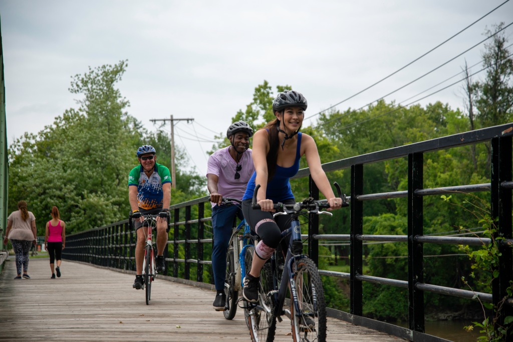
Route 2: “New York’s Crossroads” – Watervliet to Peebles Island State Park
Distance: 11 miles round-trip (EST segment)
Starting at the Watervliet trailhead parking area for the Hudson Mohawk Bike Hike Trail, this 11-mile round trip journey is geared towards experienced bike riders, who are comfortable on roadways. Although somewhat technical, this route is a great showcase of the Empire State Trail’s ability to connect communities to state parks.
Leaving the parking lot, you’ll make a quick turn on to Broadway and proceed northbound. On Broadway, you’ll ride along a mostly protected bike path with several opportunities to detour. The arsenal city’s 25th Street and 3rd Avenue host several restaurants favorited by locals, including one recently added to the New York State Historic Business Preservation Registry.
On the corner of Broadway and 23rd Street, stay alert as the protected bike lane ends. Although just under a half mile, the next series of intersections are the most complex of the entire journey. Use extreme caution and remember to use and obey all traffic signals when riding on the road.
At the intersection of Albany Avenue and Lower Hudson Avenue, you’ll have an opportunity to once again detour across the Green Island bridge into the City of Troy. Once a regional center for industry, today Troy is known for its walkable downtown, large farmers market, modern restaurants, and vibrant arts scene.
Continuing along the Empire State Trail, you’ll pass through the Village of Green Island and reach the crossroads of New York! It is here where the Empire State Trail splinters off and the Hudson and Mohawk rivers meet. Following the westbound trail markers, you’ll be introduced to an entirely new realm of possibilities as the trail follows the Erie Canal all the way to Buffalo through the city of Cohoes. Heading northbound and following this guide, you’ll reach Peebles Island with the rest of the trail running all the way up to the Canadian border.
Traversing north through Van Schaick Island, you’ll return to an off-road paved bike path. On the southern side of the island, there is a golf course and a municipal park granting an opportunity to rest before continuing towards Peebles Island.
Crossing over one last bridge, you’ll arrive at your destination, Peebles Island State Park. A 250-acre site, this park offers visitors opportunities for phenomenal bird watching, 3.5 miles of hiking trails, and spectacular views of flowing river rapids.
-Written by Jennifer Robilotto, Public Affairs Assistant
Central New York
The section of the Empire State Trail in Central New York has something for everybody, whether it’s water views, rural areas with lots of wildlife, state parks, historical sites, or even the opportunity to ride on a separated bike path through downtown Syracuse.
Route 1: “Round the Lake Ride” – Progress Park to Onondaga Lake
Distance: 4 miles to Empower FCU Amphitheater, 9 miles to Onondaga Lake Park in Liverpool, 18 miles round trip (Partial EST segment for reference)
If you want water views your whole ride, this route is for you! Take in the beautiful scenery of Onondaga Lake as you ride the Empire State Trail and then the Loop the Lake trail, or stop by the New York State Fairgrounds. Start at Progress Park on West Kirkpatrick Street in the Inner Harbor of Syracuse and follow the Empire State Trail past Destiny Mall to the lake, then follow the Loop the Lake trail along the western shore. If you choose to turn around at Long Branch Park, the trip will be about 18 miles. Possible spurs include going to the New York State Fairgrounds at the halfway point or going in the opposite direction from Progress Park into the city of Syracuse using the Onondaga Creekwalk.
If not riding a bike, walking from Progress Park to the Onondaga Lake Visitors Center (open Fridays from 12-4:30 pm) is 2.7 miles one way, and Empower FCU Amphitheater Park is 4 miles one way. Possible spur trips include following the Empire State Trail to the New York State Fairgrounds or going southeast from Progress Park into the city of Syracuse using the Onondaga Creekwalk – a great option to find a bite to eat after your adventure.
Route 2: “Cycling The Countryside” – State Fairgrounds to Weedsport and Montezuma
Distance: 16 miles to Jordan, 22 miles to Weedsport, 34 miles to Montezuma, one way (EST segment)
If you’re looking to get away from car traffic and into the countryside, this route might be just what you’re looking for. The section of trail between the New York State Fairgrounds and Weedsport is off-road for much of the trip and travels right next to Nine Mile Creek or the old Erie Canal. There are multiple parking areas along its length, from the large parking lot at the New York State Fairgrounds, to the Nine Mile Creek Aqueduct parking lot, the Lock 51 parking lot in Jordan, and the Route 31 parking lot at the Centerport Aqueduct, as well as several smaller lots. This allows visitors to break up the 22-mile route into more manageable sections that can be walked or biked in an afternoon.
Continuing to Montezuma National Wildlife Refuge involves another 12 miles of travel past the Old Erie Canal Heritage Park in Fort Byron to the Montezuma Audubon Visitors Center, where travelers are rewarded with bathroom facilities, camping at Lock 1 or Lock 25, and of course a diversity of wildlife viewing along Montezuma’s many walking trails. Traveling from the State Fairgrounds to the campsites at Montezuma is 34 miles one way and would make a great weekend overnight trip for cyclists.
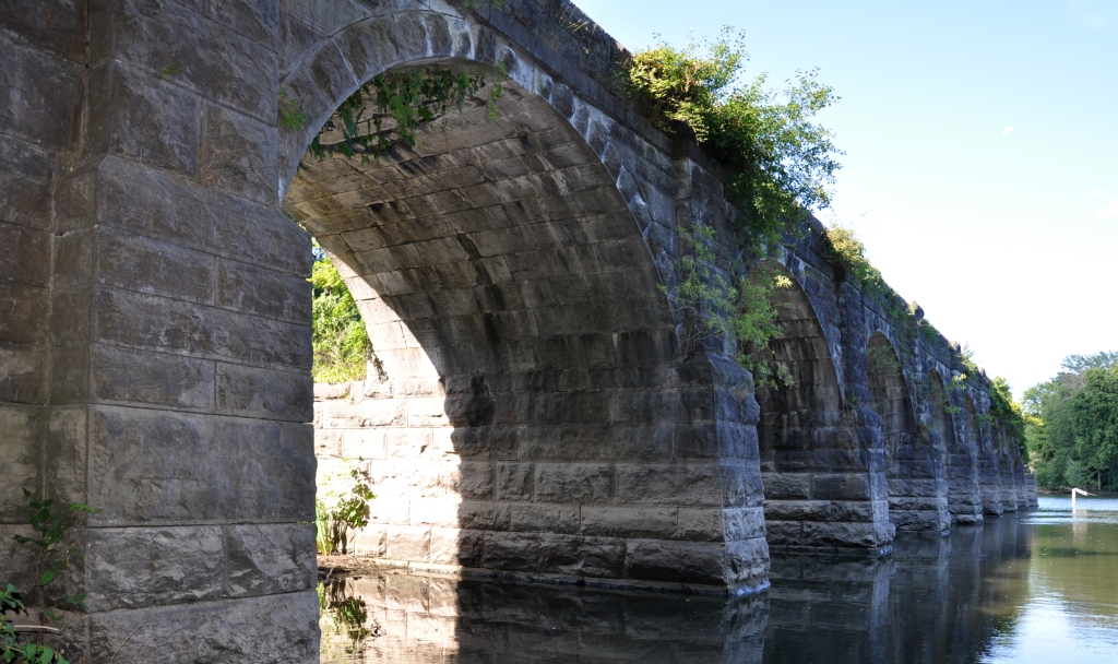
Route 3: “Ride Into History” – Dewitt to Chittenango Canal Boat Museum.
Distance: 5 miles to Green Lakes State Park, 11 miles to Chittenango, 22 miles round trip (EST segment)
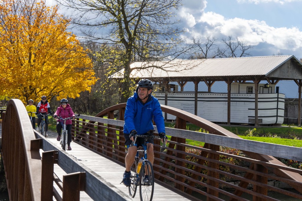
Paved sections, unpaved sections, history, views of the canal, and beautiful Green Lakes State Park – this route has it all packed into 10 miles of trail! Start at Ryder Recreation Area in Dewitt and head east along the towpath, past Cedar Bay Pavilion (restrooms available) and on to Green Lakes State Park at mile five. You can stop at Green Lakes for a refreshing swim in the deep, cool waters of Green Lakes, check out the park’s nature center, or explore miles of trails around the lake on foot or by bike. If you choose to continue east along the Empire State Trail, you will travel along a smooth stonedust path by the Erie Canal, past fields and woods until you arrive at the Chittenango Canal Boat Museum in another 5 miles. There are restroom facilities here, as well as exhibits on Chittenango’s history as a hub for building canal boats.
-Written by Garrett Boland, Trails and Accessibility GIS Specialist
Mid-Hudson Valley
There are countless opportunities to explore the Hudson Valley on the Empire State Trail, whether you’re walking from point A to point B or hopping off the trail to explore the communities you’re passing through. In eastern Ulster County, the Wallkill Valley Rail Trail portion of the EST has been widened and redone in recent years to welcome cyclists, joggers, folks pushing strollers, equestrians and more, making it a wonderful option for a day-trip adventure or longer journey.
Route: “Cement, Scenery and Cinema” – Rosendale to New Paltz (with options to add more miles)
Distance: About 7 miles to Route 299 in New Paltz, 13 miles round trip (EST segment)
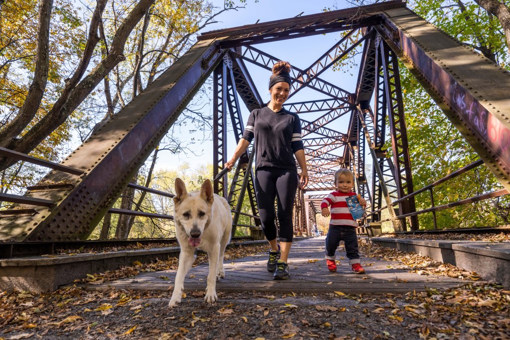
Park at the Wallkill Valley Rail Trail / Rosendale Trestle parking lot on Binnewater Road and head south (to the right) once you cross the street and access the trail. After less than a mile, you’ll be crossing the Rosendale trestle, a repurposed railroad bridge with beautiful views of the Rondout Creek and surrounding community below.

If you want to hop off the trail after the trestle, the town of Rosendale down the hill offers a number of options for grabbing a bite to eat, patronizing local businesses, and taking in regional art and culture. The town also has some rock-solid history, as it provided the hydraulic cement for several New York City landmarks, including the Brooklyn Bridge and the pedestal of the Statue of Liberty, not to mention the Washington Monument.
About a half a mile past the end of the Trestle (at Mountain Road), you’ll encounter the Lime Kiln Trail off the Empire State Trail. This 1.9-mile trail is short and sweet, and includes pretty rock formations and a lookout spot to pause for a drink of water before heading back to the EST.
For those who wish to continue on to New Paltz on the Empire State Trail, you can look forward to passing farms, views of the Shawangunk mountains on the right-hand side, and going over the Wallkill River on a bridge you may recognize from the film A Quiet Place. Heads-up, a few miles shy of New Paltz and right before that bridge, you’ll have to cross Springtown Road, a sleepy but sometimes active road, so be sure to stop and look for cars in both directions before crossing.
Once you reach New Paltz, the options for wandering are plentiful! Historic Huguenot Street, a National Historic Landmark District, is a block or so off the Empire State Trail, and dozens of eateries, shops, and scenic views are within walking distance in this funky college town that moonlights as a tourist destination.
If you want to add more miles to your journey and continue on from New Paltz, consider:
- Hopping off the Empire State Trail on Main Street to walk or ride along the local River-to-Ridge Trail, which begins just past the scenic overlook, over the Carmine Liberta Bridge. Tracing the Wallkill River before heading up to the Shawangunk Ridge, this municipal trail was opened in the last several years thanks to the Open Space Institute in partnership with Mohonk Preserve, and with support from the Butler Conservation Fund. The River-to-Ridge trail allows you to choose your own adventure with stunning open-space views (including the iconic Ridge) at every turn and tack on an additional 2 to 5 miles of on-and-off climbing if you so desire.
- Continuing on the formal Empire State Trail, which will entail some (uphill) road riding through New Paltz before putting you back on a paved trail parallel to Route 299, heading toward Highland. If you’re up to go the additional six or seven miles from New Paltz, the Empire State Trail will lead you to the Walkway Over the Hudson State Historic Park, offering a breath-taking view of the Hudson River over the world’s longest elevated pedestrian bridge.
- Heading straight on the Wallkill Valley Rail Trail toward Gardiner. This additional 6-mile section leads you through wooded areas, farms, and more scenic views of the Shawangunk Ridge before spitting you out in the small town of Gardiner, which offers fewer fare options but is worth the trip if you’re looking for extra exercise before turning back toward Rosendale.

-Written by Lacey Seidman, Deputy Public Information Officer, Public Affairs
Western New York
Is there a greater comeback story in New York State than Buffalo? Decades of hard work have cleaned up its waterways, revitalized its economy, and restored its history. While we’re still chasing those Super Bowl and Stanley Cup victories, you’ll see a lot of big wins on a trip along the Shoreline Trail in Buffalo, part of the Empire State Trail.
Route: “Biking the Buffalo Renaissance” – Buffalo Harbor to Canalside or Towpath Park
Distance: 5 to 16 miles round-trip (EST Segment)
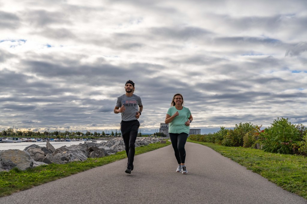
Let’s start at Buffalo Harbor State Park on Fuhrmann Boulevard, where the Empire State Trail begins. Drive or take NFTA Route 42 to this re-energized park. You can combine your Empire State Trail adventure with an exploration of the nearby Tifft Nature Preserve or get right on the trail. As you bike (or walk) towards the city, you’ll be immersed in a breathtaking panorama of water, sky and the architectural marvels that give the city its distinctive flavor. You’ll have excellent views of Buffalo’s famed grain elevators as you bike past the Buffalo River.
Take a break at Canalside, Buffalo’s signature public green space and premier event venue. Canalside can be busy with lots of varied events taking place, but you can always view the original Erie Canal locks, see the Buffalo Heritage Carousel, or take a selfie with Shark Girl! Nearby is the Buffalo Naval Park with four decommissioned vessels you can tour and the Explore And More Children’s Museum. Keep going on the trail and you’ll soon bike past the Trial Gardens at the Erie Basin Marina, with experimental varieties of garden favorites. Time it right and you can vote for your favorites! Be sure to take note of the Buffalo Lighthouse, which has stood sentinel since 1833. There are public restrooms and places for snacks or meals in and around Canalside and the Erie Basin Marina.
If you turn around here and head back to Buffalo Harbor State Park, you will have completed a roughly 5-mile route. (Try out the Bike Ferry if your legs are getting tired!) If you continue, the next leg detours onto city streets as a new chapter of Buffalo history is being written with the transformation of LaSalle Park. Travel past City Hall down Niagara Street. As you turn onto Porter from Niagara and reconnect with the Shoreline Trail, you’ll get a glimpse of the ongoing work at what will become Ralph Wilson Park. As you proceed alongside Niagara Street on a state-of-the-art protected track, you’ll enjoy views of Canada and see the Niagara River flowing towards Lake Erie. Your destination is Towpath Park, a charming waterfront pocket park where you can rest before the return trip. The entire Shoreline Trail is 8 miles long (a 16-mile round trip) and an excellent way to enjoy a taste of Buffalo.
-Written by Kate Jenkins, Public Affairs Digital Specialist
Where will your next adventure take you? The Empire State Trail website is a great resource to help plan your trip on the trail, and includes overnight lodging and camping information, updates on trail closures, activity recommendations, train information, FAQs, and much more. You can also request a map at https://empiretrail.ny.gov/request-map.


I love the concept of the Empire State Bike Trail, offering a safe, relatively car free way to travel across the entire state. I do however, have to remark on the section of the trail that runs through Dutchess Count, particularly the section that runs from the Putnam County line to Hopewell Junction. It is poorly maintained, to the point where vegetation has grown in from both sides, to make some sections almost impassable. This presents at the very least an unpleasant experience in what is inherently a beautiful section to ride. It actually looks like it hasn’t been mowed at all this year. I’m sure that we can do better with a resource of such value to our state.