

With summer now in full swing, hiking trails are calling from the Central Region of State Parks, which stretches from Lake Ontario to the Southern Tier and Pennsylvania border.
The region includes glacial lakes, sandy beaches, segments of the historic Erie Canal, and dramatic waterfalls.
Covering Broome, Chenango, Cortland, Delaware, Herkimer, Madison, Oneida, Onondaga, Oswego and Otsego counties, the Central Region is home to 22 parks, seven historic sites and three golf courses.

Maps and a variety of other useful information on NY State Parks, including those in the Central Region, are now available on the NYS Parks Explorer app. The free app, which is available for use on Android and iOS devices, is easy to download, user friendly and allows patrons to have park information readily available.
As with all hikes, there are a few things to remember beyond carrying a mobile phone. Wear sturdy, yet comfortable shoes or boots, bring water and snacks, and perhaps carry a camera to capture what you see. Be aware of your surroundings and mindful of hikes on steep terrain or those that go near cliff tops. Having a small first-aid kit available in case of an emergency is never a bad idea.
Hiking poles are also useful and can transfer some of the stress of hiking from your knees and legs to your arms and back.
Trail maps are available on the new Parks Explorer app, as well as on each individual park website page at parks.ny.gov and at the main office of each park. Be sure to download maps ahead of time or carry a paper copy as a back up
In addition to the name and distance of each designated trail in a park, the maps include facilities such as parking, comfort stations, park offices, nature centers, campsites, and boat launches. To learn more about NYS Parks trails CLICK HERE.
Hikers should know how long a trail is and how long it ought to take to finish. Since daylight is not an unlimited resource, tossing a flashlight or headlamp into your backpack is a good form of insurance, should you unexpectedly find yourself on the trail as dusk approaches.
Additionally, as incidents of tick-borne diseases surge in the state, it is always important to check yourself for ticks after being outside, even if it is only time spent in your own backyard.
Lastly, as the COVID-19 pandemic continues, remember to practice safe social distancing, particularly in parking lots and at trailheads, and use face coverings when a distance of six feet cannot be maintained. To learn more about important COVID safety guidelines, CLICK HERE.
Chenango County
Oquaga Creek State Park, 5995 County Route 20
Bainbridge, NY 13733, (607) 467-4160: Take a scenic hike around beautiful 55-acre Artic Lake on a trail perfect for all ages, including beginning hikers. Afterward, cool off by taking a swim or having a picnic at the beach. The trail starts at the right side of the beach area, where the main Oquaga Creek is tucked in the woods. After coming out of the woods, take the blue trail to the left to start a 1.2-mile journey around the lake. There are plenty of spots to stop and fish and even a cemetery dating back to the Civil War. The park has more than ten miles of wooded and open trails.
Find a trail map here…

Chenango Valley State Park, 153 State Park Road, Chenango Forks, (607) 648-5251: The two-mile Chenango Lake Trail circles the park’s namesake lake. The trail on the eastern side is open, accessible, and suitable for wheelchairs, while the western side is more robust single-track style path. There are several ways to start the trail – at the newly renovated beach area, located at the south end of the lake, or after parking in the new ADA compliant parking lot at the north end of the lake that connect to the Bog Trail, which then connects to the lake trail.. This multi-use trail also attracts dog walkers, hikers, cyclists, and bird watchers. And keep an eye out for one of the park’s resident bald eagles, gliding above the lake searching for a meal. This park has more than 14 miles of trails.
To explore the park’s 14 miles of trails, find a trail map here…
Onondaga County
Green Lakes State Park, 7900 Green Lakes Road, Fayetteville, (315) 637-6111: This 2,200-acre park has a nearly 20 miles of trails, with access starting at the main parking lot at Green Lake, a rare meromictic lake with an unique aqua color. (Meromictic lakes have water layers that do not annually intermix, as in in the case with nearly all other lakes. There are only three dozen meromictic lakes in the U.S. Green Lakes has two, with Round Lake being the second.) Trails around both Green Lake and Round Lake run about three miles, while doing just the Green Lake trail covers two miles. The park offers a variety of recreation including mountain biking, fishing, kayaking, and birdwatching.
Find a trail map here…
Oneida County
Delta Lake State Park, 8797 State Route 46, Rome, (315) 337-4670: This park is located on a peninsula that juts into the Delta Lake Reservoir. The Fox Run Trail starts in the northwest corner of the Fox Run Parking lot. At about a half-mile long, this wide level trail is perfect for beginners. With benches along the way to rest and take in the surroundings, hikers can see a variety of ducks, the occasional eagle, a rare owl and maybe even a fox. The Fox Run trail ends at the Yellow trail, where you can keep exploring the shoreline forest or head back.
Find a trail map here…

Pixley Falls State Park, 11430 State Route 46, Boonville, (315) 337-4670: A highlight of the Nature Trail, which is just three-quarters of a mile long, is the 50-foot waterfall that the park is named for. The trail can be steep, and slippery in wet weather, so proper footwear is definitely recommended. The trail includes many other smaller falls, and on its lower half follows the course of the Lansing Kill, which is well known for its trout fishing.
Find a trail map here…


Otsego County
Glimmerglass State Park, 1527 County Highway 31, Cooperstown, NY 13326, (607) 547-8662: Overlooking Otsego Lake, the famed “Glimmerglass” of James Fenimore Cooper’s Leatherstocking Tales, this park offers five miles of hiking trails and a beach for swimming afterward.
The rolling, partially wooded terrain is host to a wide variety of wildlife. If you bring your four-legged friend, remember to keep dogs on a six-foot leash at all times.
An uphill trail through Mount Wellington offers the Sleeping Lion Trail that varies terrain and offers two miles of varying terrain for a moderate hike. Along the service road that leads to the trail head offers an scenic overlook of the lake to the south toward Cooperstown.
Find a trail map here…

The Beaver Pond trail offers a half-mile ADA -accessible trail surface around the “Beaver Trail”. Along this route you will discover “Eco Boxes” that describe the animals that might been seen during a hike.
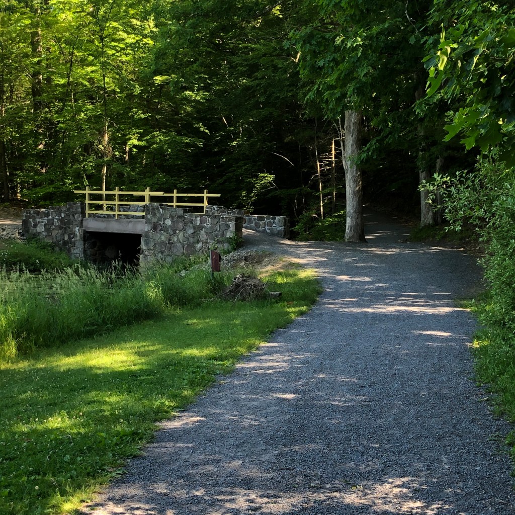
The Covered Bridge Trail leads to the oldest wooden covered bridge in the United States. This one-mile, partially wooded trail runs along along Shadow Brook that feeds Otsego Lake.
The bridge was built in 1825 on then-private property of Hyde Hall, a country mansion that is now the Hyde Hall State Historic Site.

Betty and Wilbur Davis State Park, 133 Davis Road, Westford, NY 12197, (607) 547-8662: Perched atop of a hill, this 223-acre park offers spectacular views and vistas to the south and west for some amazing sunsets.
This park has 2.7 miles of trails, with gentle meadows, wooded areas, and two catch and release ponds. Birdwatchers, remember to bring your binoculars.
Find a trail map here…

Cover Photo of Green Lakes State Park. Photo credit to Carina Scalise. All other photos from New York State Parks.
Post by Brian Nearing, deputy public information officer at NYS Parks

One thought on “Get Out And Explore … The Central Region of New York State Parks”