New York is a state of great eats. Some of the regional delicacies born here have conquered the world, like Buffalo’s wings and Saratoga’s potato chips. Others, like Utica’s tomato pie and Plattsburgh’s Michigans, remain fiercely local treasures. But they all pair magnificently with a state park or historic site!
Follow along as our team plays sommelier with the Empire State’s distinctive dishes — and our agency’s unforgettable destinations. Pack your bags and bring your appetite!
You may have already known that cardboard boxes and cans can be recycled into new products, but did you know that your hot dogs and hamburgers can be too?
On July 1, Green Lakes State Park in Fayetteville launched a large-scale pilot waste reduction initiative, featuring food scrap composting, improved signage, public education events and coordination between regional staff and staff on the ground, including and the newly created sustainable operations team.
The dream team: SUNY Climate Corps members Emily Bridgeford, Savi-Cartier Stewart, and Sanskar Narang.
There’s nothing quite like a New York summer! It’s peak season at New York State Parks and Historic Sites. Camping is in full swing, whether it’s in one of our cabins, or in tents or RVs. The swimming season is underway at our beaches and pools. And if you’re looking to make the most of the season, we’ve got you covered. Our expert staff members have combed the state to suggest exciting summertime experiences for everyone. There’s bound to be something new for you on this list!
Listen to the Sounds of Summer
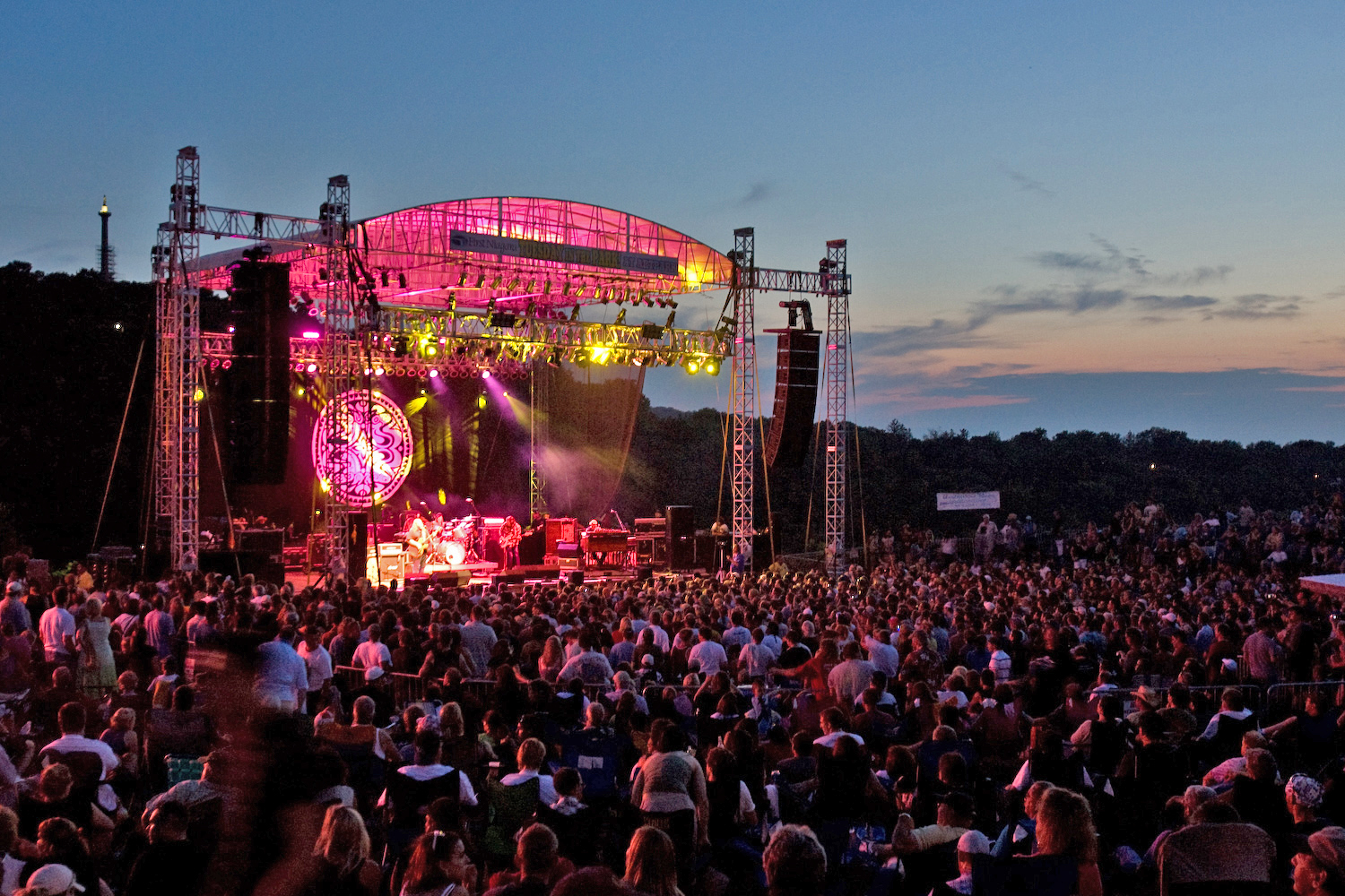
Performances at Artpark, left, and at Saratoga Performing Arts Center on the grounds of Saratoga Spa State Park.
Summer concerts are happening all season long, and there’s an affordable live music option for everyone. Enjoy the longer days and warmer nights with festivals and performances by world-famous musical artists at Saratoga Performing Arts Center on the grounds of Saratoga Spa State Park, Jones BeachTheater at the iconic Jones Beach in Wantagh, and Artpark in Lewiston, or boogie with your favorite local bands at a state park or historic site near you. All options offer the chance to relax and enjoy the show from a blanket or chair.
– Written by Gabriela Wemple, Excelsior Service Fellow
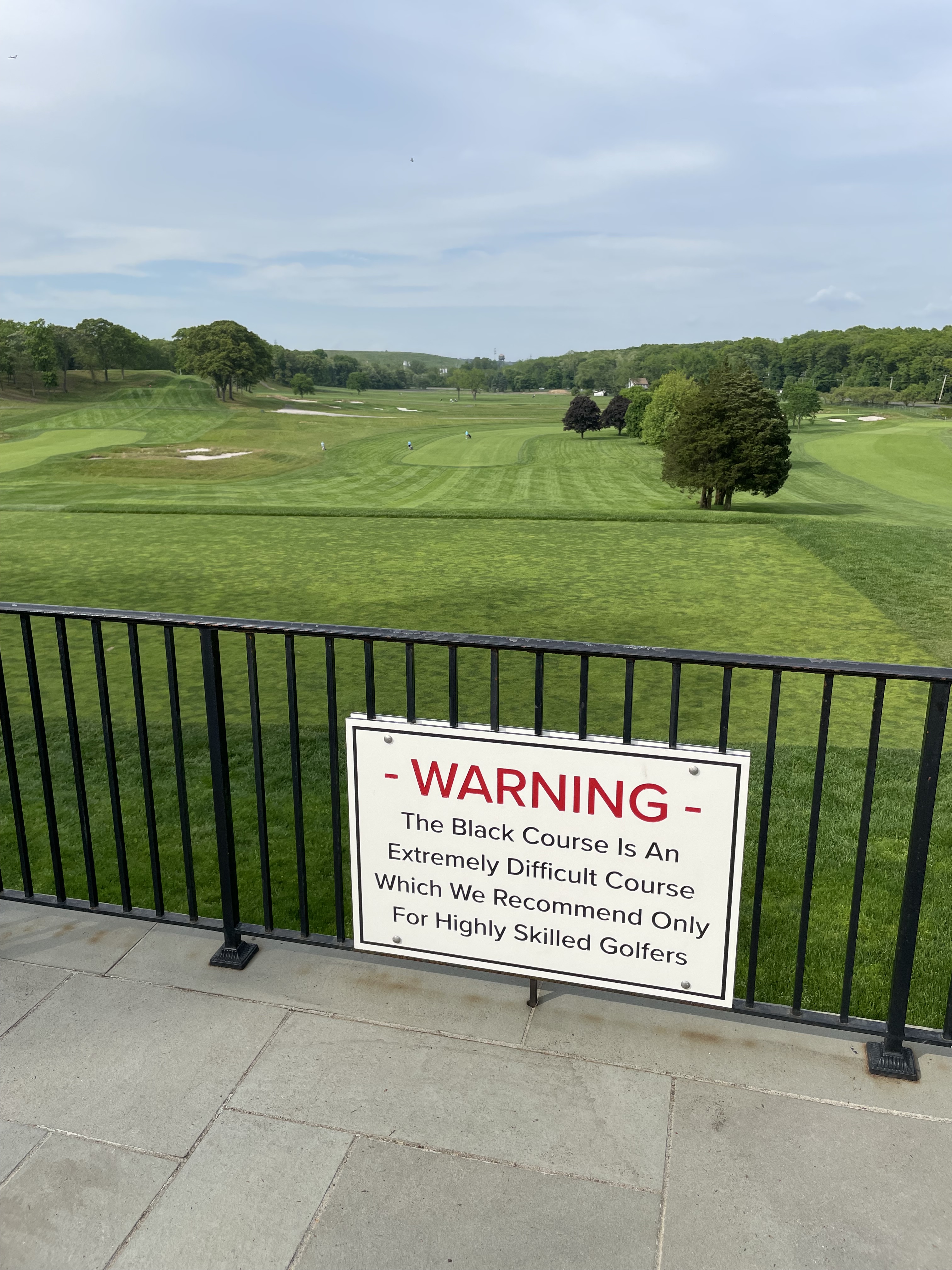
When you think of golf and New York State Parks, the first thing that probably comes to mind is Bethpage Black. It was well known on Long Island for decades but rose to prominence worldwide when the USGA brought its signature tournament, the U.S. Open, to “the people’s country club” 22 years ago.
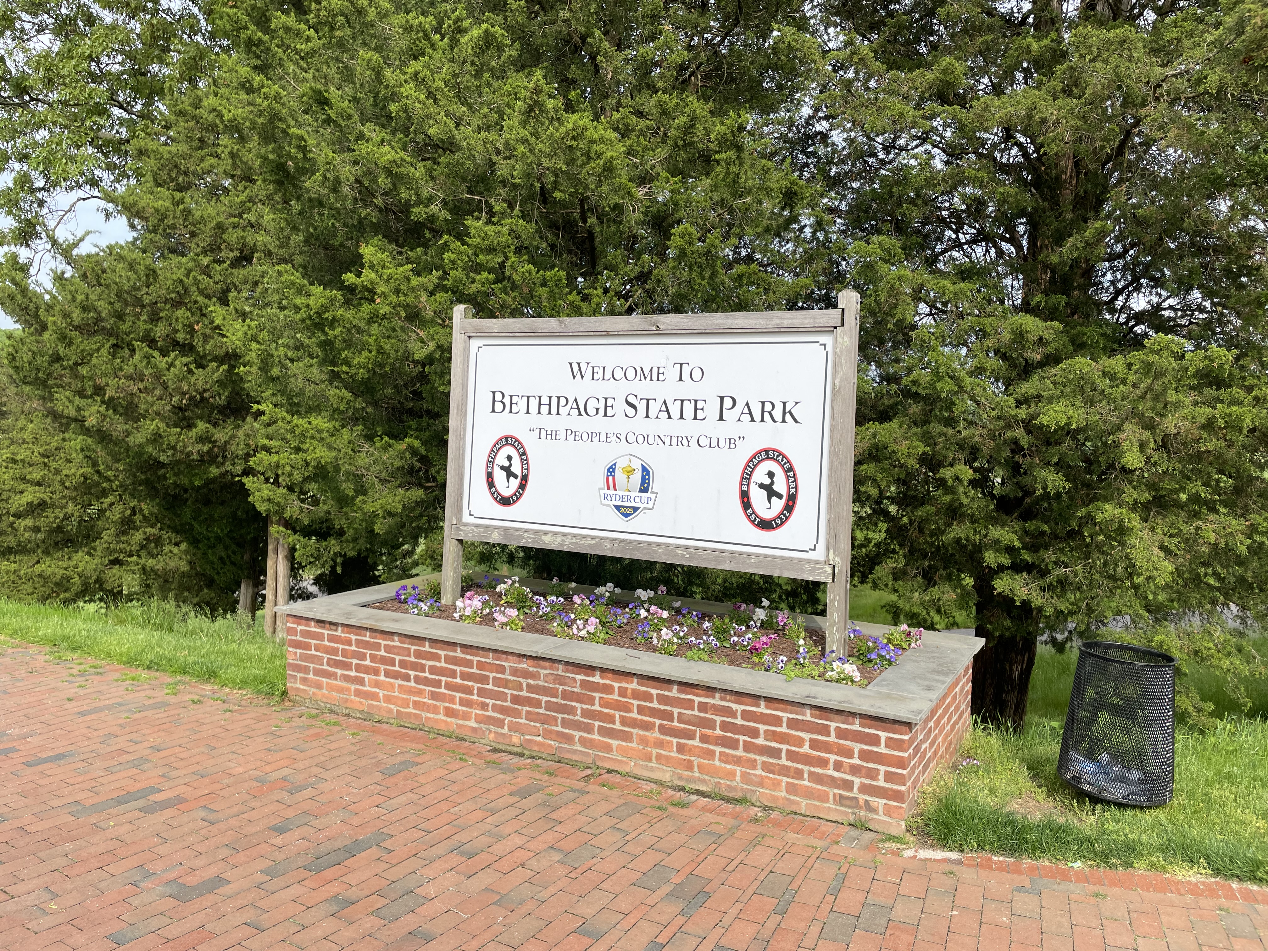
The most photogenicgolf course sign in the United States!
A fellow you may have heard of, Tiger Woods, was victorious that year when he was at the peak of his powers – his eighth Major victory (he currently has 15). He and the U.S. Open came back to Bethpage seven years later for a soggy slugfest that ended on a muddy Monday. It was a journeyman named Lucas Glover who held off Woods and the rest of the elite field, winning his one and only Major title. A decade later, Bethpage Black hosted another Major tournament, the PGA Championship, won by Brooks Koepka. And next year, 2025, it will host an event unlike anything ever experienced there – the 2025 Ryder Cup.
This sign will welcome the world to the Ryder Cup in 2025.
But this post isn’t about that much-anticipated international competition, although they are already preparing. This is about all the great golf opportunities State Parks has around New York.
In 2024, New York State Parks and Historic Sites will celebrate our Centennial, commemorating the 100th anniversary of the founding of our parks and sites system. While we have incredible public properties older than the 100-year-old system, the Centennial celebrates the vital legislation that allowed us to build and expand our network of parks and sites, forging the system we know and love today.
As OPRHP Commissioner, I am reminded every day of the immense pride and enjoyment New Yorkers take in our facilities. To prepare New York State residents and visitors from around the world for the exciting year ahead, I recently embarked on a two-day journey to showcase the breadth of our parks and sites system, highlighting various activities and partnerships that make our system so unique.