Tag Archives: Robert G. Wehle State Park

What to do with a Thousand Acres of Swallow-wort?

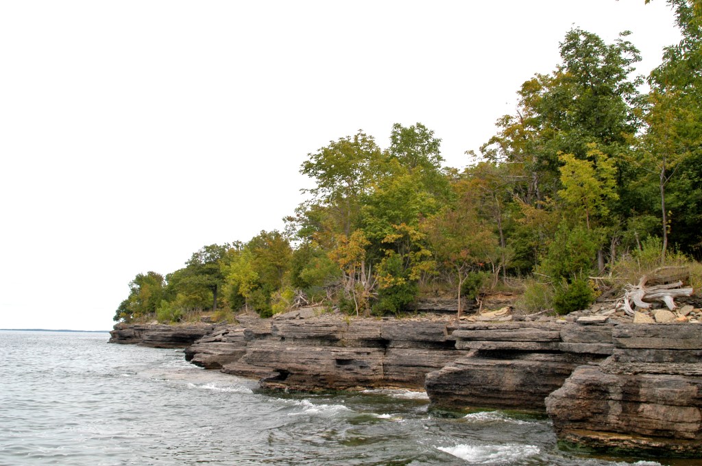
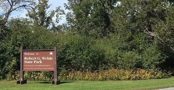
With 80-foot cliffs overlooking eastern Lake Ontario, 14 miles of hiking trails, a dog park, a state-of-the-art playground, a residential cottage that sleeps eight, and a globally rare ecosystem, Robert G. Wehle State Park is a gem.

This striking landscape also has a military history of helping to defend the country. Between 1895 and 1947 before it was a park, the U.S. military used this property as training grounds. The park includes remnants of the Stony Point Rifle Range, where soldiers trained for combat, as well as shoreline concrete observer posts where spotters oversaw aerial gunnery target practice.

In 1963, the U.S. Army sold this land to Louis Wehle, founder of the post-Prohibition Genesee brewery, and Thomas Nagle, a Rochester car dealer. In succeeding years, Wehle and his son, Robert, maintained the property as a cattle farm, game preserve, and rural retreat for raising of internationally-renowned hunting dogs . After Robert Wehle’s death in 2002, the state Department of Environmental Conservation acquired the land, later passing it State Parks to establish as Robert G. Wehle State Park in 2003.

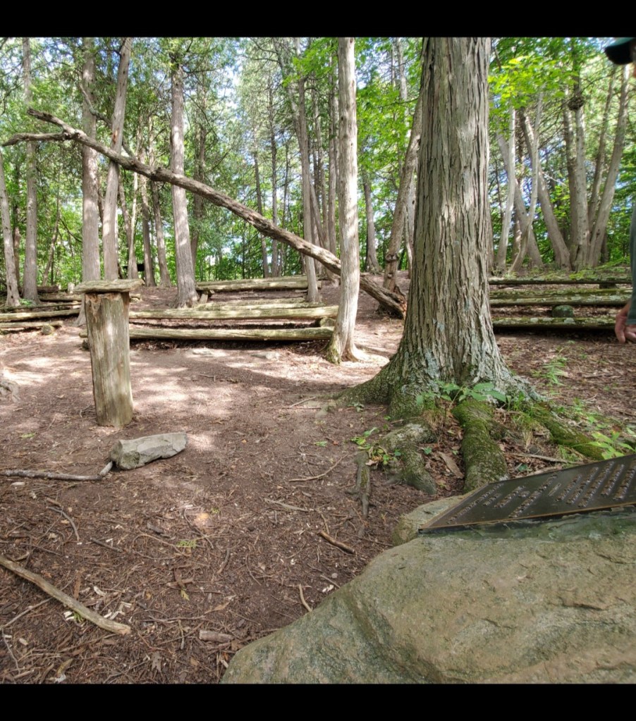
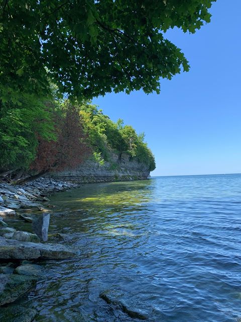
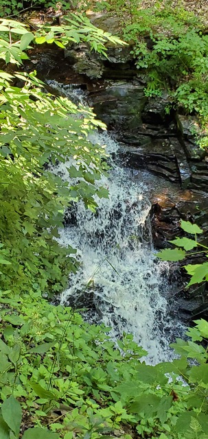
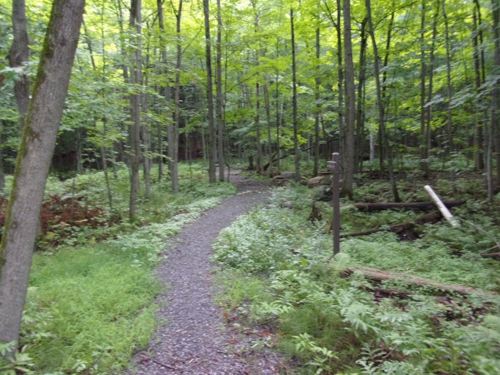
Click on this slideshow below for scenery at the park:

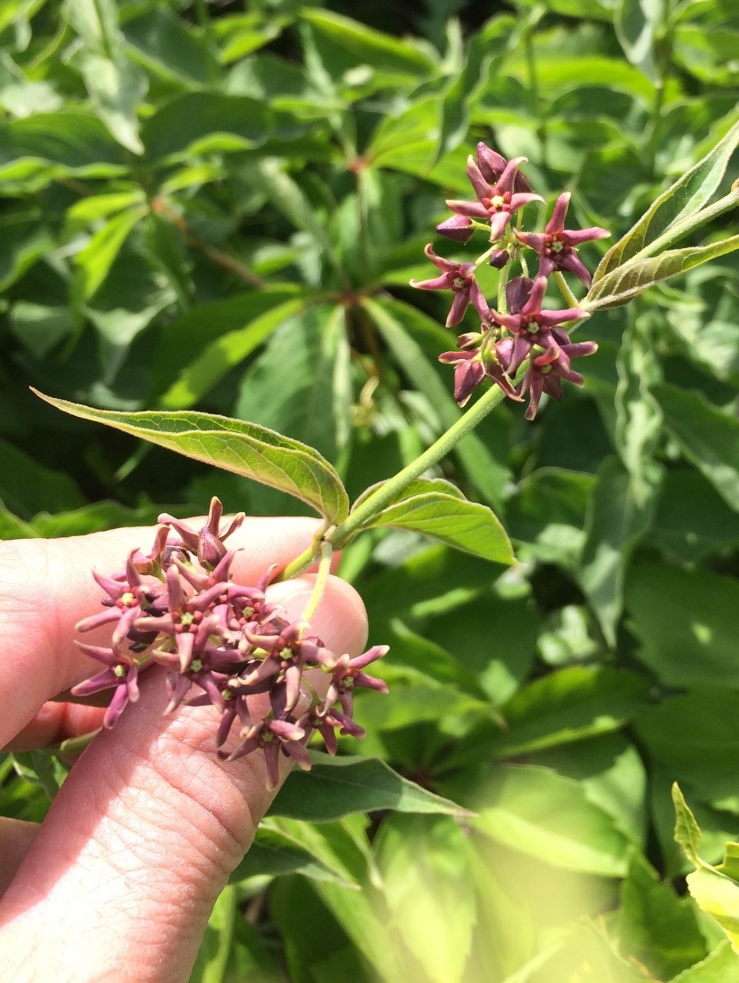
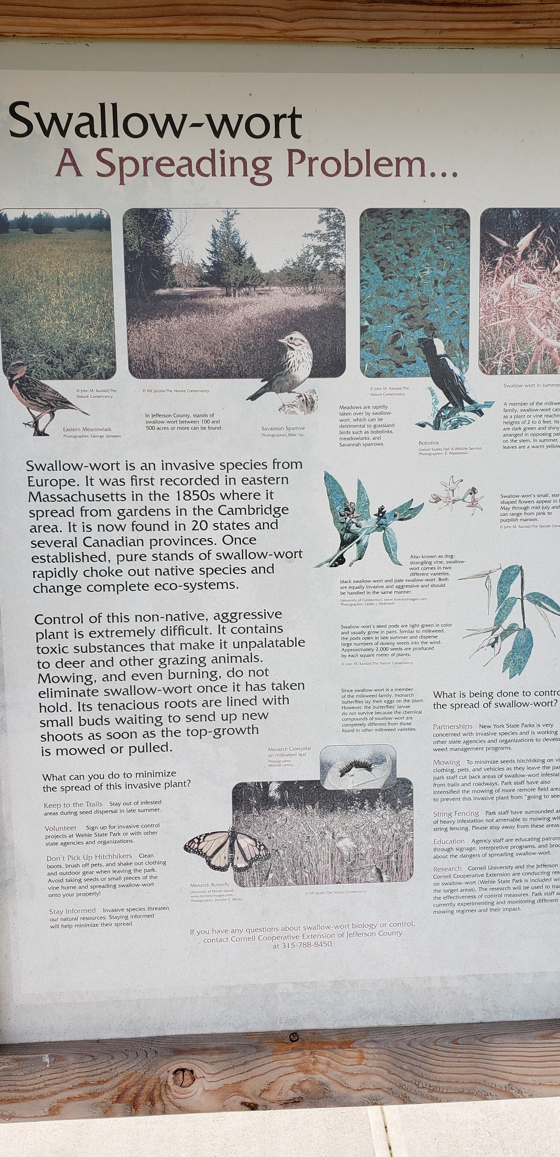
But visitors to this park may notice something else beyond its beauty _ large areas overrun by a strange, twining vine that seems to grow everywhere that is not mowed lawn, leaving few if any other plants surviving. Before his death, Robert Wehle was trying, with limited success, to control this invasive plant, known as pale swallow-wort (Vincetoxicum rossicum).

Now, decades after it was used to help train soldiers, this park is again on the front lines of a new mission: To be part of a campaign to learn whether a small moth found in Europe and Asia can help fight this invading perennial plant, which has spread throughout the eastern U.S. and Canada.

Pale swallow-wort at the entrance to Robert G. Wehle State Park in Jefferson County. The plant has begun to turn yellow at the end of the summer.


But first, what is this aggressive interloper that drives out other plants wherever it spreads?

Also given the ominous name of “dog-strangling vine,” pale swallow-wort is a native of Ukraine that was introduced to North America in the mid- to late-1800s as an ornamental vine in herbariums and greenhouses. Once here, it began expanding into old fields, pastures, and woodland understories. Pale swallow-wort wipes out native plants in its path due to its vast root system, immense seed production and seed dispersal method (seeds look similar to milkweed seeds and can float far away in the wind), and the production of allelochemicals that inhibit growth of other nearby plants and protect it from grazing animals. Whitetail deer, which will eat most plants, avoid it.

Pale swallow-wort also poses a threat to New York’s population of native Monarch butterflies, which require milkweed to reproduce. Monarchs are known to confuse swallow-wort with milkweed and lay their eggs on it. Due to the chemical composition of swallow-wort, Monarch larvae that feed on the plant usually don’t survive.

All of these traits combine to create the ‘perfect’ invasive species and a land manager’s worst nightmare. So, what has been done and what is still being done to control this tenacious weed?

Robert Wehle noticed this plant on his property, according to anecdotal accounts. The cattle herds that he kept could have suppressed the plant’s invasion in pastures through grazing and trampling.  Wehle also utilized fire management to maintain some fields, which could have held swallow-wort at bay temporarily. Records also indicate he tried chemical herbicides to control swallow-wort infestation. This suggests that, like subsequent scientific studies conducted have shown, that Wehle found grazing and burning were not effective control techniques. 

After the land became a State Park, grazing, burning, and chemicals were no longer done.  Instead, staff began mowing areas around the entrance, maintenance shop, parking lots, rental compound, and trails frequently, which cuts back swallow-wort before it matures enough to produce seeds. But only so much mowing could be done on a 1,100-acre property.

Where mowing stops at Robert G. Wehle State Park, pale swalow-wort often begins.
Pale swallow-wort along trails in the park, above and below. The plant turns yellow in the fall.
The flowers of pale swallow-wort.

A plan to address this issue was adopted in 2010 by State Parks, in cooperation with the state Department of Environmental Conservation. The first step was to raise public awareness of the problem. Interpretive signage was installed at most trailheads throughout the park to inform visitors. Boot brush stations were placed at the entrance/exit to the park for patrons to clean off their footwear to limit the spread of swallow-wort and its seeds off the property . The feathery seeds can easily stick to shoes, clothing and even the fur of dogs being walked.

That same year, State Parks hired an excavation company to carry out an experiment that may show promise for restoring degraded portions of Wehle’s globally rare Alvar ecosystem. Alvar is a grass- and sedge-dominated community, with scattered shrubs and sometimes trees. The community occurs on broad, flat expanses of calcareous bedrock, like limestone or dolostone, covered by a thin veneer of mineral soil.

Using a skid steer in selected areas, crews scraped away soil containing swallow-wort roots from limestone bedrock. Once most of the soil was gone, swallow-wort could not take root on bare rock. The areaa was then reseeded with native species. Other native plants showed up on their own, freed from the smothering competition from the swallow-wort. But these efforts could not be used everywhere in the park.

An area of the park reclaimed from pale swallow-wort by scraping off soil and later reseeding it with native plants.
In addition to the Lake Ontario and St. Lawrence regions, pale swallow-wort is found in other areas of the state, including the Finger Lakes and Hudson Valley. (Photo credit – New York State Invasive Species Information, http://nyis.info/)

Where does the moth come into this ongoing effort? For the last two years, Parks and its partners at Cornell University, SUNY College of Environmental Science and Forestry (ESF), Wells College, SUNY Cortland, and the University of Rhode Island have been using Robert G. Wehle State Park to study the viability of Hypena opulenta moths to suppress this invader.

This approach – the use of a natural enemy to deal with an invasive species – is known as biocontrol. In order to ensure that a new introduced species will not negatively impact other plants and animals, the effects must be extensively studied before any widespread use or release can be permitted. It cannot be overstated how extensively biocontrols are scrutinized before potential approval for release. Study can continue for years or even decades. Only after research confirms there will be little or little to no impacts to native species will federal regulators approve the biocontrol to be released.

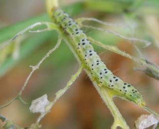
In this case, the U.S. Department of Agriculture (USDA) in 2017 approved the release of the moths for field testing as biocontrol for pale swallow-wort. After the moths lay eggs on the swallow-wort, the larvae that later emerge eat the plant’s leaves.

For the last two seasons, Hypena moths were placed in cages in areas of swallow-wort at Robert G. Wehle State Park, as well on as nearby Grenadier Island in Lake Ontario off Cape Vincent. The cages ensured that the moths would be confined to the test areas.

Results from 2020 showed promise as one cage showed 100 percent defoliation of swallow-wort within four weeks by the caterpillars. Preliminary results from this year were not as successful. However, this is all part of the scientific process as the battle against the invasive continues with Robert G. Wehle State Park playing its part.

A Hypena opulenta moth inside the mesh cage over a patch of pale swallow-wort. The moth will lay its eggs on the plants.
After eggs hatch, the emerging caterpillars begin eating the plant leaves.
After four weeks, the caterpillars have eaten all the leaves in this cage. (All photos above credited to the St. Lawrence Eastern Lake Ontario Partnership for Regional Invasive Species Management.)

Hopefully one day we can say the tide is turning. Eradication is likely not possible, but containment could give native plants a better chance at a peaceful co-existence. If you visit the park, remember: Use the bootbrushes and check your clothes! Don’t inadvertently spread the ‘perfect invasive.’


Cover Shot – A pale swallow-wort infestation at Robert G. Wehle State Park. All photos NYS Parks unless otherwise credited.

Post by Pete Zimmer, Stewardship Specialist, Mid-State Capital District/Thousand Islands Region, NYS Parks


Resources


Learn more about the biocontrol project from the report below by the St. Lawrence Eastern Lake Ontario Partnership for Regional Invasive Species Management:

More information is also available from the New York State Invasive Species Research Institute.


The 2013 report by the U.S. Department of Agriculture also describes early efforts to contain pale swallow-wort.

Get out And Explore … The Thousand Islands Region of New York State Parks

While it may be best known for world-class boating and fishing, the Thousand Islands region of State Parks also offers miles of hiking trails along shorelines and through forests, stretching from Lake Ontario north along the St. Lawrence River and finally to the shores of Lake Champlain.

Covering Lewis, Jefferson, St. Lawrence, Franklin, and Clinton counties, the region  includes 26 state parks, two golf courses and a historic site that cover a stunning mixture of woodlands, islands and water.

Maps for hiking trails and a variety of other useful information on State Parks, including those in the Thousand Islands Region, are now available on the NYS Parks Explorer app.  The free app, which is available for use on Android and iOS devices, is easy to download, user friendly and allows patrons to have park information readily available.

As with all hikes, there are a few things to remember beyond carrying a mobile phone. Check the weather forecast before you go, and dress appropriately. Wear sturdy, yet comfortable shoes or boots, bring water and snacks, and perhaps carry a camera to capture what you see. Be aware of your surroundings and mindful of hikes on steep terrain or those that go near cliff tops. Having a small first-aid kit available in case of an emergency is never a bad idea.

Hiking poles are also useful and can transfer some of the stress of hiking from your knees and legs to your arms and back.

Trail maps are also available on each individual park website page at parks.ny.gov and at the main office of each park. Be sure to download maps ahead of time or carry a paper copy as a back up

In addition to the name and distance of each designated trail in a park, the maps include facilities such as parking, comfort stations, park offices, nature centers, campsites, and boat launches. To learn more about NYS Parks trails CLICK HERE.  

Hikers should plan their route in advance, know how long a trail is and how long it ought to take to finish. Since daylight is not an unlimited resource, tossing a flashlight or headlamp into your backpack is a good form of insurance, should you unexpectedly find yourself on the trail as dusk approaches.

Parks facilities are carry-in, carry-out, so don’t leave trash behind. Follow Leave No Trace principles to keep trails clean for everyone.

Additionally, as incidents of tick-borne diseases surge in the state, it is always important to check yourself for ticks after being outside, even if it is only time spent in your own backyard.

Lastly, as the COVID-19 pandemic continues, remember to practice safe social distancing, particularly in parking lots and at trailheads, and use face coverings when a distance of six feet cannot be maintained.  To learn more about important COVID safety guidelines, CLICK HERE.

Clinton County


Point Au Roche State Park, 19 Camp Red Cloud Road, Plattsburgh, NY 12901 (518) 563-0369: The park’s Long Point Trail is a must-see, with its panoramic views of historic Lake Champlain, vistas of Vermont’s Green Mountains to the east, and New York’s own High Peaks visible to the west. The two-mile out and back trail features hardwood forests, steep cliff edges, diverse bird viewing, opportunities for world-class fishing, and much more. This state park is rich in history from the iconic Camp Red Cloud boys’ and girls’ summer camp to the famous ‘Fantasy Kingdom’ amusement park. Hikers will find a memorial to those who attended Camp Red Cloud, marked with a plaque on a rock at an outdoor amphitheater and lecture area. This area was used for chapel service around 1950 and today is used for outdoor seminars, college lecturing, actor performances, a music venue, and more.

Find a trail map here…

A view of Lake Champlain and the nearby mountains from the Long Point Trail at Point Au Roche State Park.
The trail passes the marker for the former Camp Red Cloud.

Jefferson County


Black River Trail, 25534 Ridge Road, Watertown, NY 13601 (315) 938-5083: There are three parking lots to access this trail _ Brookfield Power parking lot:  253W + 84 Black River, Rutland NY; the Ridge Road parking lot at 25534 Ridge Road in Watertown; and the Walker Avenue parking lot at the end of Walker Avenue in Watertown. This 4.5-mile, fully accessible paved multi-use trail is suitable for hikers of all abilities, as well as as perfect for running, walking, biking, and cross-country skiing. A converted railroad bed, the trail winds through a mix of forests, agricultural lands, and quiet neighborhoods. Along it are many small bridges and other concrete features that will remind you of the trail’s past as part of the New York Central Railroad. Several illuminated crosswalks allow safe transition between the multiple access points and parking lots. A newly completed extension allows connectivity to the city of Watertown’s network of trails.

Find a trail map here…

Robert G. Wehle State Park, 5182 State Park Road, Henderson, NY 13650 (315) 938-5302: The former estate of businessman Robert G. Wehle, whose family owned and operated the Genesee Brewing Company, this park boasts 1,100 acres and more than 17,000 feet of spectacular Lake Ontario shoreline. The park’s Snake Foot Trail is a moderate 4.9-mile multi-use loop trail. And no worries _ this yellow marked trail is not named for reptiles underfoot, but after Wehle’s prize-winning English Pointer named Elhew Snakefoot. Wehle was a recognized as a top breeder of pointers.

A statue representing Robert G. Wehle’s prize-winning English Pointer dog, Elhew Snakefoot, at the namesake New York State Park that was once his former Lake Ontario estate.

This spectacular trail runs along the scenic cliff faces of Lake Ontario and is truly meant for all seasons. The shoreline picnic area is equipped with a shelter, tables, and grills that are perfect for a summer BBQ. Fall is ablaze with turning leaves illuminated by the setting sunlight. The trail is among several groomed snowshoe and cross-country ski trails, however the dynamic crystalline waterfront of the Snakefoot is an amazing winter experience that should be enjoyed by all. And in spring the calls of Long-Tailed ducks and other migratory waterfowl can be heard from the rocky outcroppings. Caution!!  The Snakefoot Trail parallels the natural coastline and its steep cliffs, and there is very little obstructing the view _ or the fall hazards that come with outdoor exploration. Watch your step and pay attention especially when taking pictures!!!

Find a trail map here…

Fall colors and evening light can be a magical time at Robert G. Wehle State Park atop the rocky bluff at Lake Ontario.

The power when Lake Ontario’s waves roll crashing onto shore

… contrasts with a lake that also can be placid and flat

Lewis County


Whetstone Gulf State Park, 6065 West Road, Lowville, NY 13367 (315) 376-6630: The park’s North Rim and South Rim gorge trails are a 5.6 mile moderately trafficked loop trail that features a waterfall and spectacular scenic vistas. The trail is rated as moderate and highlights a park that is built in and around a stunning three-mile gorge cut into the eastern edge of the Tug Hill Plateau. Primarily used for hiking, nature trips, snowshoeing and cross-country skiing, the trail is best used from March until November. Dogs are welcome on this trail but must be kept on leash. The gorge is steep, so be sure of your footing and stay on the trail at all times.

Find a trail map here…

St. Lawrence County


Jacques Cartier State Park, Route 12, Morristown, NY 13664 (315) 375-6371: This park on the St. Lawrence River might be best known for its excellent fishing, but it also features several short trails through the forest that crisscross the park entrance road into the park. The Krooked Kreek Trail can be accessed on either end from the entrance road trail head or the trail head located on the park office road. This easy-to-walk trail is slightly more than a half-mile long, and meanders along several winding streams through an open hardwood forest. The streams are rock filled with several drop off ledges making for small water falls at high water. The openness of the forest makes for great plant and wildlife viewing along the way. Come spring, hikers can spot a large assortment of forest flowers including Trillium, Jack In The Pulpit, Carnal Flower and Solomon Seal to name a few. White tail deer, mink, owls and hawks are common sighting along the streams. A rare treat is a glimpse at an elusive fisher (a member of the weasel family) prowling the shores along the trail. Two bridge crossings offer wonderful location to pause and reflect as the stream passes beneath and on down through the forest on its way down to the river.  In the winter months, the main park entrance road is closed and not plowed. This adds plenty of great opportunities for cross country skiing and snow shoeing with side excursions down the trails looping around and back to the road.

Sign at Jacques Cartier State Park for the Krooked Kreek Trail.


Cover Shot- Sunset on Lake Champlain at Point Au Roche State Park. All photographs by New York State Parks.


And learn about hikes in other State Parks regions in previous posts in the “Get Out and Explore…” series. See you out there!

Get Out and Explore … The Palisades Region

With autumn leaves now turned, hiking in the Palisades region of State Parks offers spectacular views of the Hudson Valley and the Catskills to go with a fascinating history that includes an outlaw’s lair, the state’s early iron industry, and a traitor’s secret meeting place. Located on the west side of the Hudson River, this…

Get Out And Explore … The Central Region of New York State Parks

With summer now in full swing, hiking trails are calling from the Central Region of State Parks, which stretches from Lake Ontario to the Southern Tier and Pennsylvania border. The region includes glacial lakes, sandy beaches, segments of the historic Erie Canal, and dramatic waterfalls. Covering Broome, Chenango, Cortland, Delaware, Herkimer, Madison, Oneida, Onondaga, Oswego…

Get out And Explore … The Saratoga/Capital Region of New York State Parks

Centered on the confluence of the Hudson and Mohawk Rivers, between the Adirondacks and the Catskills, the Saratoga/Capital Region of New York State Parks offers opportunities for both hikers and paddlers. Covering Albany, Schenectady, Rensselaer, Saratoga Washington, Schoharie, Montgomery and Fulton counties, the region includes a dozen state parks, as well as eight historic sites…

Get out and explore … the Taconic Region of State parks

With more than 2,000 miles of marked trails across New York, the State Parks have something for hikers of every ability. That includes the beautiful Taconic Region, located on the east side of the Hudson River and stretching through Columbia, Dutchess, Putnam and Westchester counties. Palatial estates, highland trails, Hudson River vistas and woodland campgrounds…