

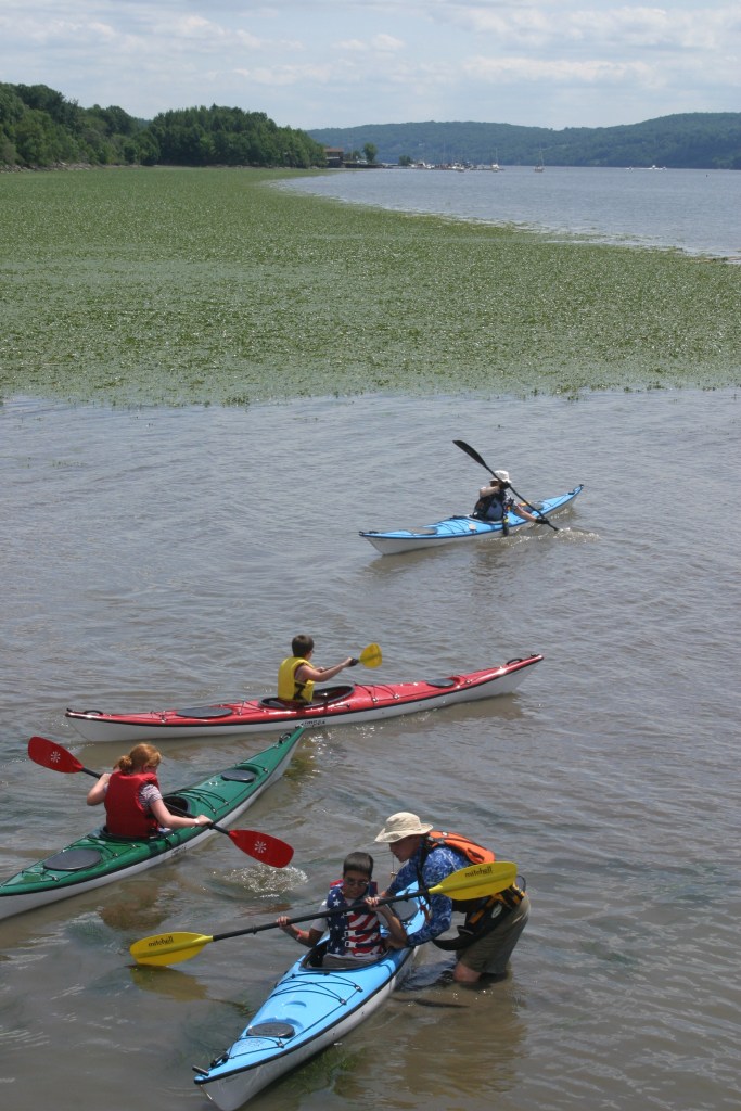
With more than 2,000 miles of marked trails across New York, the State Parks have something for hikers of every ability. That includes the beautiful Taconic Region, located on the east side of the Hudson River and stretching through Columbia, Dutchess, Putnam and Westchester counties.
Palatial estates, highland trails, Hudson River vistas and woodland campgrounds define some of the exceptional treasures to be found in a region with 14 parks and eight historic sites.
If you are new to hiking or have not yet explored hikes in this region, named for the Taconic Mountain range that runs north-to-south along the state border with Connecticut, Massachusetts and Vermont, here are some suggestions to start you out.
As with all hikes, there are few things to remember beyond carrying a mobile phone. Wear sturdy yet comfortable shoes or boots, bring water and snacks, and perhaps carry a camera, to capture what you see. Be mindful of hikes on steep terrain or that go near cliff tops. Having a small first-aid kit available in case of emergency is never a bad idea.
Hiking poles are useful, and can transfer some of the stress of hiking from your knees and legs to your arms and back. And use a trail map, which is available online at each park website at https://parks.ny.gov/ and at the main office at each park. Check the park’s individual website to see if its maps can be downloaded to your iOS Apple or Android device.
These maps include Park facilities such as parking, park offices, nature centers, campsites, and boat launches in addition to the location, name and distance of each designated trail in the park. For some facilities, data is available as a Google Earth KML file or a map is available to download to your iOS Apple and Android mobile devices in the free PDF-Maps app. Learn more…
It never hurts to know how long a trail is and how long it ought to take to finish it. Since daylight is not an unlimited resource, tossing a flashlight or headlamp into your backpack is a good form of insurance, should you unexpectedly find yourself on the trail as dusk approaches.
Westchester County
Rockefeller State Park Preserve, 125 Phelps Way, Pleasantville, (914) 631-1470: With 55 miles of crushed stone carriage roads that crisscross the former country estates of petroleum tycoons John D. Rockefeller and William Rockefeller, the preserve offers a wide variety of hikes for any ability, with the carriage trails offering a consistent, predictable surface. After parking at the preserve office, follow the markers for Brother’s Path, a 1.1-mile loop around scenic Swan Lake. Heading south on the Brother’s Path, there a connection on the right to the .9-mile Overlook Path, a gentle climb and a good place to spot Eastern Bluebirds and get a beautiful view of Swan Lake. The preserve is home to more than 180 different species of birds and 120 different species of native bees.
Maps here…

Franklin D. Roosevelt State Park, 2957 Crompond Road, Yorktown Heights, (914) 245-4434 : This is a short hike in the woods on level terrain leaving to a small pond. From the parking lot for the swimming pool, take the white-marked trail, turning onto the blue-marked, 1.2-mile trail for Crom Pond. At the end, turn around, or continue on the orange-marked, .7-mile Mohansic Trailway through more woods before turning around.
Maps here…

Putnam County
Fahnestock State Park, 1498 Route 301, Carmel, (845) 225-7207: Hike, sunbathe and swim all at one location. Start at the Canopus Beach Parking Lot, where you can pick up the blue blazed AT Connector Trail from the north corner of Canopus Beach. A short 0.3-mile hike passing along the edge of Canopus lake will lead you to the famous Appalachian Trail. Turn right and take the white blazed AT trail northbound. A steep section of trail will lead you to a beautiful viewpoint over Upper and Lower Canopus lakes. Continue north and after one mile on the AT turn right and head south onto another blue blazed AT connector trail. A rolling 0.75-mile hike will lead you back to the Canopus Beach Parking Lot and all the other activities.
Maps here…

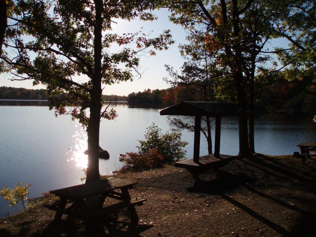
Mills Norrie State Park, 9 Old Post Road, Staatsburg, (845) 889-4646: This park has a very scenic hike along the Hudson River. Turn onto Norrie Point Way and follow signs for the Marina, where you find signs for the White Trail. If you brought a kayak or canoe, you can put it into the river there. The White Trail is approximately two miles long and and leads to Staatsburgh State Historic Site, the elegant 65-room country mansion of Ogden Mills and his wife Ruth Livingston Mills. You can choose to take the White Trail back along the river, or the Blue Trail. Along this wooded trail you can view the historic Hoyt House and Carriage Barns. While at Staatsburgh, catch a view of the 148-year-old Esopus Meadows Lighthouse on the river. If you plan to visit by boat, the Mills Norrie State Park marina has 145 boat slips.
Maps here…
Columbia County
Lake Taghkanic State Park, 1528 Route 82, Ancram, (518) 851-3631: Start at the parking lot at the swimming beach, and pick up the white-marked Lakeview Trail, which goes about 5 miles around the lake but is not a loop. It can be hiked as an out-and-back by going either north or south on the trail, which is mostly level and good for all abilities.
Maps here…
There is a full list of activities this month at State Parks and Historic Sites in the Taconic Region. It can be found here …
Keep an eye on the NY Parks Blog in coming weeks as we explore hikes in the ten other State Parks regions… Do you have a favorite to share?

2 thoughts on “Get out and explore … the Taconic Region of State parks”