

As Tom Petty once sang, “You belong among the wildflowers, you belong in a boat out at sea.” At New York State Parks, we cannot offer you a boat at sea, but we CAN offer you wildflowers! New York State is blessed with a bounty of native wildflowers that you can view throughout the year, but they are particularly brilliant in the spring.
Continue reading You Belong Among the Wildflowers (In a New York State Park)Category Archives: Hiking

Shoot Like a Pro at Parks and Historic Sites’ Most Instagrammable Spots
Spring season is photo season! Whether you’re capturing prom or graduation photos, scouting locations for wedding photos, thinking ahead to your Christmas cards, or just looking to refresh your social feeds, it’s the perfect time of year to get out there with your camera or cell phone. Read on for location inspiration in various categories—truly one-of-a-kind locations, waterfalls, iconic New York visuals, design-focused areas, and more!—and get professional photography tips from our State Parks photographer and videographer.
Continue reading Shoot Like a Pro at Parks and Historic Sites’ Most Instagrammable Spots
First Day Hikes Kick Off Year of Wellness
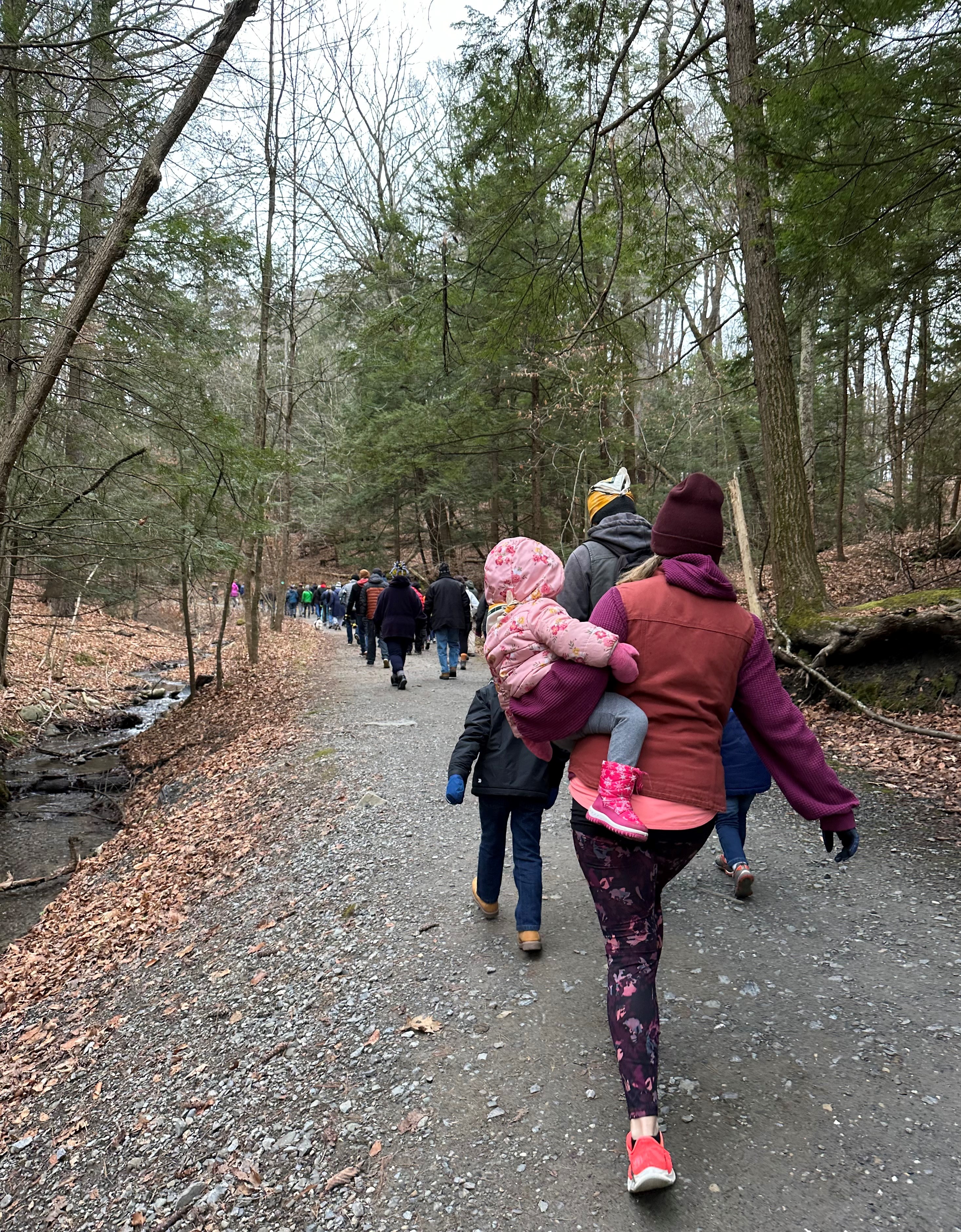
2025 is the year of wellness in New York State, and our First Day Hikes event series was the perfect way to start the year! For the fourteenth time, state parks, historic sites, and public lands rang in the new year by hosting group hikes. More than 90 sites statewide participated, and thousands of New Yorkers joined us to begin 2025 on a high note.
There was little snow on the ground across most of New York this year, but lots of joy, optimism and community in the air. Here are a few highlights of the day. Browse our First Day Hikes 2025 Flickr album to see all the photos.
Continue reading First Day Hikes Kick Off Year of Wellness
Get Outside and Join New York State Parks for First Day Hikes 2025!
For thousands of New Yorkers, First Day Hikes are a favorite way to ring in the New Year.
This tradition is an opportunity to get active outside with friends and family while working towards your New Year’s resolutions. 2025 marks the fourteenth iteration of the event in New York State, with hikes taking place on Wednesday, January 1, 2025.


More than 90 hikes will take place across New York’s public lands, at state parks, historic sites, wildlife areas, forest preserves, nature centers, and canal trails. These family-friendly hikes range from one to five miles, based on location and trail conditions. No matter your experience level or time commitment, there’s a suitable adventure to be found!
Continue reading Get Outside and Join New York State Parks for First Day Hikes 2025!
Summer Fun at State Parks and Historic Sites
There’s nothing quite like a New York summer! It’s peak season at New York State Parks and Historic Sites. Camping is in full swing, whether it’s in one of our cabins, or in tents or RVs. The swimming season is underway at our beaches and pools. And if you’re looking to make the most of the season, we’ve got you covered. Our expert staff members have combed the state to suggest exciting summertime experiences for everyone. There’s bound to be something new for you on this list!
Listen to the Sounds of Summer
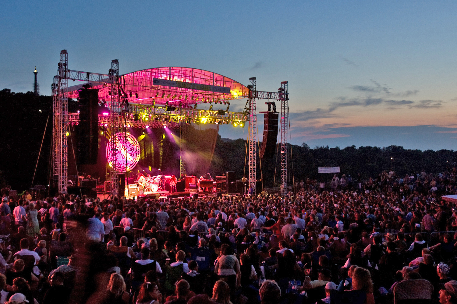

Summer concerts are happening all season long, and there’s an affordable live music option for everyone. Enjoy the longer days and warmer nights with festivals and performances by world-famous musical artists at Saratoga Performing Arts Center on the grounds of Saratoga Spa State Park, Jones Beach Theater at the iconic Jones Beach in Wantagh, and Artpark in Lewiston, or boogie with your favorite local bands at a state park or historic site near you. All options offer the chance to relax and enjoy the show from a blanket or chair.
– Written by Gabriela Wemple, Excelsior Service Fellow
Continue reading Summer Fun at State Parks and Historic Sites
