Tag Archives: Restoration

Pitching In For Dwarf Pines at Sam’s Point

With a fire-damaged dwarf pitch pine forest at the Sam’s Point Area of Minnewaska State Park Preserve rebounding slower than expected from a devastating wildfire, a State Parks greenhouse in the Finger Lakes is helping to grow a new generation of trees.

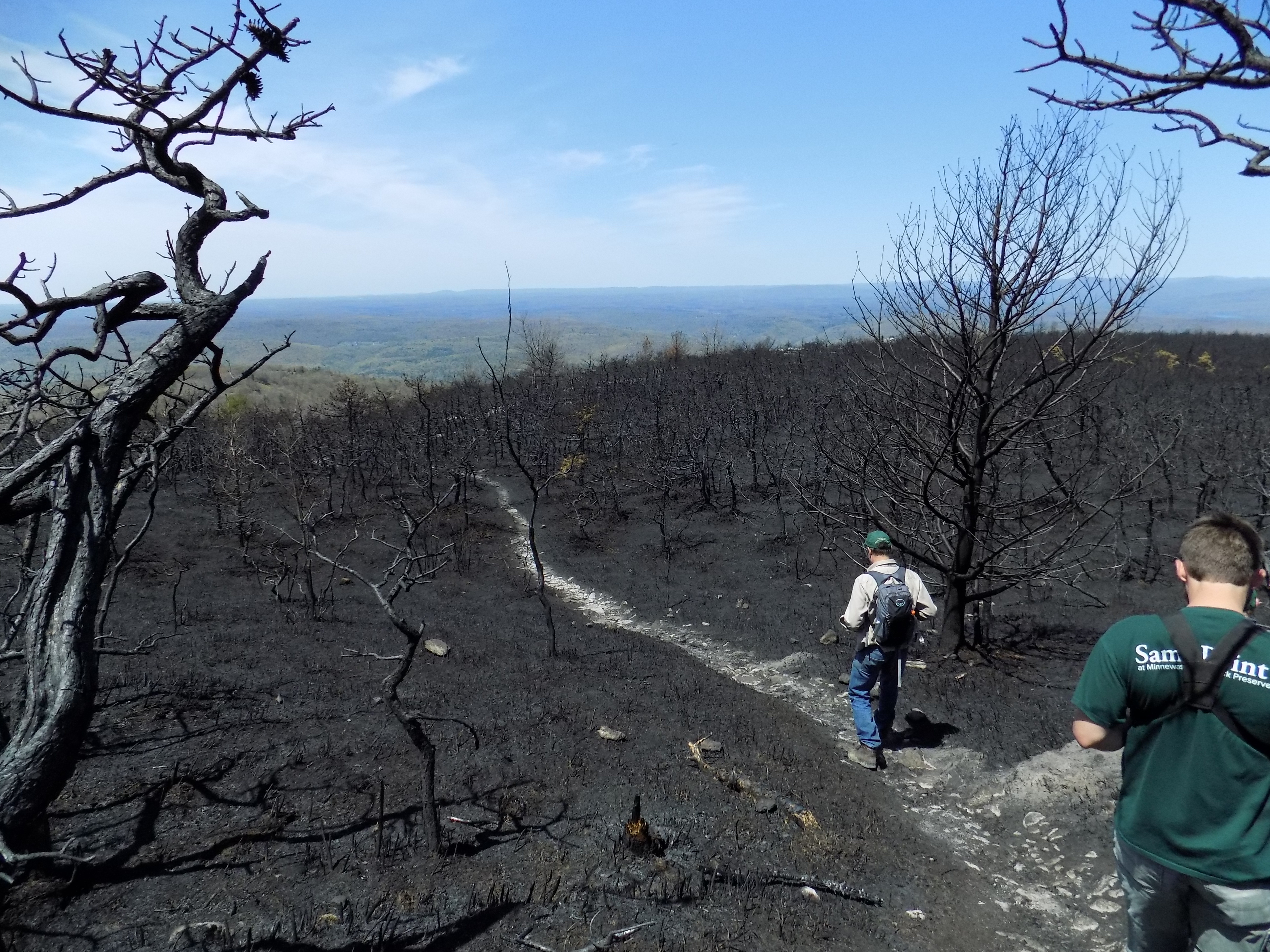
Since fire burned more than 2,000 acres in April 2016 at Sam’s Point, State Parks staff there has been monitoring the health of this globally rare forest ecosystem in Ulster County.

This high ridge in the Shawangunk Mountains is predominantly pitch pines (Pinus Rigida), a fire dependent species of conifer. The pitch pines at Sam’s Point are dwarfed, which means they can be hundreds of years old, while still only roughly as tall as a person.

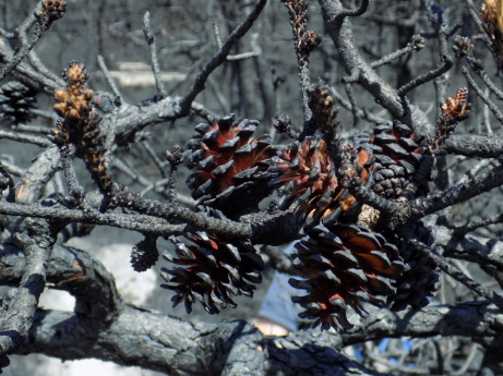
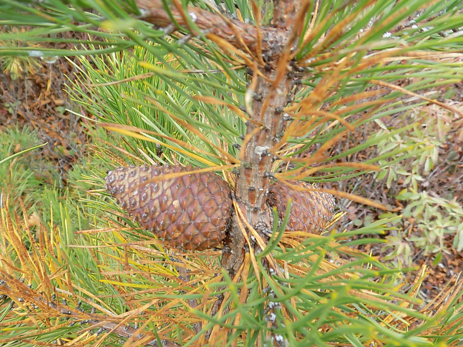
Pitch pines have serotinous cones, which means the cones require heat from fire in order to open protective scales and cast seed. These trees also have non-serotinous pine cones, which release seeds from November into the winter and do not require heat. Pitch pines take two years to fully develop cones with mature seeds, and the serotinous cones can remain sealed for years until the outbreak of fire.

Burned pitch pine cones at Sam’s Point after the 2016 fire. (Photo credit – Lindsey Feinberg)

The Sam’s Point fire burned hot and quick, which left parts of the duff soil layer still covering underlying mineral soil that is necessary for pitch pine seeds to germinate into seedlings. Duff is made up of partially and fully decomposed organic matter, including pine needles, branches and mulch.

While these exposed pitch pine seeds released after the 2016 fire were a nutritious bonanza for red squirrels, turkeys, and other seed-eating animals, that also meant fewer pitch pine seedlings were taking root to replace trees that had been lost.

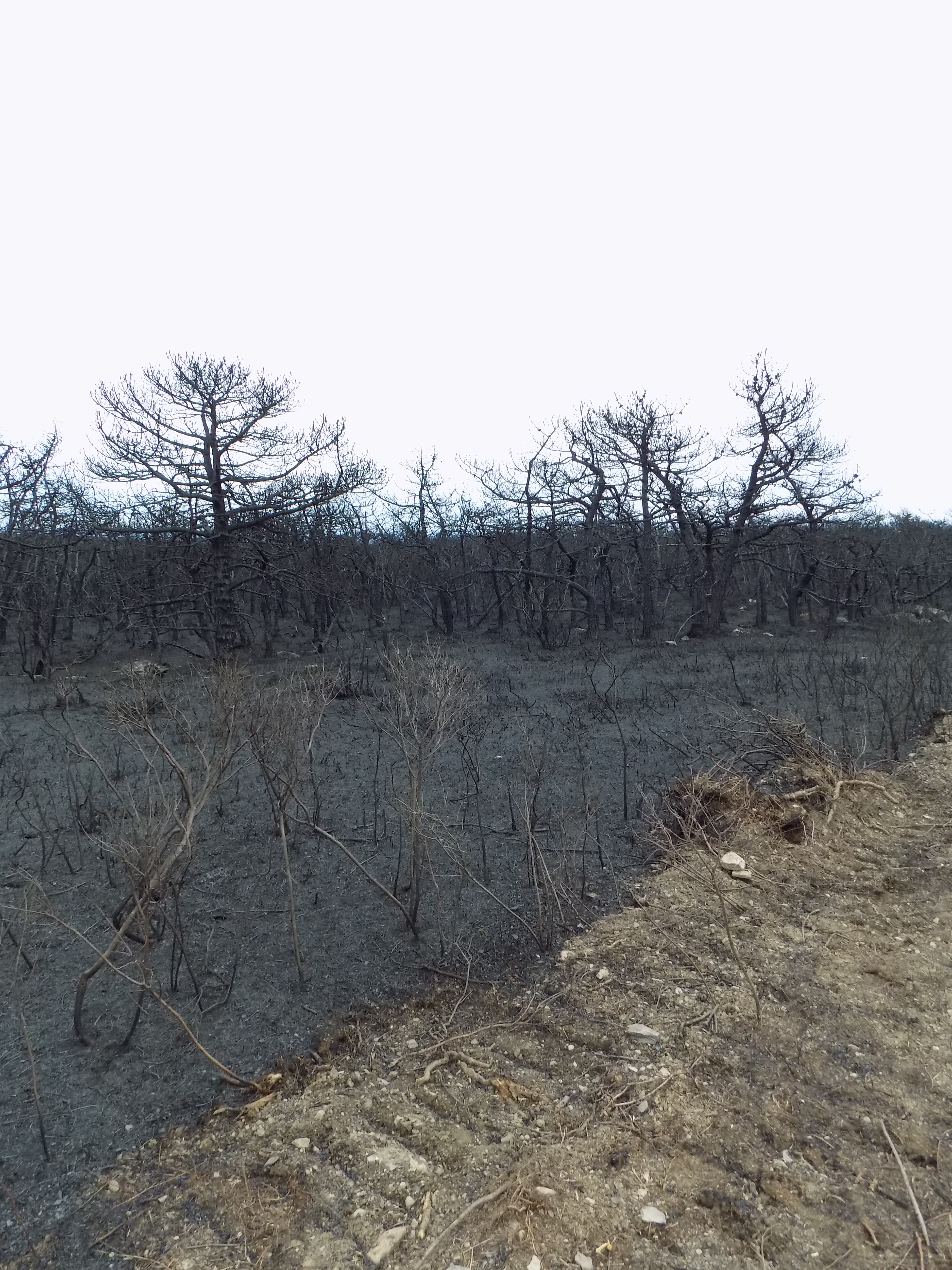
Pitch pine forests require regular moderate fires to expose the proper mineral soil and regenerate successfully. The Sam’s Point fire was the first large fire in this area in 70 years and had some exceptionally hot patches. While pitch pines are resilient to fire due to extra thick bark, an especially hot and large fire like 2016 can badly damage or simply incinerate the trees.

During the summer of 2020, it was determined that 77 percent of the pitch pines had died within 20 different plots in the burned zone being monitored by Parks staff. This was a 17 percent increase from an initial survey done in 2016, where 60 percent of the pitch pines were deemed lost to fire damage.

In the immediate aftermath of the fire, State Parks staff went into the burned zone along the Indian Rock path to survey the damage.
In this photograph taken in November 2020, the extent of the fire still shows in this area where pitch pines remain dead (left).

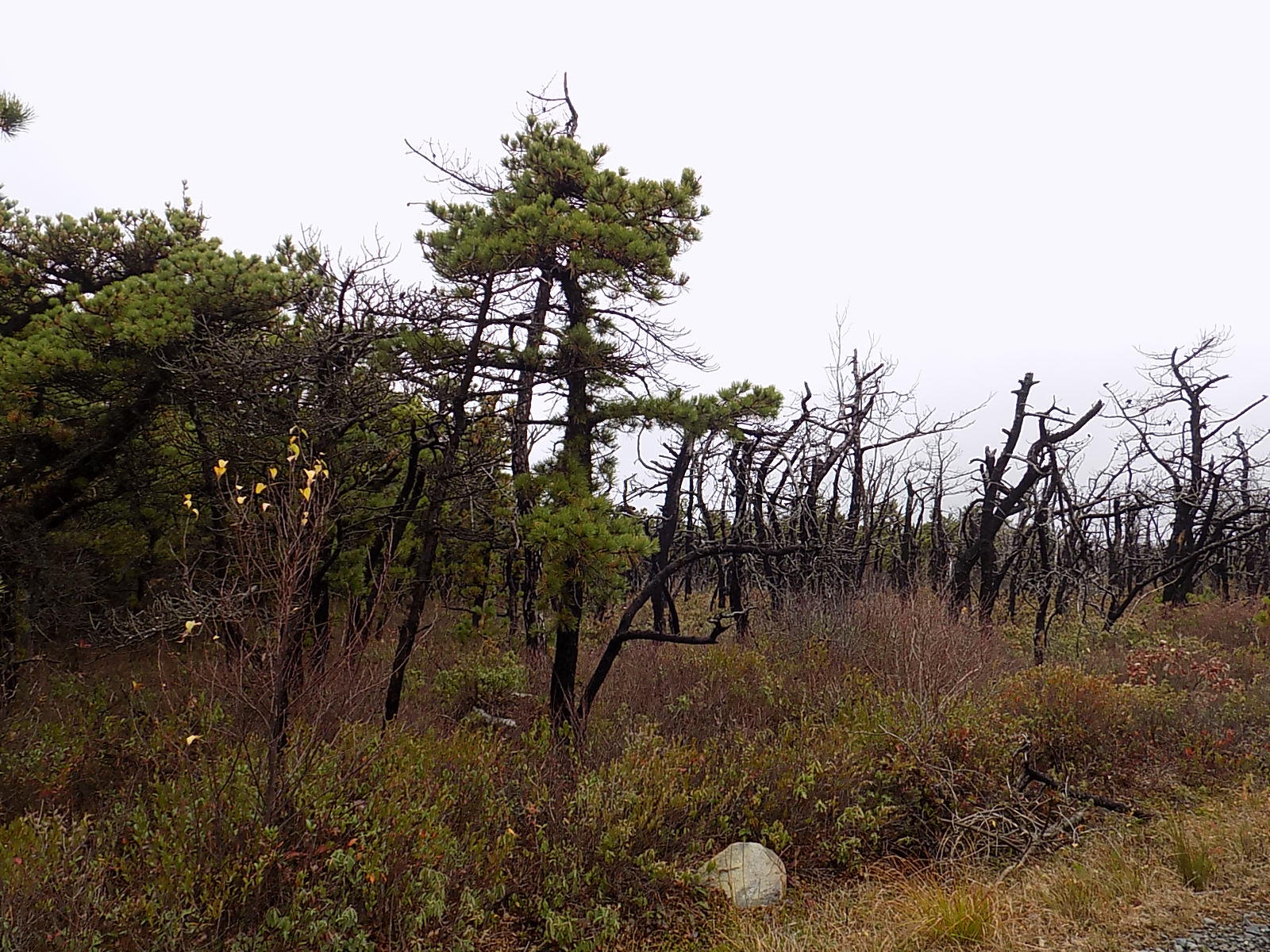
At the same time, fewer seedlings were growing in the aftermath of the fire. Monitoring of the forestry plots has found pitch pine seedling growth peaked in 2017 with 85 seedlings but has continually declined since then. This year only 27 seedlings were found within those 20 plots.

And with fewer trees and lagging replacement growth, it was feared that bird habitat was being lost. Minnewaska State Park Preserve is a designated state Bird Conservation Area as an exceptional example of a high elevation forest community with a diverse forest dwelling bird population.

Some of these birds include the Northern Saw-whet owl, Black-and-white Warbler, Black-throated Blue Warbler, Eastern Towhee, Indigo Bunting and Prairie Warbler. Parks staff at Sam’s Point has been surveying for bird activity, but so far has found no clear impacts from the fire to bird populations.

It also is notable that the duff layer at Sam’s Point has increased by almost three-quarters of an inch since the fire. This is due to a lack of any fire succession since 2016. Deeper duff means that the regrowth of this globally rare pitch pine forest will be very slow and difficult, as seedlings continue being inhibited from taking root.

Right after the fire, staff at Sam’s Point wrote a Burned Area Recovery Plan (BARP), using a template created by the National Park Service.  Several important actions are outlined in this plan included:

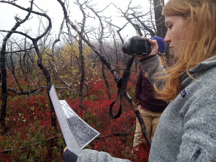
  1.  Creating and monitoring 20 forestry plots to study pitch pine regeneration     
  2. Monitoring impact of the fire on songbirds which depend on the unique trees and understory found at Sam’s Point for their breeding grounds in the spring through annual species counts
  3. Monitoring and mitigating new fire breaks for erosion, invasive species, and blocking off firebreak and recreational trail intersections with plantings or brush

This work has been carried out carefully by Sam’s Point staff and regional stewardship staff. Assistance was provided by Student Conservation Association Hudson Valley Corps interns as well as interns and staff from regional universities and colleges.

Daphne Schroeder, a Parks staff member from Sam’s Point, takes part in a survey of one of the burned areas.

In early 2019, the Plant Materials Program Staff at Sonnenberg Gardens & Mansion State Historic Park in the Finger Lakes region, reached out to Palisades regional Stewardship staff to discuss restoration projects. Out of nine proposed Palisades projects, two projects were to grow pitch pine seeds collected from Sam’s Point to help regenerate this rare forest.

Sonnenberg Plant Materials Program Lead Technician Dave Rutherford and staff visited Sam’s Point and gathered pitch pine cones in mid-November 2019.

The cones were carefully selected from an area near Lake Maratanza. Specimens needed to have ‘scales’ fully closed, and have a light brown, healthy luster. Older, closed pitch pine cones are dull and grey, so to ensure viability the seeds, these cones were not collected. No more than 20 percent of the cones were collected from any individual tree. Cones were cut from the base of the tree and kept in a woven plastic bag until it was time to process them.

Back at Sonnenberg, cones were heated in small batches at 400°F to simulate the effect of a fire. Crackling and popping as resin softened and melted, cones opened up their protective scales. After the cones had cooled, staff at Sonnenberg turned each one upside down for seeds to fall out for collection.

A healthy, mature pitch pine cone suitable for collecting for seed.
Pitch pine cones arranged for seed harvesting at Sonnenberg Mansion & Gardens State Historic Park.
The heat is on…

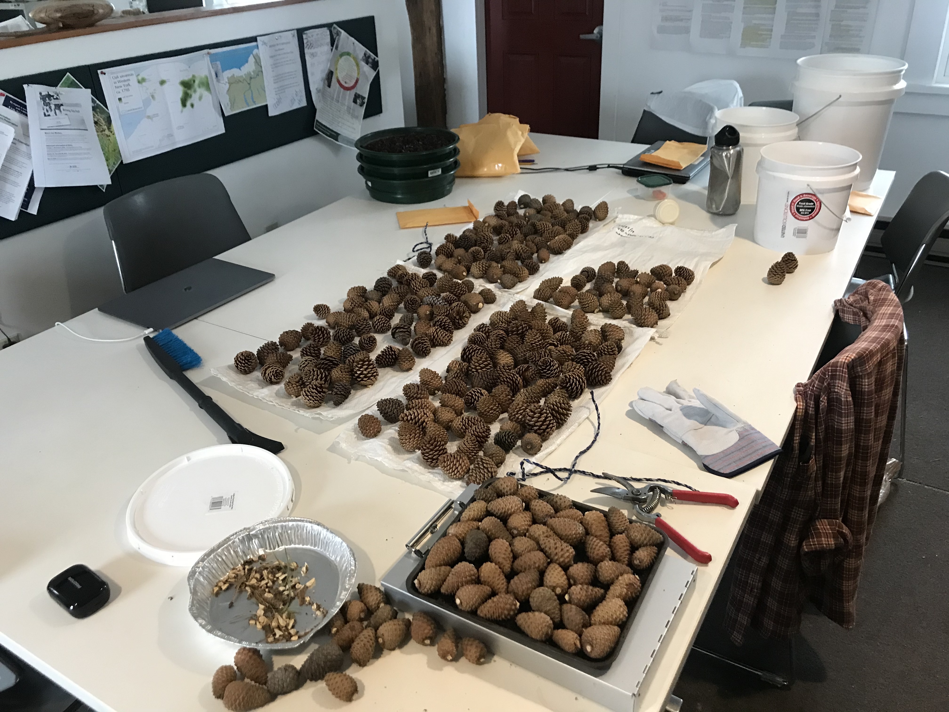
These efforts resulted in about 10.5 ounces of seeds, estimated to contain more than 41,000 individual seeds, each one about two-tenths of an inch long. Plant Materials staff started growing some seeds in April of 2020, and now have more than 500 pitch pine seedlings in their greenhouse.

Learn more in the NYS Parks Blog about the work being done at Sonnenberg Mansion and Gardens to grow native plants as part of Parks’ mission of responsible environmental stewardship:


Growing the Future in Gilded Age Greenhouses

State Parks contain a diversity of habitats, from forest and fields, to shrub swamp, marshes and streams. All these landscapes support a wide variety of native plants. As part of efforts at Parks to restore land and protect biodiversity, it is important to have the right plants for the right habitats in order to support…

Another area of degradation at Sam’s Point due to fire damage are fire breaks, especially when created by a bulldozer. Crews made these breaks by removing trees and other potential fuel from the path of the fire to contain its spread. 

Fire managers who worked on the Sam’s Point fire added eight miles of new fire breaks around the park preserve using bulldozers. This equates to adding eight miles of new and hastily planned roads in a semi-wilderness.

A fire break made by a bulldozer in the immediate aftermath of the fire. Breaks were made to remove potential fuel from the path of a fire.
One of the fire breaks at Minnewaska created by bulldozers to contain the 2016 fire is blocked off to discourage hikers from using it.

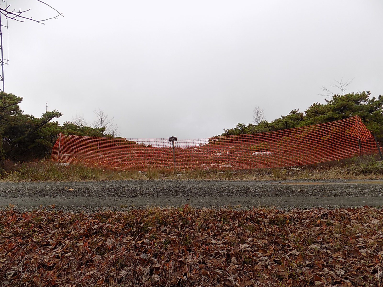
Potential impacts of concern from these dozer breaks are erosion, spread of invasive plants and creation of new, unplanned, travel corridors by hikers within the park preserve.

Existing recreational carriage roads do serve as a natural fire break, but new dozer lines had to be made to control wildfire spread. There are a few places where dozer lines intersected with the park preserve’s carriage road and trail systems. These fire breaks are now open, linear, areas with knee high shrubs (huckleberries and blueberries) growing amongst the rocky duff layer.

This is potentially a perfect storm for invasive species to take hold, if people are out hiking on these new scars. People are a powerful vector for transporting invasive plant species. These dozer lines also provide a clearing for people to wander off in and get lost or injured. The intersections between fire breaks and carriage roads are a perfect place to establish re-growth of pitch pines, to hide these open scars.

These seedlings now growing at Sonnenberg will be a year old in April 2021, and hopefully can be planted at Sam’s Point sometime next year as the final piece to our restoration plan after the Sam’s Point fire. These seedlings will go into dozer break scars and hot spots.

It is important to note that because the seeds were collected from the globally rare pitch pine forest at Sam’s Point, the native biome is preserved. Once these seedlings are planted, these trees will be growing for hundreds of years, eventually blending in and keeping this forest intact and healthy for generations to come.

The new pitch pine seedlings growing at Sonnenberg’s greenhouse in preparation for being planted at Sam’s Point Area in 2021.
Working in fire-burned areas can result in a bit of soot here and there, as these three Parks staffers show after a day doing surveys at Sam’s Point.

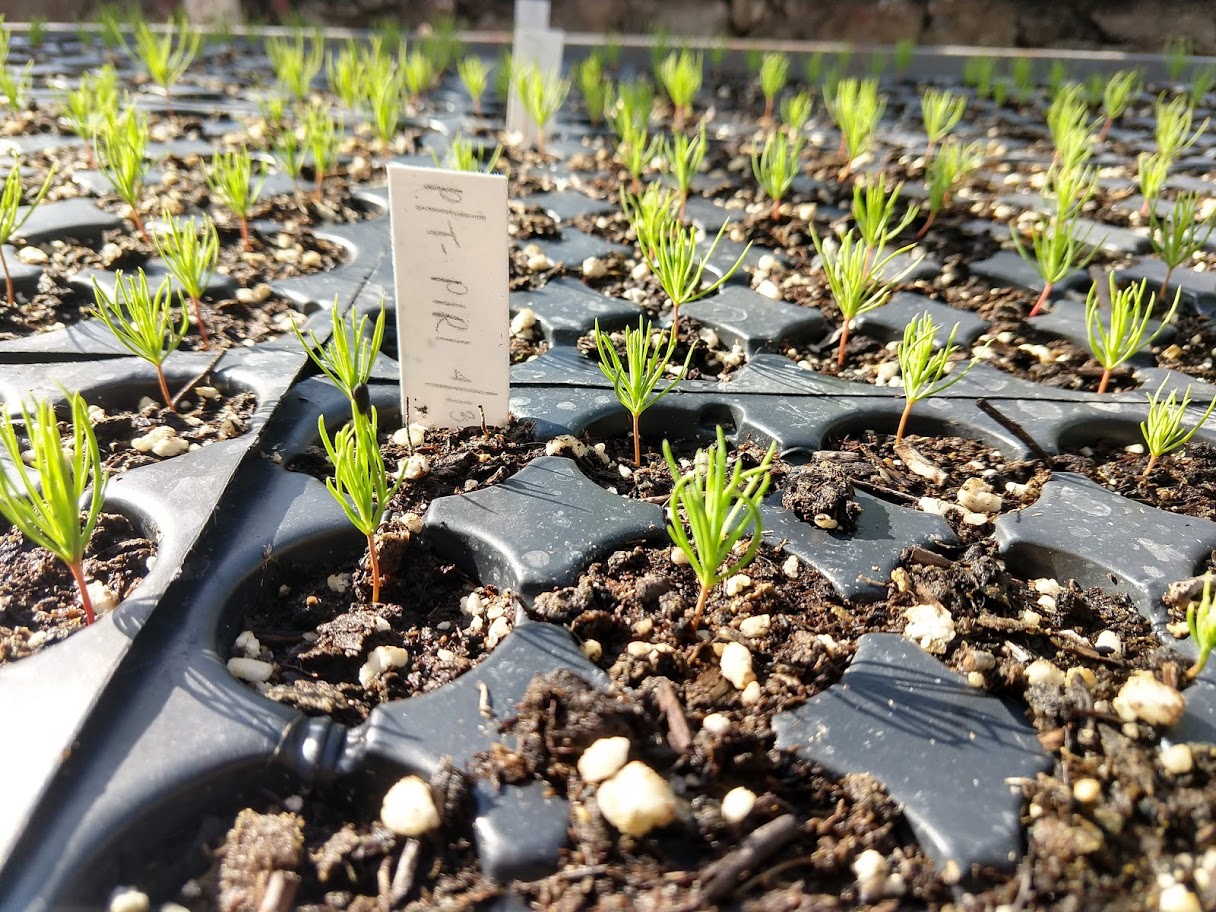
Cover shot – Pitch pine seedlings grow at Sam’s Point Area. All photos from NYS Parks.

Post by Rebecca Howe Parisio, Interpretive Ranger, Sam’s Point Area of Minnewaska State Park Preserve.


Learn more about the immediate aftermath of the 2016 fire at Sam’s Point and initial signs of recovery in the year following in these posts from the NYS Parks Blog:

Rebirth After Fire

Text and photos by Lindsey Feinberg, Student Conservation Association Intern at Sam’s Point  Please ask permission to use photos. Located within Minnewaska State Park Preserve is Sam’s Point, an area of unique ecological significance encompassing roughly 5,000 acres in the Shawangunk Mountains of southern New York. Toward the end of April, during a particularly dry…

From Ashes to Awesome: Sam’s Point

In April 2016, a wildfire engulfed around 2,000 acres of the Sam’s Point Area of Minnewaska State Park Preserve in the Shawangunk Mountains. The “Gunks” (a nickname for the Shawangunks) are well-known not only for climbing, but also for the globally unique community of high altitude dwarf pitch pine barrens which hold some interesting and…

Did You Know That Allegany State Park Played A Role In Wild Turkey Restoration?

The wild turkey is native to North America, but suffered severe declines due to wide-scale forest clearing and over hunting. By the mid-1800’s, this great bird was gone from New York state and much of the northeast. However, in the mid to late 1940’s, some wild turkeys were observed along the NY and PA border from Allegany State Park to the Genesee River Valley, a sign that the habitat might be recovering and able to support them again. So, in the early 1950’s, the New York State Conservation Department (forerunner to the NYS Dept. of Conservation) began a restoration effort in the early 1950s. They started with game farm turkeys, but after a few years, this effort failed because the game farm birds were not wild enough to avoid predation and lacked the capacity to survive.

fall.hens
Flock of hens in the forest in the 1950’s.

Meanwhile, a healthy breeding population of wild turkeys expanded from Pennsylvania into the Allegany State Park region of New York. Park managers then gave the Conservation Department permission to trap turkeys in the park, initiating the wild turkey trap and transfer program which began in 1958 and concluded successfully in 1974. This program allowed for more rapid expansion of the turkey population to suitable unoccupied habitats.

dec.file.2
Tom turkey displays his tail.

The turkeys trapped in Allegany State Park were moved to several areas in the Region and then throughout the state. In addition to the in-state trap and transfer, turkeys from the park were also sent to Connecticut, New Hampshire, New Jersey and Vermont. Other trapping efforts in the region and elsewhere in New York sent birds to Delaware, Minnesota, Rhode Island and the Canadian Province of Ontario. New York turkeys helped re-establish populations throughout the Northeast, Midwest and southeastern Canada.

New York State Conservation Department was one of the pioneers among state agencies to restore wild turkey populations in the United States. This program would not have been successful without the cooperation of Allegany State Park and to this day is recognized as one of the greatest wildlife management success stories of North America.

RickMiller OleanTimesHerald
2017 Monument commemorating the first wild turkey trap and transfer program, photo courtesy of Rick Miller, Olean Times Herald

Conservationist 10-2017 p 28
Wild Turkey Restoration exhibit in the Red House Natural History Museum, image from DEC Conservationist, October 2017, p 28.

Marsh Madness: Restoration of Iona Marsh from Invasive Phragmites

Iona Island, located along an elbow of the Hudson River in Bear Mountain State Park, is technically an archipelago of three islands connected by marshlands. Iona has had many owners in its storied history, prior to being bought by New York State in the 1960s. The Island was host to Native American tribes for thousands of years, who took advantage of the plentiful shellfish along its shores. In the last few hundred years, it has been the site of an unsuccessful vineyard, a hotel and weekend destination for NYC residents, a U.S. Navy arsenal, and a partially built park recreation area. The eastern side of the island past the railroad tracks has been closed to the public since the 1980s, but a small portion of the island consisting of the five remaining Navy buildings is used for storage for the Palisades Interstate Park system. The rest of the island has returned to a more natural state of woods, meadows, and rocky outcroppings and serves as a sanctuary for wintering bald eagles.  The island achieved National Natural Landmark status in 1974, and was designated a NYS Bird Conservation Area and Audubon Important Bird Area shortly thereafter.

A key natural feature at Iona is the extensive marshlands, 153 acres in all, flanking its western side.  Part of the Hudson River National Estuarine Research Reserve (HRNERR), this brackish tidal marsh (marshes with water that has different concentrations of salt depending on the tides) teams with life including fish, waterfowl, waterbirds, plants, and crustaceans. In recent times, the rich biodiversity of the marsh, including a number of state rare species, has been threatened by Phragmites australis, or as it is more widely known, common reed.

Common reed (Phragmites australis) is a plant that was likely brought to the US from Europe and Asia in the 1800s through ship ballast or the water taken in by ships to allow them to balance on long voyages. Commonly referred to as just Phragmites, this non-native plant is invasive in the U.S., displacing and crowding out native plant species, such as cattails, rushes, asters, and many others. In turn, the presence of this species has undermined the complex web of marsh dependent organisms.

The non-native Phragmites is identifiable by its tall stature, dark blue-green leaves, and tendency to form dense stands, with little to no possibility for native species to grow in the areas that they occupy. A native species of phragmites (Phragmites americanus) occurs in NY as well, but this smaller plant with reddish stems grows with less density so it does not crowd out other flora.

Pre20018 Iona
Iona Island Marsh in 2008 before treatment. Phragmites dominate the background.

The phragmites problem at Iona Marsh began in the early 1960s, when the first small colony appeared near a pipe draining into the marsh. Over the next 40 years, phragmites steadily expanded until it covered nearly 80 percent of the marsh area. Researchers tracking these changes noted a concurrent decline in marsh specialist birds and specialized brackish marsh plants, including state rarities.  In an effort to reverse these trends, the Palisades Interstate Park Commission, while partnering with Hudson River National Estuarine Research Reserve and the Highlands Environmental Research Institute, started a New York State Department of Environmental Conservation (NYSDEC) funded management program in 2008 focused on a 10-acre test area. The goal was to reduce the invasive phragmites, and make room for native plants to once again occupy the area. If the program was successful in this small area (1/15th of the marsh), it could be expanded to additional marshlands.

A multi-faceted control and monitoring program has been developed and implemented and the results have been dramatic. More than 90% of the phragmites was eliminated within one year and nearly 97% by the third year. Researchers saw the return of huge meadows of annual native marsh plants, including some state-threatened species, followed by perennial cattail stands. Marsh specialist birds such as Virginia rail, least bittern (State-threatened), and marsh wren followed soon thereafter.  Based on this success, the project was expanded to an adjacent 32-acre area of the marsh known as Ring Meadow. Both areas now have less than five percent Phragmites cover, an overall success on the journey to reestablish native vegetation.

2017 Image
Map of the Iona Island Marsh Treatment Areas

While complete eradication of the Phragmites may be impossible to achieve, success can be maintained through continued monitoring and spot treating remaining and new patches.  Bird and vegetation surveys are conducted annually, as are measurements of sediment build-up on the marsh surface, as it relates to sea level rise.  The goal remains to restore the native plant communities in the marsh to promote biodiversity. A healthy, native marsh community will lead to increased productivity and habitats for fish, birds, and mammals – many of them specially adapted to the brackish conditions at Iona.  With continued management, the long-term outlook is positive for this Hudson River jewel, one of only four large brackish marshes on the Hudson.

RingMeadow
Ring Meadow in 2016. Cattail and blooming Rose Mallow have regrown where phragmites once were.

Interested in seeing Iona Marsh for yourself? While public canoeing and kayaking are not allowed in the marsh itself to protect this unique place, through collaboration with the State Parks, NYS DEC offers free public canoe programs each summer.  Not a fan of getting on the water? Iona Island is accessible by road. There is a parking lot approximately ½ mile onto the island, right before the railroad tracks (the boundary of the public accessible areas), where you can park and view the marsh. Lucky visitors may spot waterfowl, muskrats, frogs, turtles, wetland birds, deer, or even bald eagles!

Photo credit:   PIPC Archives

Dr. Ed McGowan,  2017 Annual Report Iona Island Marsh

Post by Jesse Predmore, SCA

Edited by: Dr. Ed McGowan & Chris O’Sullivan

Featured image: lulun & kame accessed from Flickr

Weathering the Storm by Restoring a Native Grass

In October 2012, Superstorm Sandy hit New York, causing severe damage on the Atlantic and Long Island coasts. The strength of the storm highlighted the importance of storm readiness. In one park on Long Island, the storm also brought an opportunity for habitat restoration.

Sunken Meadow State Park is located on the north shore of Long Island, and contains the Sunken Meadow Creek, which flows into the Long Island Sound. The park is over 1,000 acres and includes important coastal habitats including coastal forest, low salt marsh, marine eelgrass, tidal creek, and maritime dunes.

When Sandy struck, it destroyed a berm (a wall made of earth) that State Parks constructed in the 1950s. Ever since it was built, the culverts through the berm were inadequate and greatly reduced tidal flow to Sunken Meadow Creek, decreasing the quality of the habitat upstream. Rather than rebuild the berm, a plan was set in motion to restore the tidal marshland by replacing the berm with a bridge and planting saltmarsh species.

Sunken Meadow Creek after Sandy with photo credits
The remnants of the berm in Sunken Meadow Creek after its destruction by Superstorm Sandy in 2012.

Even before Sandy struck, many partners had joined with State Parks to restore the habitat, including NYS Department of Environmental Conservation (DEC), Connecticut Fund for the Environment, Save the Sound, Long Island Sound Study, National Oceanic and Atmospheric Administration, Restore America’s Estuaries, Sea Grant New York, US Fish and Wildlife Service, The Nature Conservancy, and the Louis Berger Group. The New York Natural Heritage Program provided valuable information to help guide the restoration. The National Fish and Wildlife Foundation provided the funding.

With the removal of the berm came the return of tidal flow (a range of 2-3 feet per tidal cycle), and the gradual natural restoration of 135 acres of tidal creek and salt marsh habitat. Common reed (Phragmites australis) – an invasive plant with low tolerance for salt – had been a problem upstream of the berm, but the return of salty water cleared away much of this undesirable species. Once the common reed was gone, a three-acre area of mudflats was exposed, which the partners identified as an ideal location for marsh restoration work.

Mudflats 2013 with photo credits
xposed mudflats in 2013, one year after Superstorm Sandy, looking toward the pedestrian bridge.

The partners and volunteers teamed up to plant the mudflats with smooth cordgrass (Spartina alterniflora). Thanks to the roots of this native saltmarsh species, this section of the creek is now more resilient in the face of erosion and flooding that storms can bring. (Want to see how plants slow down erosion? Try this fun home experiment!) The restoration will also improve habitat for fish, macro-invertebrates (like fiddler crabs), and birds, providing them with space to forage and reproduce.

Mudflats 2017_with photo credit
View of mudflats looking toward bridge in 2017, two years after restoration planting of smooth cordgrass. You can see the remnants of the fencing put up to protect the young grass plants from being eaten by geese – these posts will be removed in the coming months.

The site continues to be monitored for the success of the plants. State Parks staff will also observe changes in the marsh elevation using Surface Elevation Table monitoring stations (SETs), which were installed in the restoration site and a control site downstream.  The elevation of the marsh surface may change in the future as mud is washed up and sea level rises. To learn more about SETs and how they are used, click here.

DEC staffers with photo credit

To learn more about the tidal creek and salt marsh habitat at Sunken Meadow State Park, check out some of our educational programs! NYS Parks works with local schools to engage students in citizen-scientist projects. A seasonal intern leads nature walks and uses the mobile touch tank to share the tidal world with park patrons. Sunken Meadow also participates in the “A Day in the Life of the Nissequogue River” program, which you can learn more about here.

To find out more about programs available at Sunken Meadow State Park, check the calendar.

Post by Juliana Quant, State Parks

Sources

Connecticut Fund for the Environment, 2013. Sunken Meadow Comprehensive Resilience and Restoration Plan. National Fish and Wildlife Foundation – Hurricane Sandy Coastal Resiliency Competitive Grants. EasyGrantsIS: 42442.

Hurricane Sandy

More details on the Sunken Meadow State Park restoration project from Save the Sound