Humans aren’t the only species of animals that enjoy state parks. Park staff will occasionally find clues of what animals may live there, such as scat, a chewed branch, or a feather. But we don’t always get to watch out for wildlife to stroll on by, especially in remote parts of parks. The best tool for this job is a game camera. Park staff use these camera traps to ‘capture’ these animals in a safe, respectful way.
Park educators from across New York have put together a snapshot of what we’ve discovered. Now, you too can witness and enjoy some of our favorite remarkable wildlife encounters taking place here at our parks when humans are not present.
If you’ve ever drifted off to sleep at Betty and Wilbur Davis State Park or gone to a nature program at Minna Anthony Common Nature Center and wondered about their namesakes, this post is for you! During Women’s History Month, let’s explore the stories of writers, activists, politicians, and ordinary women who have lent their names to state parks and nature centers.
Many buildings and features built for New York state parks during the 1930s mimicked the natural environment. In the period after World War II, this rustic style started sharing space with more modern designs.
One of the busiest construction periods of the New York State Parks system was during the 1950s and 1960s, when park planners were expecting to welcome record numbers of visitors. You can learn more about that history in our Blazing a Trail timeline project. But, for a deeper dive into the architecture leading up to that era, keep reading…
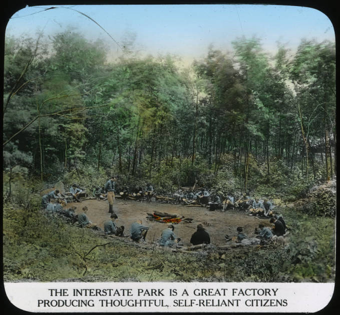
If you’ve explored our Blazing A Trail Centennial timeline, you’ll know that the creation of New York’s state park system was influenced in part by two larger social movements: A new environmental conservation movement that sought to protect open spaces from development, and a growing social reform movement that sought to address the inequalities that arose during America’s Gilded Age of the late 1800s.
Two lantern slides and their captions perfectly depict the social goals of the New York state park system at its creation: a haven for working city-dwellers and a place of self-improvement. Courtesy of the The Palisades Interstate Park Commission collection at nyheritage.org.
The state park system was founded on the value of the outdoors to public physical and mental health, and the pressing need to preserve land for public use. In a statement supportive of the 1924 State Park Plan, then-state senator Nathan Straus Jr. said:
“The city dweller often forgets that he is closely related to the other members of the animal kingdom. Like the other members, he loves the earth and the trees and craves contact with the soil. Sensing instinctively the need of the open country, the wealthy city man joins a golf club and organizes a fish and game reservation where he can enjoy camping and outdoor life. The city dweller of moderate means has the same cravings and the same needs. But when he takes his family out for a Sunday, or for a longer outing, he finds himself on a congested road hemmed in by private property, which is marked with the sign “No Trespassing.” Where is he to go? The answer is, the state park.”
When John Boyd Thacher State Park Manager Bill Hein got a call saying that Ron Swanson was going to visit his park, he thought it was a prank. It’s not every day that you get a visit from a celebrity, but that’s just what happened when Parks and Recreation star Nick Offerman visited this State Park in rural Albany County last month to promote his newest book on the network news program CBS Mornings.
The 51-year actor played the deadpan, gruff, libertarian head of small city parks department on the critically acclaimed series, which ran from 2009 to 2015. As fans know, Offerman in real life is a passionate woodworker, making furniture, canoes, and boats, and is the husband of actress Megan Mullally, who is best known for starring on the sitcom Will & Grace. She was filming locally, so CBS producers looking for a picturesque natural Capital Region location for their interview with Offerman chose Thacher Park for its sweeping views from the Helderberg Escarpment.
The Helderberg Escarpment at Thacher State Park at sunrise.
Joining CBS anchor Anthony Mason, Offerman started his morning with sunrise fishing at Thacher’s Thompson’s Lake. While there, the two discussed Offerman’s background. Born and raised in Illinois, Offerman has penned a new book (Where the Deer and the Antelope Play) that reads like a love letter to the outdoors and a reflection on our shared responsibility to act as stewards of our environment. It isn’t his first book but may be his most poignant – set against the backdrop of some of the nation’s most incredible natural sites, including Glacier National Park. His best advice? Get outside!
“In my book, with a sense of humor, I’m trying to remind everybody … to get out. If you don’t know what the poison ivy or poison oak situation is, then you’re not getting deep enough in the woods,” he said.
Read this interview that Offerman gave to the Los Angeles Times about the book and some of his outdoor adventuring that inspired it.
Getting outside is just what he did at Thacher, a flagship park in the eight-county Saratoga-Capital Region. After a morning fishing at the lake (with no catch to show for it), Offerman and Mason enjoyed a hike along Thacher’s famous limestone escarpment. Sitting atop the Indian Ladder Trail, the overlook has a panoramic view that stretches to Albany, down the Hudson Valley, and east into neighboring Vermont.
Punctuating the visual splendor was a roaring waterfall, flowing with gusto from a string of summer rain showers. Offerman couldn’t contain his glee. “We don’t have this in Illinois,” he said.
Nick Offerman chats with Parks staffer Ray Muniz.
Fishing is only one of the activities available at Thompson’s Lake. Featuring 140 campsites, the park also has volleyball court, horseshoe pits, a playing field, swingsets, carry-in boat access, canoes, kayaks, and stand-up paddleboards, fishing areas, and nature trails. The lake is open for ice fishing in the winter.
Settling down on a picnic table to continue the interview, Offerman stopped, pulled out his handy Leatherman multi-tool and tightened up a few screws he thought might be coming loose, much like his Parks and Recreation character, who was really into tools, maintenance, and repair. Offerman reflected on his penchant for woodworking with Mason throughout the interview. It’s a hobby so central to his story – and so unique for an actor – that it was written into his character, who in one episode received a fictional award for woodcraft.
As the crew wrapped up from its morning shoot, Offerman met with some of our real-life Parks and Rec staff, including Regional Director Alane Chinian, Park Manager Bill Hein, and Environmental Educator Savannah Wilson. Hein, an avid fan, even brought copies of Offerman’s previous books. In true Ron Swanson fashion, Offerman was generous with his time, cracking jokes, answering questions, and offering autographs.
Offerman chats with Parks Student Conservation Association members Anna Pirkey and Grace Brennan (l-r).
Saratoga-Capital Regional Director Alane Ball-Chinian, Anna Pirkey, Nick Offerman, Grace Brennan, Thacher Park Manager Bill Hein, and Parks Environmental Educator Analyst Assistant Savannah Wilson.
“I had heard Nick mention Aldo Leopold during part of the taping and that kind of struck a chord with me,” Hein said. “I had read “A Sand County Almanac” in my earlier years and Leopold’s writing on killing wolves in the Southwest helped show me the importance of conservation and the delicate balance that nature lies in. It helped me solidify the career choice I was making out of college.”
Hein had brought with him a copy of Offerman’s earlier book “Paddle Your Own Canoe” for him to autograph. Beneath his signature, he wrote two words: “To Mirth.”
Offerman signs a book for Thacher Park Manager Bill Hein.
Before leaving Thacher, Offerman had one last compliment to offer Parks staff. “I love your office,” he said, gesturing to the escarpment. “Thank you for the work that you do.”
And thank you, Nick Offerman and CBS Mornings, for helping bring a bit of the beauty of Thacher State Park to a national audience. With its spectacular views and 25 miles of trails spread across some 2,500 acres for hiking, mountain biking, cross-country skiing, snowshoeing, and snowmobiling, it is truly a year-round destination!
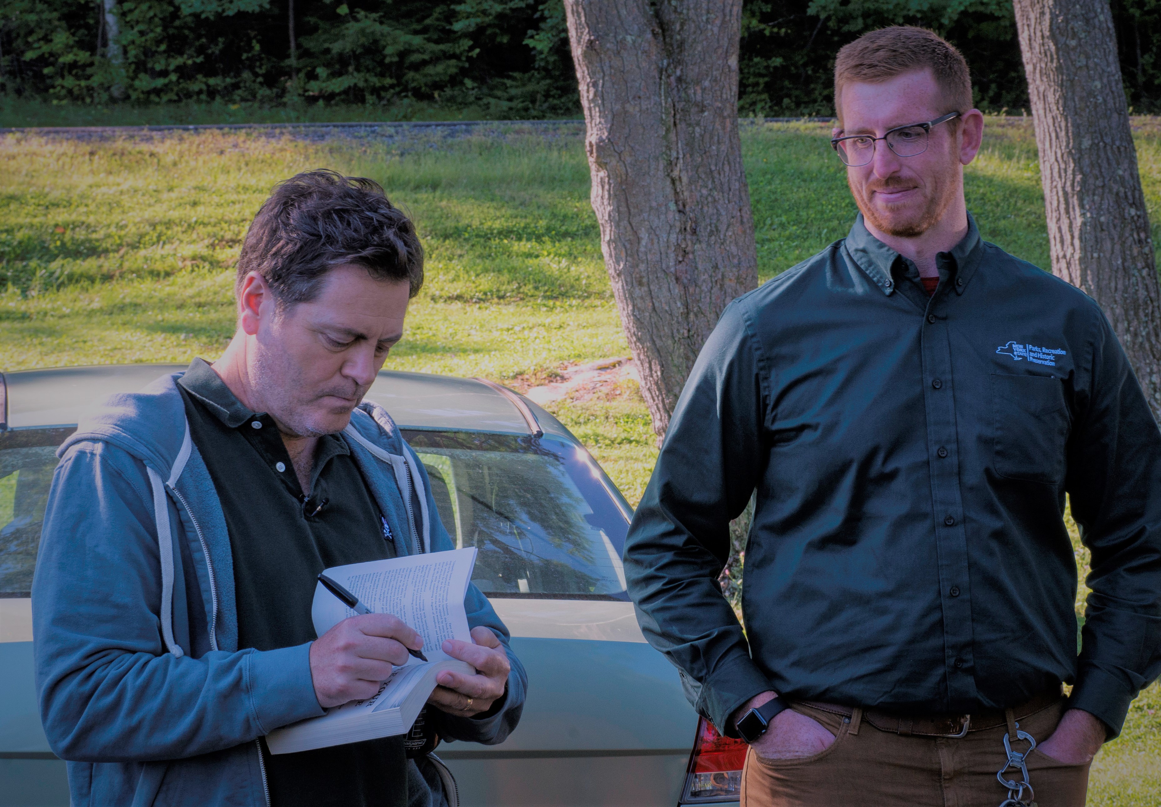
Cover Shot- Nick Offerman. All photos by NYS Parks
Post by Rey Muniz, Public Affairs Manager, Saratoga-Capital Region, NYS Parks