

Camping at our 100-plus campgrounds is the ultimate affordable getaway option, but it’s so much more than just a money saver. Camping connects you to nature and allows you to unplug in ways you just can’t replicate on a day trip. While some of our campgrounds are well-known statewide, others are unsung outside their immediate area, their natural beauty and ecological significance waiting to be discovered. As you plan your summer, get up to speed on camping guidance and consider these seven often-overlooked New York State Parks campgrounds for your next great stay.
Continue reading New York State Parks’ Best-Kept Secrets: Seven Campgrounds Worthy of Your SummerTag Archives: mine kill state park

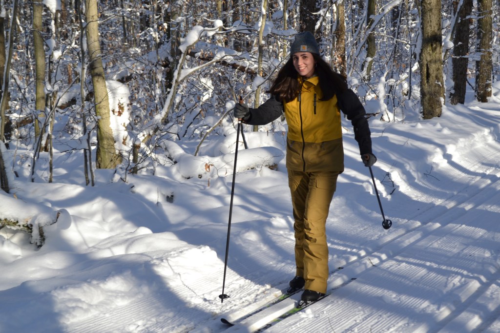
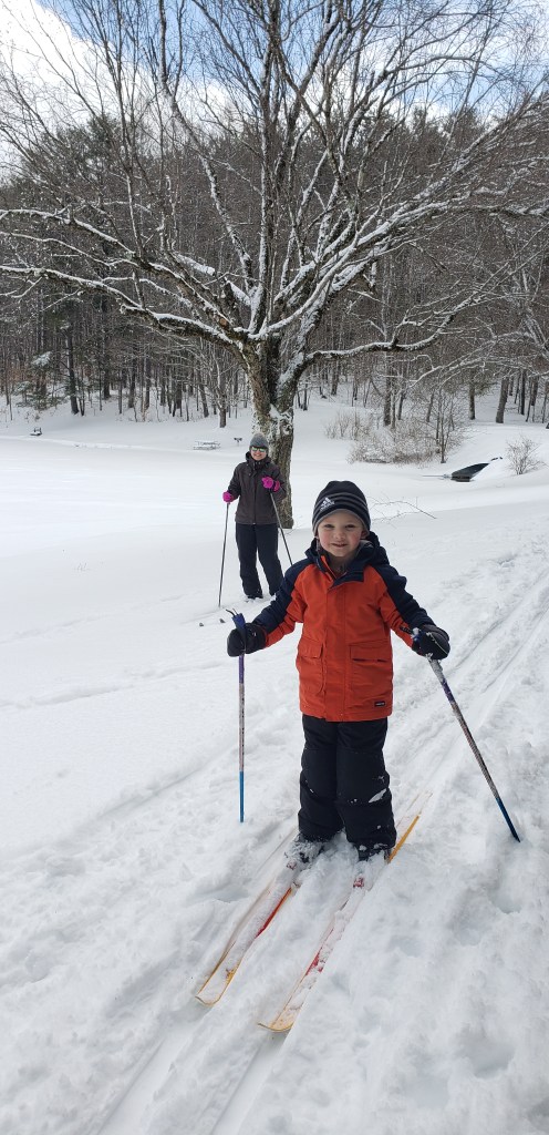
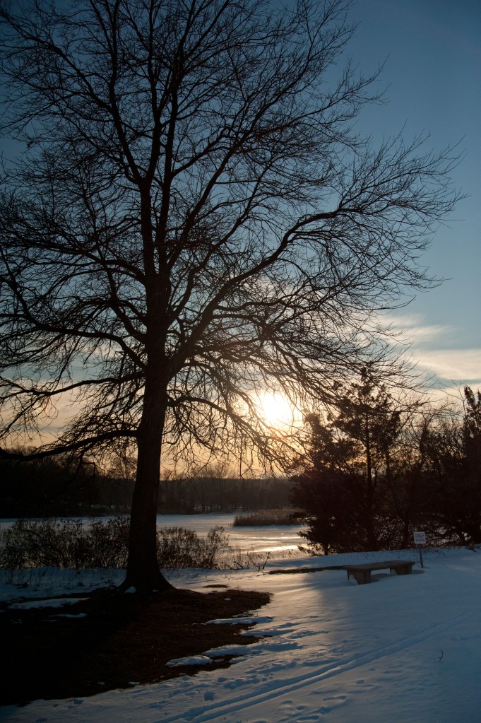
Glide Through Winter on State Park Ski Trails
“Can you imagine anything freer and more exciting than when you, swiftly as a bird, zoom down the wood-clad hillsides while country air and spruce twigs whiz by your cheeks and eyes; brain and muscles tense, ready to avoid any unknown obstacle which any moment might be thrown in your path? You are one with your skis and nature. This is something that develops not only the body but the soul as well, and it has a deeper meaning for a people than most of us perceive.”
— Fridtjof Nansen – Norwegian explorer, scientist, humanitarian and advocate for cross-country skiing, 1890
The use of skis to cross winter terrain dates back millennia, with the oldest-known image of a person on skis carved about 5,000 years ago into the rock of a Norwegian island.
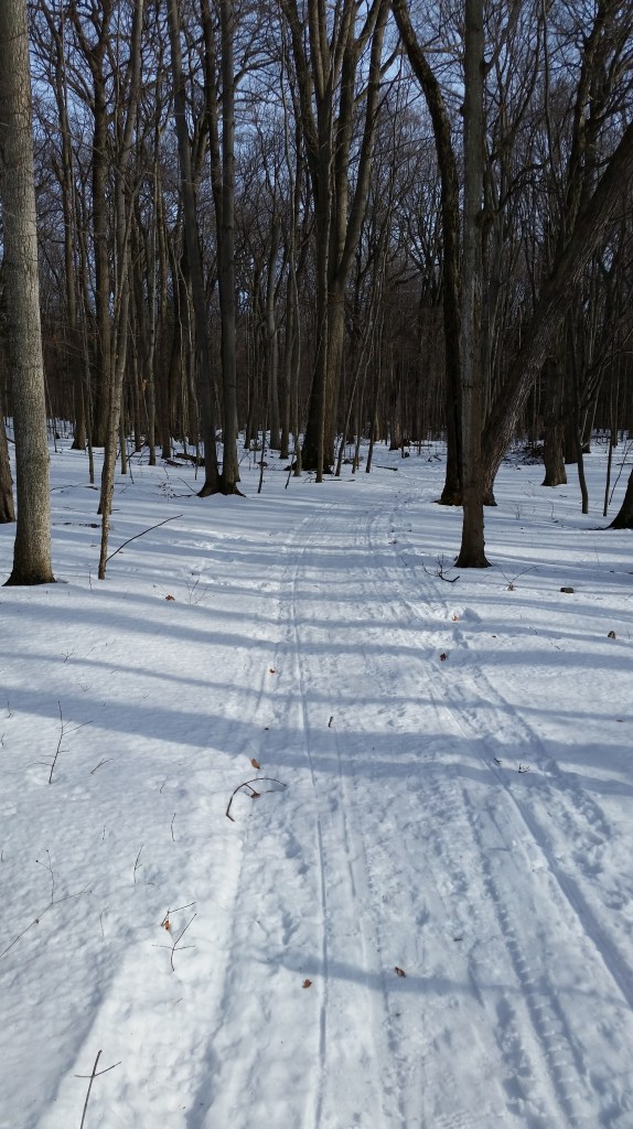
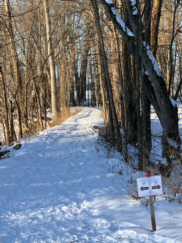
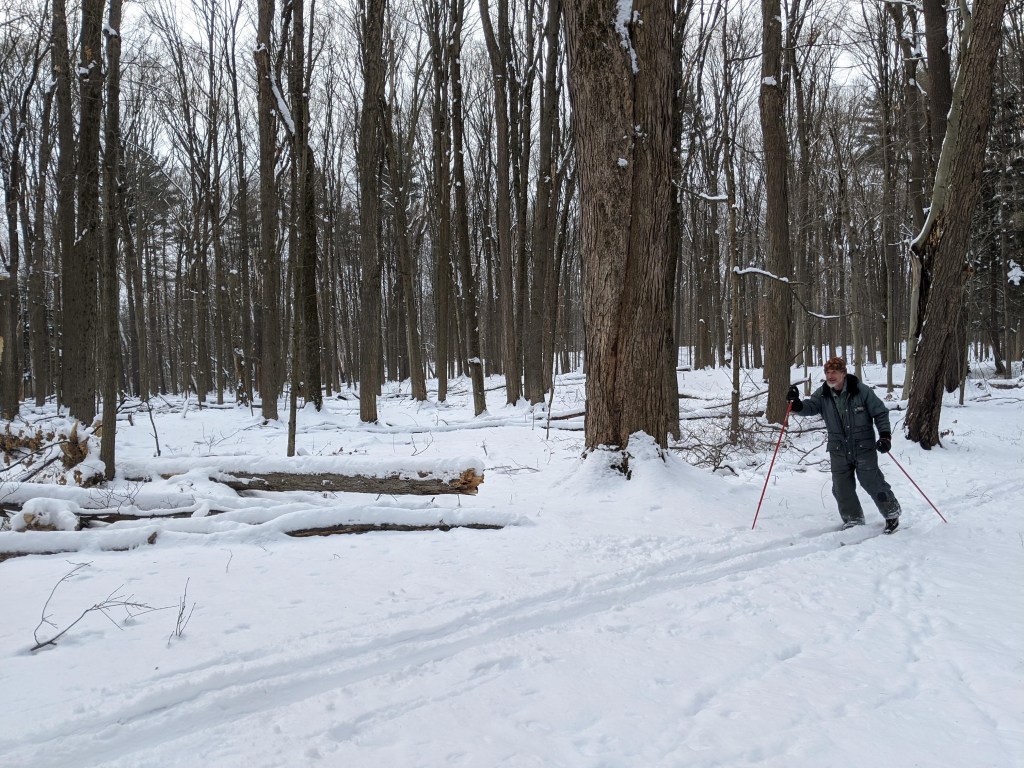
When winter graces the state with snow, State Parks are a great place to enjoy cross-country skiing, with many miles of ski trails for all abilities, from beginner to expert across 104 state parks and eight historic sites spanning the state.
Known in shorthand as XC (or also as Nordic) skiing, this family-friendly sport is a full-body, low-impact cardio workout as well as a wonderful way to get outdoors during winter to see how beautiful the season can be. Skiing is quiet as well, so skiers often have a chance to spot wildlife (and also get a close look at its tracks) that has not been scared off by their approach.

After a promising December start for XC skiing, this season has suffered from a dearth of snow. Perhaps a snowstorm or two is still to come before spring, or if not, this list can be held until the start of next season. Always call ahead to check on snow conditions.
This online map from the National Oceanic and Atmospheric Administration also is a handy tool for getting a picture of snow cover across the state when planning a ski trip.
Either way, to help decide where to go in State Parks when conditions allow, here are some staff favorites. Check each park’s website for a map of their trails:
Allegany Region
With 24 miles of trails, the Art Roscoe Cross Country Ski Area at Allegany State Park in Salamanca, Cattaraugus County, offers some of best groomed skiing in western New York. Novices can try the 3.5-mile Christian Hollow Trail, a loop with gentle grades, or the multi-use, 3.5-mile Red House Bike Path.
Intermediate skiers can try the 3.3-mile Patterson Trail, which is a former rail bed. There are parking areas at both ends of the gently sloping trail, so a shuttle trip can be done by leaving cars at both ends.
Other more adventurous skiers can tackle the Ridge Trail for a 7.7- mile trek geared to intermediate to advanced skiers.
Ski equipment rentals are available at the park’s gift shop at the Red House Administration Building. Trail reports can be found online here.
Finger Lakes Region
The extensive trail network at Harriet Hollister Spencer State Recreation Area in Springwater, Livingston County, has grooming and is about an hour’s drive south of Rochester. Be prepared to share some of the trails with fat tire bikers on occasion.
A golf course can be a great place for novices to learn and practice, since such terrain is open, free of obstructions and tends not to be very steep. Going doing hill as a beginner? Remember to hold those skis in a “V” shape to control your downhill speed as you test out the friendly terrain at Soaring Eagles Golf Course at Mark Twain State Park in Horseheads, Chemung County.
Central Region
There are 12 miles of trails at Selkirk Shores State Park in Pulaski, Oswego County. A staff favorite is a beginner/intermediate three-mile loop that incorporates the Front Pond Trail, Pine Grove Trail, a section of the 52C snowmobile trail, and Red Fox Trail, before returning to the Pine Grove Trail
Verona Beach State Park, in Verona Beach, Onedia County, offers miles of trails where they might encounter wildlife like white tailed deer, squirrels, foxes, and more. The two-mile Hog’s Back Trail loop follows a natural rise along Verona Beach’s massive swamp. Keep your eyes open at the overlooks for a potential glimpse of the nest of a mated pair of bald eagles.
There are about 15 miles of trails at Gilbert Lake State Park in Laurens, Otsego County. The mile-long trail around the namesake lake is periodically groomed, as is the two-mile Ice Pond Trail to the Twin Fawns Lake Trail.


Genesee Region
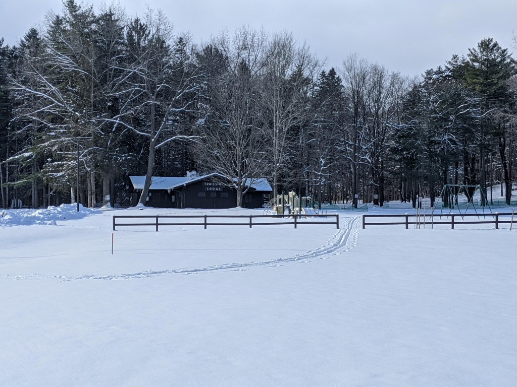
In Wyoming County, head for Letchworth State Park in Castile, and its Humphrey Nature Center and the Winter Recreation Area at Trailside Lodge. Here, there are three beginner trails, each about 1.5 miles long.
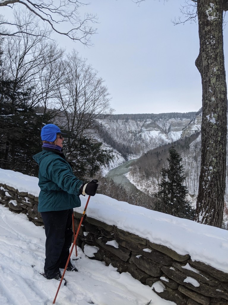
The park contains seven different parking areas to access about 15 miles of (usually ungroomed) trails. Glide through old-growth forest on the Gravel Loop and the Bishop Woods Loop. For great views of the spectacular Great Bend Gorge, check out the Chestnut Lawn Loop.
Long Island Region
There are two ungroomed trails at the Caleb Smith State Park Preserve in Smithtown, Suffolk County _ the 1.5-mile beginner Green Trail that goes through woods, fields and wetlands, and the 1-mile Orange Trail that offers view of Willow Pond.

At the Connetquot River State Park Preserve in Oakdale, Suffolk County, there are many miles of marked hiking trails that can be skied. There is no grooming, and trails range from one to eight miles in length. The preserve includes an historic former sportsmen’s club and a newly-restored 18th century gristmill.

About six miles of ungroomed trails, ranging from intermediate to advance, are found at Sunken Meadow State Park in Kings Park, Suffolk County. Take the Field 4 Trail to ski through woods before reaching overlooks for Sunken Meadow Creek and Long Island Sound. No skiing is allowed on the golf course.
Niagara Region
At Knox Farm State Park in East Aurora, Erie County, explore the Outer Loop Trail that begins at the Red Barn Parking Lot. A 2.7-mile trail suitable for beginners, it meanders through open pastures and fields, with some short legs through forests and views of farmlands and valleys.

Explore trails at Evangola State Park in Irving, Chautauqua County, to capture views of Lake Erie. The trail network covers about five miles, with the Rim Trail running along the edge of the lake.
Saratoga/Capital Region
At Mine Kill State Park in North Blenheim, Schoharie County, start at the park office for the moderate, three-mile Long Path/Bluebird Trail Loop, which offers sweeping views of the Schoharie Valley and the Blenheim-Gilboa Reservoir. Snowshoes and a small assortment of XC skis are free to borrow from the Park Office with a small deposit.

The moderate/intermediate Shaver Pond Trail at Grafton Lakes State Park in Grafton, Rensselaer County is a two-mile loop around the pond, where you can often see signs of beaver activity. The trail has some roots and rocks, so be mindful of snow cover. The park office rents snowshoes, but not skis.


Skiers have been going to Thacher State Park in Voorheesville, Albany County, for years because of its extensive trail network. Try out the lesser-used North Zone of the park, and its Fred Schroeder Memorial Trail, a three-mile intermediate loop through fields and forests. Use the Carrick Road parking area.

Beginners can practice on groomed trails that run for a total of three miles through the camping loops and around the lake at Moreau Lake State Park in Moreau, Saratoga County. There is skiing on ungroomed trails through the rest of the park.
Taconic Region
While there are no marked or groomed trails for skiing at James Baird State Park in Pleasant Valley, Dutchess County, the park’s golf course and many small, undulating hills there are a great place for beginners to practice climbing, turning, slowing and (maybe a little) falling.
Skiers could spend days touring the 25 miles of carriage roads at Rockefeller State Park Preserve in Pleasantville, Westchester County. Some favorites are the beginners’ 1.15-mile Brothers Path/Swan Lake Carriage Road, with views of the lake; the Thirteen Bridges/Gory Brook Carriage Roads, which along 2.5 miles of intermediate terrain offer view of the Pocantico River and waterfalls; and the intermediate Rockwood Hall Middle, Lower and Foundation Loop Carriage Roads, that go past the Hudson River.
There are 12 miles of trails at Fahnestock Winter Park in Carmel, Putnam County. Equipment rentals are available at the lodge, which also marks the start of the popular Lake Trail. Weather permitting, trails are also groomed on the lake. The trail will take you by a beaver lodge, over the dam built by the Civil Conservation Corps during the Great Depression, and past many small islands.

Cross-country skiing at Old Croton Aqueduct State Historic Park in Dobbs Ferry, Westchester County can be as near as one’s own backyard, as most of the ungroomed 26-mile trail is bordered by homes. As the park is level, the area is great for those who are new to the sport.
The Aqueduct is crossed by many streets, and the best cross-country skiing is found in the sections with the fewest road crossings. Top on the list is the section from Gory Brook Road in Sleepy Hollow to Country Club Lane in Scarborough, about two and a half miles of level trail through the woods. This section connects to Rockefeller State Park Preserve. Those who like hills should enter Rockefeller Preserve just north of the Weir chamber and follow the Peggy’s Way trail south for some gentle hills before returning to the Aqueduct.
Another popular area is at the northernmost section by the Croton Dam. Here the trail clings to the sides of a steep gorge through which runs the Croton River. The Gorge is a park of its own, operated by the Department of Environmental Conservation and called the Croton Unique Area. Only two lightly-traveled roads cross the 2.5 miles of wooded Aqueduct trail as it heads south to Croton.
Curiously the most densely-populated area through which the trail runs also features a fine area for skiing. This section, likewise of about 2.5 miles, has two road crossings, but almost all of it runs through the woods, with unparalleled winter views of the Hudson River and Palisades.
Palisades Region
There are stunning clifftop views from trails at Minnewaska State Park Preserve in Kerhonkson, Ulster County. Being free of rocks, roots and other obstructions, the 16-mile network of carriage trails are wide and “skiable” even with only a few inches of snow.
Thousand Island Region
At Robert Moses State Park in Massena, St. Lawrence County, there are more than five miles of trails through the woods and along the St. Lawrence River in NY. The Nicandri Nature Center offers ski and snowshoe loans for all ages as well as ski instruction.
In the western Adirondacks, Higley Flow State Park in Colton, St. Lawrence County, has the popular 1.3-mile Overlook Trail that passes through a pine and spruce forest. This trail connects with the Backcountry Trail (1.9 miles) and the Warm Brook trail (1.6 miles) for those wishing to challenge themselves further.
This is just a sampling of the ski trails at State Parks. So, when snow is on the ground, grab your skis, and get out there!
Cover Photo: Skiers at Saratoga Spa State Park. All photos by State Parks.
By Brian Nearing, Deputy Public Information Officer for NYS Parks

Read this history of cross-country skiing in the Adirondacks.

Building Bridges: the Excelsior Conservation Corps Lend State Parks a Hand at Mine Kill
Members of the Excelsior Conservation Corps (ECC) (an AmeriCorps program) recently visited Mine Kill State Park to help the State Parks staff with a few projects. The ECC is a non-profit organization within the Student Conservation Association. The members involved in this program range from ages 18-25 and learn skills and methods on conserving and maintaining the environment. The ECC crewmembers were given the tasks of building a bridge and creating a new trail.
The members started off their workweek by focusing on rerouting the trail. The original trail was on an old tractor road. It was dangerous due to the steep slope, and would also become muddy and slippery when it rains. The ECC members chose to create a new trail that led uphill into a woodsy area.
When making a new trail “from scratch”, there are a few guidelines to follow to identify good areas for foot travel. Prior to the ECC arriving, Park staff confirmed that no sensitive resources like artifacts or rare species were present along the route. Then the ECC crew could move forward on the project. One of the key factors is to make sure the path is a fairly flat surface with no obstacles in the way. When you’re in the middle of a wooded area, finding a natural path that meets these standards can be difficult, but the crew was able to fix a majority of the problems with the tools they brought. Another factor to keep in mind is to avoid putting a trail at the bottom of a slope, because water can collect and make it muddy and hazardous. If there is no other option than putting a trail in an area where the water pools, trail features can help diminish the impact of the water.
After the team marked off the proposed path with flagging tape on tree branches, they reviewed the route and identified needs. They brought out their tools and began digging up the dirt to make a more obvious trail. Shovels, pick mattocks, loppers and hoes are normally used for digging dirt up, picking out rocks and roots, and cutting down tree branches that are hanging over the path.
In certain areas, the path would hit a steeper slope. In order to even it out, the work crew needed to “bench” it. This required digging out a flat wall in the steep slope and dragging the dirt out to make it flatter for foot travel. This can help reduce erosion of the soil too, to make for a more durable and lasting trail.

In the end, the rerouted trail was measured to be a quarter of a mile long!
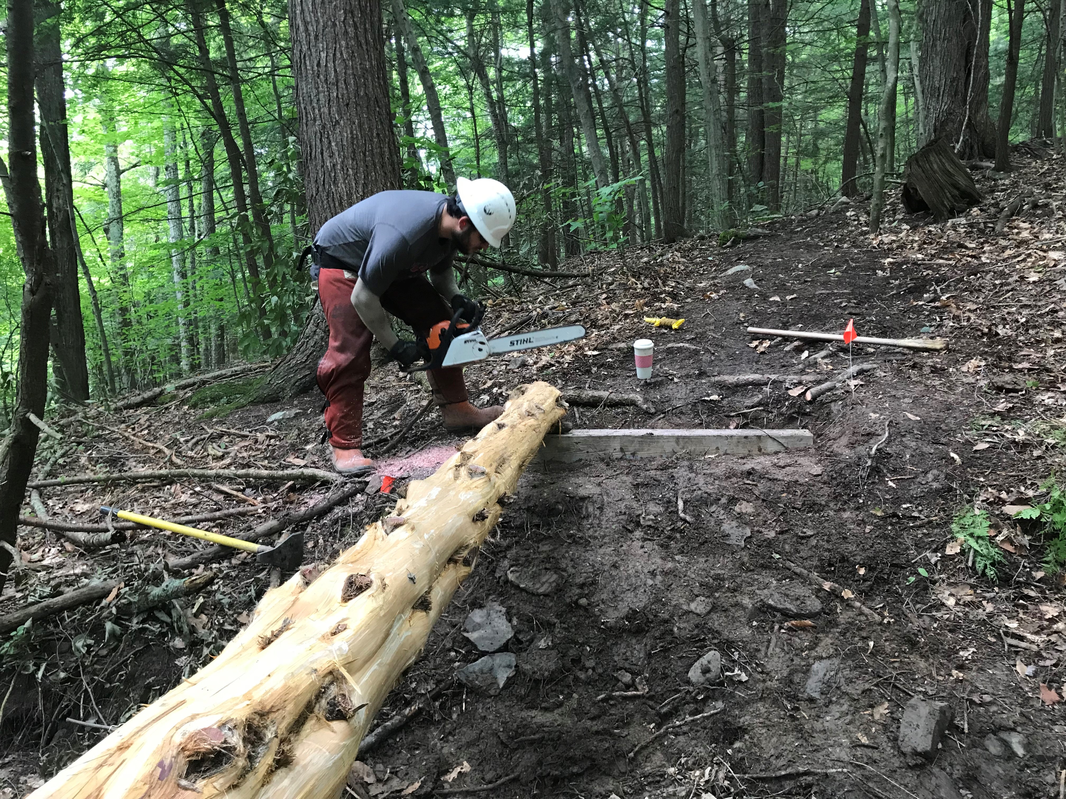
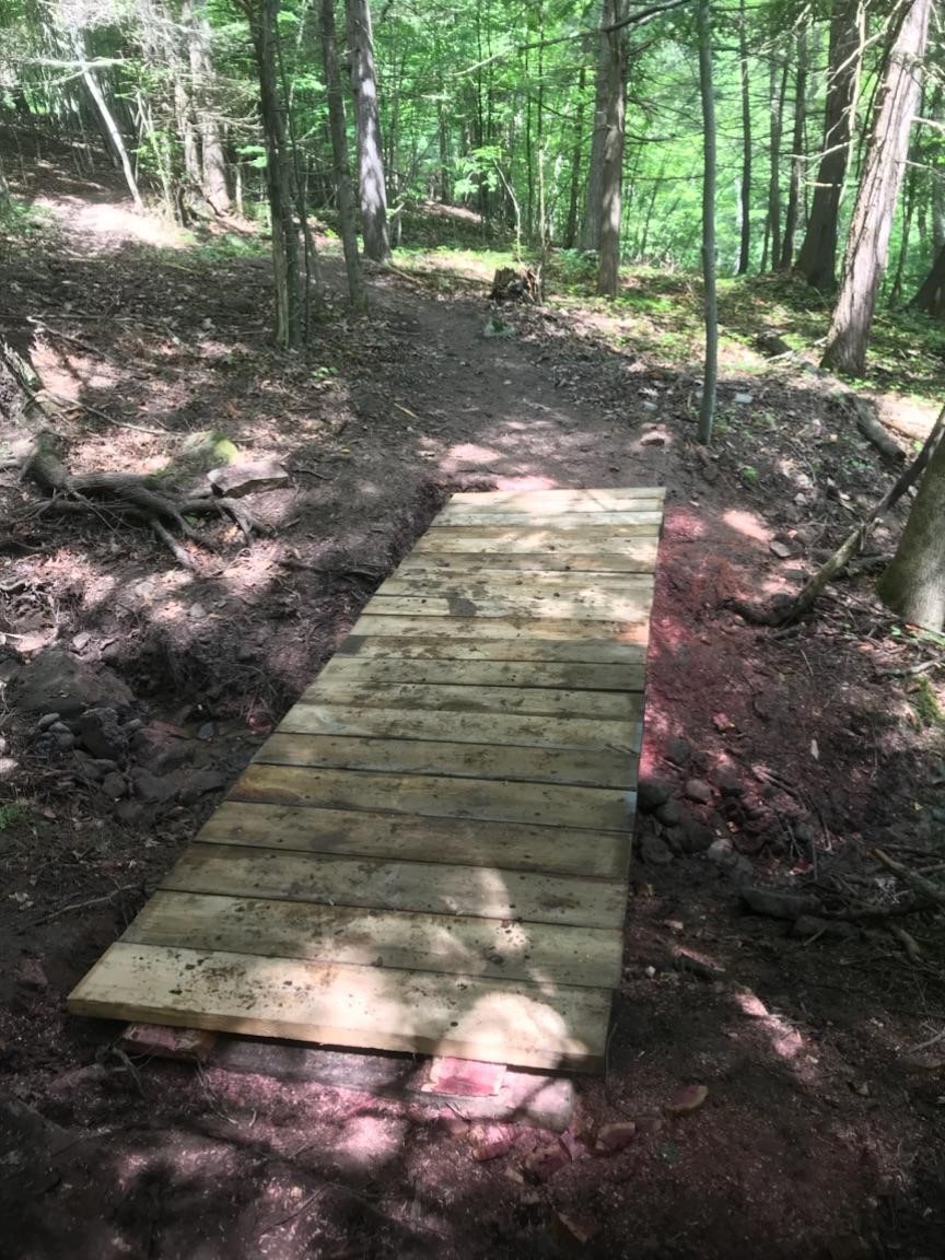
The other project was building a 14-foot long bridge. The ECC team began the task by cutting down two cedar trees in the woods to use as an under support system for the planks. After the trees were cut down, they carried them over to the site where they used knives and axes to “debark” the trees. Cedar is resistant to rot and by peeling off a few outer layers of the cedar trees, it delays decay even further in the future, which would potentially destroy the bridge.

After they took off the bark, they used chainsaws to split the logs lengthwise to create flat side to lay the planks. Once the trees were flattened out and put into place, the planks were drilled and bolted to lock them onto sturdy blocks of wood on either side of the creek. Finally, they placed each short plank on the cedar rails, spaced them out evenly and drilled the planks in, completing the bridge.
Now, thanks to the work of the Excelsior Conservation Corps, Mine Kill State Park has a new improved trail route and bridge crossing ready for patrons to enjoy.
Post by Amber Goodman, ECC member

Best Loved Hikes in New York State Parks
When quizzed about some of their best loved hikes in State Parks, our staff had to choose from amongst the hundreds of miles of hiking trails along shorelines, through mountains and open fields, overlooking lakes, rivers and gorges, and meandering through old growth forests.
Here are some of their favorites. (Note: trail maps can be found at each park’s website)
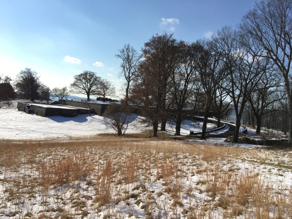
Mike’s favorite: Mine Kill State Park, located in the scenic and historic Schoharie Valley, is about an hour southwest of Albany. The park boasts almost 10 miles of trails, the most well-known being definitely the five-mile section of the Long Path. The Long Path (LP) is a 358 mile-long hiking trail running from New York City to John Boyd Thacher State Park just south of Albany. This particular section of the LP was designated as a National Recreation Trail by the Department of the Interior (National Park Service) in 2014 due to its unique flora and fauna, diverse history and incredible scenery. Along this stretch of trail, a hiker may wander past active bald eagle nests, the picturesque Mine Kill and Schoharie Creek, the historic Lansing Manor and its namesake, the 80-foot high Mine Kill Falls.
Nancy’s favorite: The Indian Ladder Trail (0.40 miles long) in Thacher State Park near Albany is like a hike through geological history. You get an up close look at the 1,200 foot high limestone escarpment as you climb metal staircases to start (and end) your hike along the bottom of the escarpment. Layers of limestone, sandstone, and shale, lifted and eroded by wind, water, and other elements, formed the escarpment over 100 million years ago. Prehistoric people used nearby areas as hunting camps, possibly as early as 6,000 B.C. Native Americans traversed the escarpment via footpaths and logs (acting as ladders) between the Mohawk/Hudson and Schoharie Valleys, hence the name ‘Indian Ladder’ Trail. Along the hike, you can see waterfalls (if it’s not too dry a season), marine fossils, small caves, and stand near the crowns of mature trees growing below the escarpment. Best of all are the views from the Indian Ladder Trail, and the Escarpment Trail above, of surrounding valleys, the urban landscape, and further in the distance, the Adirondack Mountains of New York and the Green Mountains of Vermont.

Nick’s favorite hikes at Minnewaska State Park Preserve in the Hudson Valley include the Lake Minnewaska Carriage Road, a two-mile gentle loop trail around the glacially formed Lake Minnewaska. It’s an historic carriage road left over from a Victorian Era mountain resort. This hike features many views of Lake Minnewaska, a peak at the Catskill Mountains from several spots, and views of the greater Hudson Valley. This hike is popular due to the lake (people love water!), the ease of access, and the rock perches and cliffs that overlook the lake and Hudson Valley.

Nick’s other favorite hike is Gertrude’s Nose Trail, an approximately seven mile hike on a mixture of historic carriage roads and footpaths traversing some of the most rugged terrain in Minnewaska State Park Preserve. These footpaths are loaded with evidence (signs) of the last glacial event, featuring glacial polish, glacial erratics (large rocks deposited by glaciers), chatter marks (any of a series of grooves, pits, and scratches on the surface of a rock, usually made by the movement of a glacier(from Dictionary.com)), sharp cliffs and massive talus blocks (rock debris below a cliff face). This hike is very popular mainly because this cliff edge trail gives panoramic views of the Shawangunk Mountains along the way.
Tom’s favorites: Green Lake and Round Lake Trails, located in Green Lakes State Park, are favorite hikes near Syracuse. They follow around the shores of these two glacial meromictic lakes. Meromictic lakes are lakes where there is no mixing of surface and bottom waters and they remain thermally (temperature) and chemically stratified (in layers) throughout the year. Other unique features of the lakes include their brilliant blue green appearance and the presence of “thrombolitic microbiolite marl reefs.” This basically means that a living organism is creating a rock out of material in the water. More specifically a cyanobacteria or algae is taking calcium compounds that entered the lake with groundwater seeping through the surrounding limestone bedrock and making it into a solid as part of cellular respiration. The United States Department of Interior designated Round Lake as a National Natural Landmark in 1975.
Green and Round Lake Trails are generally flat, 8-10 feet wide, and easy hiking trails. The full loop, including both trails, is approximately three miles long with benches located periodically for resting and enjoying the scenery. A swimming beach, playground and boat rentals are located at the north end of Green Lake. These trails are part of a 17-mile trail system in the park that also takes you through or to old growth forest, wetlands, grassland bird habitat, cliff edge overlooks, camping areas, a golf course, and connects to the 36-mile Old Erie Canal State Historic Park.

Nicole’s favorite: As the largest State Park in the Long Island region, hiking at Connetquot River State Park Preserve can feel secluded even in the middle of densely populated Long Island. The beautiful scenery and diversity of life within the park make it her favorite hiking spot. Starting from the parking lot, the Greenbelt Trail (indicated by the white and yellow blazes) takes you directly to the fish hatchery, where you can get up close and personal with trout being raised. From there, the Red Trail can take you back along the Connetquot River to Main Pond. The Red Trail merges with the Blue Trail at the pond and the hike ends at the historic Grist Mill and Main House. Then it’s a short distance down the road back to the parking lot. This loop is a little over two miles but flat and even throughout, making it perfect for all age groups. Don’t forget to check in with the Nature Center at the Main House on the way out to find out about all of the amazing programs they have there.

Molly recommends hiking at Wellesley Island State Park in the Thousand Islands Region. A favorite is to start at the Minna Anthony Common Nature Center and hike along the Eel Bay Trail (1.1 miles) to the Narrows Trail (0.45 miles). From there you can head back the same way or follow along another trail to loop back to the Nature Center. Sitting on the exposed granite outcroppings and watching the St. Lawrence River Eel Bay and passing glacial potholes are highlights of this hike. The Narrows is a narrow water passageway located between Wellesley Island and Murray Isle connecting South and Eel Bays. Along the Narrows Trail you can watch boats pass through the channel and see a variety of birds while picnicking on an open rock area. These trails are generally easy hiking but have some steeper rock climbing areas. Don’t forget to check out the Nature Center!

FORCES stewards Nick and Adriana recommend two hikes in the Finger Lakes Region.
Buttermilk Falls State Park is a located in the heart of the Finger Lakes to the south of Cayuga Lake and has much to offer avid hikers, families, and visitors to the area. Hike the Rim and Gorge Trails together for a 1.5-mile loop, or hike each separately. Starting either trail from the lower parking lot will require a strenuous uphill walk (Rim Trail) or climbing of a long staircase (Gorge Trail). The Gorge Trail has much to offer and you will encounter many waterfalls, and beautiful rock formations along the 0.65 mile trek up the gorge. Mosses, liverworts, and ferns coat entirety of the gorge, providing a vivid green walk that is topped by a hemlock hardwood forest along the ridge. As you come out of the gorge, you will cross a bridge to take the 0.82-mile Rim Trail back to the parking area. This walk takes you through a beautiful hemlock hardwood forest filled with eastern hemlock, chestnut oak, and witch hazel, along with many other species. This loop can be done in about an hour, but more time may be needed for taking in all the sights along the way. Hiking these two trails as a loop is a relatively easy hike after you complete the initial stairs, or uphill climb.

The Upper Loop in Robert H. Treman State Park is a one mile round trip on sections of the Gorge and Rim Trails. The trail is situated above Treman Gorge and offers spectacular views of the many waterfalls including the 115-foot Lucifer Falls. The trail begins at the upper section of the park (the Old Mill Parking area) at the entrance to the Gorge Trail and takes visitors through the upper gorge. The trail highlights the scenic beauty of the gorge, amazing rock formations, stone bridges, and the many water features along Enfield Creek through the ravine. The trail takes you to the top of Lucifer Falls and then down the side. At the bottom is a wooden bridge over the stream that will take you to the Rim Trail and the second portion of the hike. This begins with a climb up the “Cliff Staircase” – it is the most difficult section of the loop but it also offers some of the best views in the park. At the top is an overlook of Lucifer Falls and then a moderate downhill slope back to the upper parking lot. Multiple overlooks from high vantage points make the trail perfect for photo ops and for viewing the gorge below. Although the hike is short, some visitors may find to be strenuous due to the elevation change and the many staircases.

This weekend, try one of these hikes or find your own ‘best-loved hike’ in a park near you.
— Post compiled by Nancy Stoner, State Parks
Lace up those boots for National Trails Day!
In August 2011, Hurricane Irene and Tropical Storm Lee devastated the Catskill Mountains and Schoharie Valley with a torrent of wind and rain. Several bridges were washed out, including the historic Blenheim Covered Bridge located just north of Mine Kill State Park. A culvert over a tributary of the Mine Kill on the Long Path was subsequently destroyed. On June 6th, the Student Conservation Association (SCA), Long Path North Hiking Club and New York State Parks will join together to construct a new bridge spanning 40 feet over the drainage to once again allow safe passage over this creek for hikers.

SCA Hudson Valley AmeriCorps members remove invasive species in the Habitat Garden at Hudson River Park in Manhattan.

SCA Hudson Valley AmeriCorps members working to replace interpretive signage along the trail at Esopus Meadows Preserve.

SCA Hudson Valley AmeriCorps members are all smiles after completing a new section of trail including split rail fencing at Saratoga Spa State Park.
Every year, on the first Saturday in June all across the country, people celebrate National Trails Day by getting out and going hiking, biking, geocaching and more. National Trails Day is not only about getting out and recreating, but is a great day to give back and volunteer on projects helping to build and maintain trails that we all love and enjoy. This year, three Trails Day projects will be organized and led by SCA AmeriCorps members at Mine Kill State Park in North Blenheim, John Boyd Thacher State Park in Voorheesville, and Hudson River Park in Manhattan. These projects not only accomplish vital work on trails in the region, but also provide SCA members with valuable experience in project management and peer leadership.
For many years, the SCA Hudson Valley AmeriCorps program has been partnering with New York State Parks, Recreation and Historic Preservation as well as New York State Department of Environmental Conservation and several non-profit organizations providing internships across the Hudson Valley region. Currently, 46 SCA members serve for up to ten months at sites from Saratoga Springs to New York City. To learn more about the SCA and Trails Day projects you could get involved in, visit www.thesca.org/events.
Post by Nick Marcet, Student Conservation Association (SCA). Photos by SCA.
