Category Archives: Park Projects

What Makes Jones Beach a Classroom

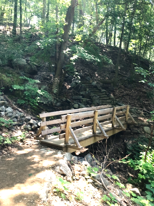
Jones Beach has always had a special relationship to energy. Located on Long Island’s South Shore just 20 miles from New York City, Jones Beach State Park is on a barrier island shaped over hundreds of thousands of years by the energy of advancing and receding glaciers, and later by the energy of the sun currents of ocean water and wind carrying sand along the coast.

Originally called Short Beach, this barrier island was inaccessible to the public. To create the state park almost a century ago, planners and engineers harnessed the energy of machines and human labor, moving sand and plants to expand the island, and building roads, amenities, and the Art Deco tower and buildings so recognizable today.

Today, energy is everywhere on Jones Beach. It’s in the dramatic dive of a predator like the Common Tern, and in the bright sun that drives photosynthesis of the Seaside Goldenrod, Beach Grass or Beach Pea. It’s in water that brings migratory species and the winds that distribute seeds and carry pollinators from plant to plant. But energy is also present in the engines of the cars that bring visitors to the Park, and in the historical construction of the parkways that they follow to get here.

In an era of climate change, and in the context of New York’s growing commitment to developing renewable energy systems, the Jones Beach Energy & Nature Center aims to help New Yorkers understand the fundamental ways human energy consumption and energy infrastructure continue to shape our natural environment.

To further this mission, the Center recently released Energy & Us, a 300-plus page curriculum for high school students that is available to view or download for teachers and school districts at no cost through jonesbeachenc.org/curriculum.

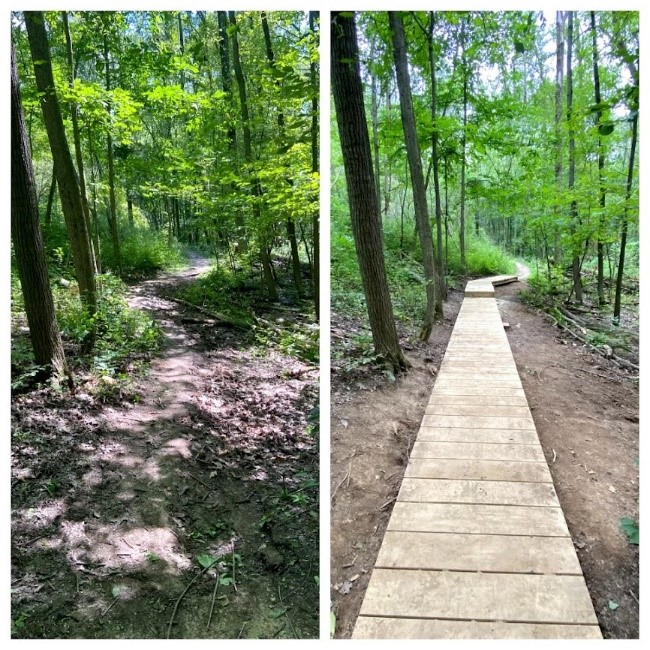
The goal of the program is to inspire young people to think critically about how energy shapes their landscapes and their lives, as well as their own roles in energy systems and ecosystems that surround them. With the beach itself as a classroom, Jones Beach State Park is the perfect place to learn about energy from sunlight, sand, wind, and water.

NATURAL ENERGY AT JONES BEACH


Let’s start by considering the very essence of Jones Beach – a simple grain of sand. A crystal structure composed of millions of molecules, typically of the compound silicate (SiO2), sand is held together with very strong bonds. By comparison, bonds in a drop of spray from the ocean are much weaker. Much less energy needs to be added to water than to sand to trigger what is known as phase shift: A puddle of water will quickly evaporate in the sun, while a similarly sized patch of sand won’t melt. Sand will melt with enough heat, as in done in glass-making, but does sand melt in nature?

Close-up images of grains of sand. (Photo credit – Wikipedia Commons)

Consider when lightning strikes a beach, it creates melted and recrystallized sand formations called fulgurites, also known as “fossil lightning.” Lightning possesses tremendous energy — the core of a lightning strike can reach 53,500 F — but only makes contact with a relatively small surface. The strike quickly heats the sand to a high enough temperature that its chemical bonds are broken. Fulgurite then forms as the energy transfers out of the melted sand into the surrounding ground and air, and the melted matter becomes solid again, forming this unusual form of fused sand.

Have you ever gone swimming in the late summer or early fall, and found the water to be warmer than the air? Solar energy that is absorbed over the course of the summer dissipates in the fall more easily from land and air than from water. This is because water is a relatively poor conductor; energy moves through it with difficulty, so water is slow to heat and slow to cool.

Air is a good insulator and a poor conductor, which is why fur and down help keep animals warm. It’s not the quantity of hairs or feathers that matters, but rather the layer of air trapped within that stops energy from being conducted out of the body into the surrounding air. Birds fluff up during the winter to trap more insulating air in their feathers.

A snowy owl sits among the sand dunes and beach grass at Jones Beach. (Photo credit – Sean Hanley and G. Anthony Svatek/Kulturfolger Productions)

When sunlight hits the beach, radiant energy transforms into the kinetic energy of excited electrons in the sand, which vibrate, producing what we experience as warmth. Maybe even too much warmth on a sunny day, as anyone who has walked barefoot knows! The excited electrons also release new photons, wave particles that carry energy away from the sand and produce what we perceive as glare.

A Monarch butterfly among the seaside Goldenrod in the maritime dunes at Jones Beach, harvesting the energy found in the flowers’ nectar. (Photo Credit – Julie Lundgren/NY Natural Heritage Program)

ENERGY DRIVES ECOSYSTEM CONDITIONS


At Jones Beach, dominant winds flow from the west and the north, pushing sand dunes gradually towards the sea. Meanwhile, ocean currents flow parallel to the mainland, pushing sand from east to west and moving the shoreline westward. A jetty constructed in the 1950s at the West End interrupts these currents, causing sand to accumulate on the eastern side while the western channel remains open.

Winter and storm-season waves typically contain more energy, pulling more sediment off the beach and into the water in a process called erosion. When large waves wash over dunes during high tides and storms — a phenomenon called “overtopping” — dunes can flatten and shift. In summer, ocean currents, waves, and winds typically bring sands back onto the beach and dunes in a everchanging cycle.

Jones Beach shoreline change map. (Photo credit – Ruth Nervig/JBENC)
Fresh sands are deposited by summer waves, wind and storms creating open habitat for piping plovers, terns and some rare plants like Seabeach Knotweed and Seabeach Amaranth. (Photo credit – Julie Lundgren/NYNatural Heritage Program)

Water and winds can also influence how species move through Jones Beach. Birds, winged insects, fish, phytoplankton, and various other organisms travel on currents in the air and water, and currents also distribute seeds, eggs, and nutrients that organisms need to survive. Local examples of this include plankton that float on ocean currents, providing food for larger marine animals; shorebirds that depend on the strong sea breeze; and grass seeds spread by water and wind. Although major storms can decimate local populations of some species, most of the plants and animals of this ecosystem are adapted to these natural processes.

Seabeach knotweed (Polygonum glaucum) is a plant that needs open and untrampled beach and dune areas. (Photo credit – Julie Lundgren/NY Natural Heritage Program)
In the aftermath of a hurricane at Jones Beach, the massive energy of the storm washed up this massive uprooted tree trunk. (Photo credit – Julie Lundgren/NY Natural Heritage Program)

ENERGY SHAPES PUBLIC INFRASTRUCTURE AND PRIVATE LIFE


When planner Robert Moses envisioned Jones Beach State Park in the 1920s, he recognized that the automobile would have an increasing role in daily American life.

The rise of cars was coupled with another innovation by automaker Henry Ford – the assembly line that allowed for costs to be reduced, creating a new class of workers with enough disposable income to purchase the goods they produced, and with more leisure time to allow travel.

Jones Beach State Park was one of the first and most prominent parks to connect this growing urban middle class to the environment.

Automobiles entering Jones Beach on its opening day on Aug. 24, 1929. (Photo credit – New York State Archives)

A map showing the Parks and Parkway envisioned by Robert Moses. (Photo Credit – Long Island State Parks Commission)

In 1924, as the new chairman of the State Parks Commission and President of the Long Island State Parks Commission, Moses began planning a system of “Parks and Parkways” to connect car-owning city residents to beaches and parklands across Long Island. Moses envisioned parkways as an extension of the parks themselves: green spaces that transported urban dwellers to a beautiful natural landscape.

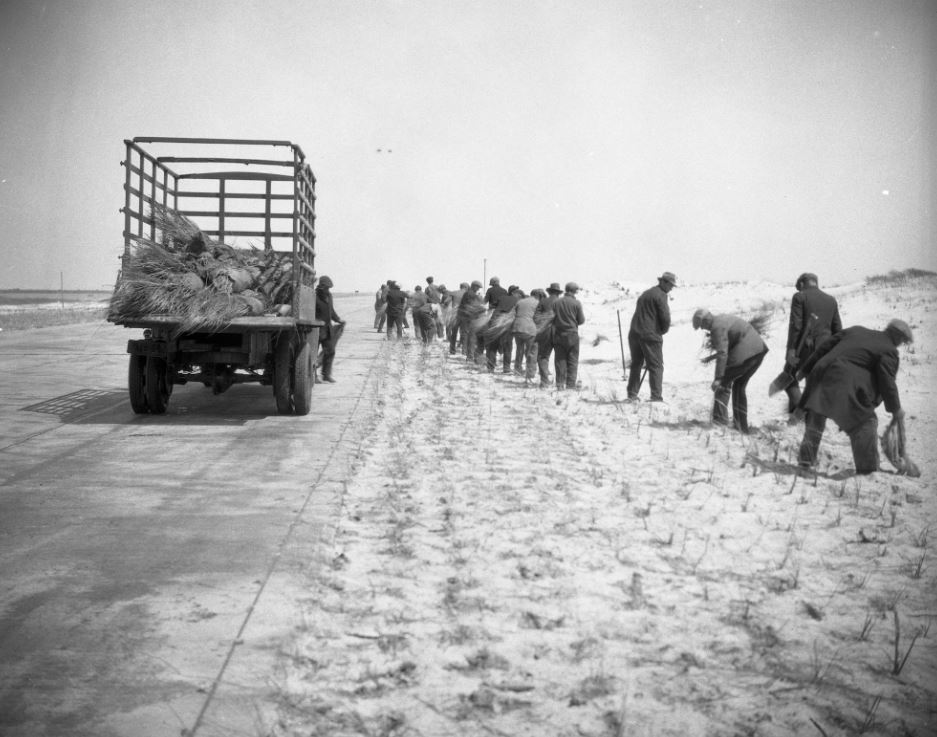
Jones Beach opened in 1929 as a triumph of 20th century engineering. Forty million cubic yards of sand were dredged from the bay to widen the beach and raise its elevation up to 12 feet. Workers hand-planted a million native Beach Grass plants to prevent the taller dunes from blowing away in the wind.

Workers planting Beach Grass during construction at Jones Beach State Park (Photo credit – NYS Parks)
Beach Grass (Ammophila breviligulata), native to Long Island, has long roots which help create and stabilize the maritime dunes at Jones Beach. (Photo credit – Julie Lundgren/NY Natural Heritage Program)

Moses’s plan for parks and roads across Long Island reflected a new approach to “nature,” one of landscapes constructed intentionally for public enjoyment. The parkways also helped spark a new era of Long Island suburbanization, which greatly increased consumption and the demand for energy.

Many different types of energy come together at the Jones Beach Energy & Nature Center. As climate change impacts the globe with rising seas and stronger storms, Jones Beach will model the positive possibilities for access and use of energy. Solar panels that power the Center represent New York’s commitment to expand renewable energy and reduce greenhouse gas emissions that are driving climate change. Resilient design modeled by the building itself will be key as New York’s communities adapt to rising sea levels and changing weather patterns.

There has never been a more important time for New Yorkers to understand the connections between energy, nature, and society. With the Energy & Us curriculum, young people throughout the state can begin to reconsider about how those forces shape their own lives, and how they can engage with them to transform the future.


Cover shot – Jones Beach Energy & Nature Center, Michael Moran/nArchitects


Post by Olivia Schwob, a writer, researcher, and editor interested in human geography, political economy, and public things. Olivia was Developer of the Energy & Us curriculum from 2020-2021, Curatorial Team Writer for the Jones Beach Energy & Nature Center from 2019 – 2020, and Managing Editor of Urban Omnibus, a publication of the Architectural League of New York, from 2016 – 2019. She lives in Brooklyn.

Human Zamboni Machines of Moreau Lake State Park

On of my favorite childhood memories was going to an outdoor ice skating rink behind a warehouse in South Glens Falls in Warren County. It was only a field with a large frozen puddle but to me it was amazing. Years later now in my role as manager at Moreau Lake State Park, I wanted to give people near my park the same opportunity.

I started researching ice rinks and how to make them safe but also affordable for the park. While we do have the lake to work with, lake and pond ice usually is bumpy and cracked, thus making stumbles and falls more likely. As I continued researching online, an image of a homemade Zamboni apparatus popped up. Major ice rinks use large Zamboni machines to lay down smooth coats of ice on indoor rinks, but that kind of heavy machinery was not in my budget, so the hand-made model I saw looked like the way to go!

Using a steady flow of warm water to apply a continuous smooth ice surface just like the big machines, a small, human-powered Zamboni was my solution to make lake ice smooth and safe for skaters.

Our two homemade units were created by Aaron Aiken, a staffer at Moreau, who fabricated them after seeing the online photo. It was amazing. Aaron simply gathered all the materials he needed and finished in a day. We had most of the parts needed on hand at the park so there was little to no cost to us.

Aaron assembled a 55-gallon poly tank (used to hold the warm water), a 10-foot piece of 2-inch PVC pipe, a 2-inch PVC valve, a 4-foot piece of felt or wool (for trailing the water and flattening it out as smooth ice) and a sturdy wheeled cart. With that and a bit of ingenuity _ presto, a human powered Zamboni machine!

Moreau staffers Donna Fortner (left), and Jay Hauser, load up the Zambonis with warm water before going to lay down ice on the rink.

Zambonis work by slowly drizzling out warm water over the surface of existing ice. The warm water melts all the high spots and fills in all the lows before freezing to create a perfectly smooth surface perfect for skating. The operator judges how fast they want water to come out by adjusting the flow with the valve.

At Moreau, our crew pulls a Zamboni around the rink three times before it runs out of water, and then the other Zamboni takes its place. It is important to have two setups because ridges can form in the ice if you stop putting down warm water even for an instant. To create a smooth rink, it took about 110 gallons of water, applied by two Zambonis over six laps, for a total of about an hour of work.

Measuring 250 feet by 100 feet, the outdoor skating rink at Moreau Lake State Park welcomes skaters! The Park has free loaner skates.

Another service that Moreau Lake State Park provides to visitors is the Daily Ice Report. Parks staffers measure the thickness of the ice starting a day after rink ice is laid on, meaning when the ice totally covers the surface of the lake, we wait a day and then start the ice thickness report. Two staff members start at shore with an ice auger and drill through the ice and measure the thickness. If it is under 3 inches they stop at that hole. If it is over 4 inches, they move out 20 feet and drill another hole. They follow the same procedures until it is determined that the average thickness (average readings taken from multiple places on the lake) is at least 6 inches.

When that happens, the lake is opened to skaters, pedestrians and ice fishermen. These ice reports are published over social media every day at 8:00 a.m. until the ice is safe and then these reports are replaced by the open one.

All this comes together to make the lake a safe and enjoyable place to recreate in the winter. At our rink, located just off the beach, a campfire is usually going nearby so skaters can warm themselves. So grab your skates (or borrow ours) and give us a visit!

Cover shot – Moreau staffer Jay Hauser (foreground) pulls a homemade Zamboni around the skating rink at Moreau Lake State Park, as fellow staffer Donna Fortner comes along behind with the second Zamboni . All images NYS Parks unless otherwise noted.

Post by Al LaFountain, Park Manager, Moreau Lake State Park and Grant Cottage State Historic Site

More about Moreau Lake State Park


Covering some 6,250 acres in Saratoga County, Moreau Lake State Park features hardwood forests, pine stands, and rocky ridges. More than 30 miles of hiking trails are available, and can be used for snowshoeing and cross-country skiing in winter. Snowshoe rentals are available.

Last year, Governor Kathy Hochul announced an 860-acre expansion of this park to include spectacular natural habitat along an undeveloped stretch of the Hudson River that will be known as Big Bend Point.  This acquisition makes Moreau Lake State Park one of the ten largest parks in the state park system.


Resources


Learn about a Gilded Age ice skater who helped promote figure skating for women from this previous blog post by the curator at Staatsburgh State Historic Site.

Gilded Age Ice Skater Carved Early Path

Staatsburgh State Historic Site, formerly the Gilded Age estate of the very wealthy and socially-prominent Ruth Livingston Mills and her husband, financier and philanthropist Ogden Mills, sits along the eastern bank of the Hudson River in the mid-Hudson Valley. Commanding a view of the river and the Catskill Mountains, the estate’s Beaux-Arts mansion was once…

A hand-operated Zamboni machine is on display at the Original Hockey Hall of Fame in Museum, in Kingston, Ontario, where it is also described as a “hand flooder.” (Photo credit – Wikipedia Commons)

“Skating is in my heart, not my head.” – Olympic Medalist Michelle Kwan

Holiday Points of Light at Grafton Lakes State Park

Lights have long been associated with the holiday season, along with family, holiday cheer, and guiltlessly indulging in your sweet tooth.

At Grafton Lakes State Park in Rensselaer County, staff chose to embrace that season of light by placing dozens of luminaria along trails for the park’s inaugural annual holiday “Luminary Walk” in December. What are luminaria, one might ask? ( Hint: It is not the plural of luminary.)

Originating in the Philippines after it became a Spanish colony at the beginning of the 16th century, luminaria are small paper lanterns with candles used to mark the Christmas season. Originally made then from bamboo and paper coming from China, the Philippine tradition of luminaria was brought eastward by Spanish traders into the southwestern North America and Mexico when that region was still controlled by Spain.

Today, holiday luminaria as a reflection of a holiday contribution of Hispanic culture are a common sight in the southwestern United States, including New Mexico and Arizona, but have become popular in other parts of the country as well.

To bring that festive glow into the northern forests at Grafton, parks staff led by Tamara Beal arranged for more than 125 luminaria for the festival, while also seeing to it that firewood was stacked, marshmallows were prepped on sticks, and hot coco was steaming by the jugful.

Each light was powered by three triple AAA batteries and each white paper bag required a precisely cut wooden block to weigh down the bag. The maintenance staff cut the blocks and strung lights along the boardwalk for the event. All 125 bags with lights and blocks were put together, loaded up into a utility vehicle and spaced out along a half-mile of trail by staffers Rebecca Milanese and Ava Bassallo.

Check out the slideshow of the luminaria trail below…

Under crystal dark skies and the light of a full moon in December, an unprecedented 900 people showed up for the event and to walk the illuminated paths.

With Holiday music wafting from the Welcome Center back patio, there was a general buzz of happiness and joy. Visitors warmed up by the fire with marshmallow and stick in hand, creating a tasty treat. Children sat down inside stimulating their imaginations to create one-of-kind holiday crafts. Behind the scenes, volunteers and staff members were serving the public, refilling the hot chocolate jug, breaking up pieces of chocolate, restocking the crafts, and more.

The magical illuminated journey began on the boardwalk just beyond the back patio. As the Holiday music faded, a serene silence welcomed the wanderer. Each step in the light a reminder of fond Holiday memories. Up the stairs of the replica fire tower, with a bird’s eye view, the forest twinkled in brilliance. Just beyond the forest, romance rolled on the wind by the lake as many couples opted for a moonlit stroll.

What was originally foreseen by event coordinator, Tamara Beal, as being a small quaint event, left hundreds of people renewed in their holiday cheer in a park dotted with dozens of warm points of light. Thank you to all those who came out and to staff members and volunteers who dedicated their time and contributed to the magic.


Cover shot – Replica Fire Tower with luminaria at Grafton Lakes State Park. All photos by NYS Parks unless otherwise noted.

Post by Tamara Beal, Environmental Educator, Grafton Lakes State Park

Check out future events at Grafton Lakes State Parks here.

Moonlight over Long Pond at Grafton Lakes State Park (Photo Credit – Deborah Balcanoff, used with permission)

***UPDATE***

Interested in attending an upcoming luminaria walk? There is one scheduled for 6 p.m. Feb. 24, 2021 at Moreau Lake State Park in Saratoga County. Click here for more details.

Camping in the Round

While State Parks offers more than 8,100 campsites, 825 cabins, and 136 full-service cabins across New York, in the western part of the state, there is another kind of camping option available – yurts.

A yurt is a round fabric shelter on a raised platform, with a roof, door, and windows that provides more shelter and room than a ground tent yet is a simpler accommodation than a traditional wood-framed cabin. The history of yurts traces back about 3,000 years to central Asia, where nomadic peoples used these portable homes as they moved around vast treeless grassland plains, known as steppes.

Yurt is a Turkish adaptation of the Mongolian word “ger” (meaning “home”) originally used to describe such residences, which were meant to be easy to assemble and disassemble as their owners moved with their horses and livestock throughout the seasons. Yurts are formed by a circular wooden lattice wall that supports wooden rafters attached to a elevated center ring, with the structure draped in fabric, originally felt, wool or hides. Being round, yurts were perfectly designed to resist high winds common in the region, since the shape has no corners or flat spots to catch wind gusts.

According to historians, the Mongol conqueror Genghis Khan led his vast armies from his command post in a large yurt that moved from battlefield to battlefield.

The historical importance of the yurt to the region is represented in the official flag of the republic of Kyrgyzstan in central Asia. The flag consists of a red field charged with a yellow sun that contains a depiction of a “tunduk,” the opening in the center of the roof of a yurt. This view is what someone might see looking up upon awakening in a yurt

The state flag of Kyrgyzstan, featuring a representation of the center opening in a yurt’s roof. (Photo Credit – Wikipedia)
A Mongolian ger on the steppe at Gobi Gurvansaikhan National Park in southern Mongolia. (Photo Credit- Wikipedia Commons, Uploaded by Adagio at English Wikipedia)

Easy and quick to build, this ancient design arrived in America during the 1970s as part of the simplified “back to the land” movement, slowly developing a following as an inexpensive form of housing that could be assembled in a day. The structures have been gaining popularity in recent years as a camping accommodation that puts its residents close to nature, while offering more comfort and sturdier protection against the elements than a tent. Modern yurts are meant primarily to be kept in place as semi-permanent structures, although they still can be taken apart and moved if necessary.

Three state parks in western New York now offer yurts as places to camp _ Four Mile Creek and Golden Hill state parks in Niagara County, and Evangola State Park in Erie County. Made from wooden lattice and rafters covered with heavy-duty fabric and insulation, these yurts feature a domed roof, windows, and bunk beds, as well as a refrigerator, microwave, and heating/AC units.

The yurts at both Four Mile Creek and Golden Hill at located closed to Lake Ontario and offer beautiful views. Golden Hill’s yurts are situated so that the decks provide a view of both sunrises and sunsets with Golden Hill’s Thirty Mile Lighthouse in sight. Take a slideshow tour of the Golden Hill yurts below…

At Evangola, the yurts are located next to a fishing pond, and just a short walk to the park’s Lake Erie shoreline.

Campers who have stayed in the yurts tell State Parks that they like it because it’s “in-between” camping in a tent and a cabin, being particularly useful for those who might not have all the gear needed for tent camping.

When the first yurts went up in 2013 at Four Mile Creek, New York State Parks joined a growing number of state parks across the country embracing this form of shelter as a camping alternative.

A yurt at Four Mile Creek State Park with an ADA accessible ramp.

According to industry accounts, the first two yurts in a state park in the U.S. went up in Oregon in 1993. Now, some two dozen state park systems across the country have added yurts.

The yurts in New York’s state parks are 20 feet in diameter, which results in about 330 square feet of interior living space and plenty of head room. While that might seem spacious for those used to maneuvering around a tent, that is a far cry from the largest yurt in the world. The so-called “White Building” (Ak Öýi) in the Turkmenistan capital of Ashgabat, dedicated in 2015, is in the form of a yurt more than 200 feet in diameter that stands about 100 feet high, with three separate stories holding a café, offices, apartments and an auditorium with 3,000 seats!

So, when considering camping at State Parks in western New York, think about trying out a yurt. Three thousand years of history can’t be wrong!

A traditional yurt on a cart in contemporary Kazakhstan. (Photo Credit- Wikipedia Commons/Creative Commons)

Cover Shot- A yurt at Four Mile Creek State Park. All shots credited to NYS Parks unless otherwise noted.

Post by Brian Nearing, Deputy Public Information Officer, NYS Parks

Resources

All reservations for New York State Park yurts, campsites, cabins, and full-service cottages are handled through the ReserveAmerica website.

Happy Trails to You from State Parks

People love New York’s trails! Did you know that State Parks has more than 2,000 miles of trails across the state? And that merchandise featuring trail markers is among the top sellers at the Parks online store?

T-shirts with State Parks trail markers are some of the items sold online in the Parks store.

More people than ever have been using Parks trails during the past ten years, especially during the recent pandemic, as being outdoors offered safe and healthy recreation when some other venues weren’t available. With so many trails, there is always lots of work to do for our trail crews, staff, and non-profit partners to maintain, improve and expand our network. Let’s take a tour of some of what’s been done recently.

To help find your way on the trail, check out the Parks’ Explorer app for smartphones and mobile devices. Available for both iOS and Android devices, the free app offers a range of useful information, including trail maps and a real-time location function that allows users to easily follow along on the park’s map.

Capital Improvements


To help support some of its trail work, each year Parks receives funding through the state budget as part of the NY Works capital program. Some of the program’s largest funded trails projects over the past five years include:

  • $500,000 for the Backcountry Trails Program to repair and restore trails in the Hudson Highlands of our Taconic and Palisades Regions.
  • $400,000 to restore hiking, skiing, equestrian, and snowmobile trails in Allegany State Park in western New York.
  • $250,000 to repair stonework and restore the scenic gorge trail of the Finger Lakes Region.
  • $200,000 for improvements to park trails across the Saratoga-Capital Region.
  • $175,000 for region-wide trail projects in the Thousand Island trails.

Crews working under the Backcountry Trails Program (BCTP) have spent years rehabilitating miles of trail in Hudson Highlands and Sterling Forest State Parks. The program engages AmeriCorps volunteer service members to learn and apply highly skilled trail building techniques from April through October each year.

This past season more than 2,000 feet of trail were rehabilitated and more than 140 stone steps installed on the Washburn and Undercliff Trails in Hudson Highlands State Park Preserve in the Hudson Valley. In the Palisades Region, miles of trail have been added and improved on the very popular multi-use trail system at Sterling Forest State Park. 2022 will mark the ninth year of the BCTP implementing high-quality trail construction projects in our facilities.

A backcountry trails crew works at Hudson Highlands State Park.

Accessible Trails


The Universal Trail Assessment Process (UTAP) project has so far assessed 40 trails in State Parks with a goal of identifying those that could be made accessible for persons with disabilities. Funded through a Federal grant, the project completed its third year of field assessments to find  trails that meet or have the potential to meet federal standards for accessibility.

Learn more about this project in a previous post on the NYS Parks Blog HERE

Partner Projects


On July 1st, the ribbon was cut on the new Nimham Trail in Hudson Highlands State Park Preserve, which was completed in partnership with the Hudson Highlands Fjord Trail organization. Named for the last Mohican chief in the Hudson Valley, this new trail allows for an easier ascent and safer descent to the popular Breakneck Ridge – but it’s still a challenge! This new trail has over 600 stone steps and climbs 600 feet of elevation in less than a mile. Images below of the the Ninham Trail show, left to right, new stairs, a trail information map, and a new bridge.

In Clarence Fahnestock State Park Preserve, the Open Space Institute (OSI) broke ground on a sustainable multi-purpose loop trail suitable for hiking, biking, and equestrian use. More than 5.5 miles of new or rehabilitated trail have been created as well as two bridges, four boardwalks, and two turnpikes. As a complement to this project, West Point engineering cadets designed and built a multi-use arched bridge to traverse a mountain stream. This is the fifth bridge constructed in partnership with OSI and West Point on the Hubbard-Perkins project.

Cadets from the U.S. military academy at West Point put the finishing touches on their new bridge in the Hudson Highlands State Park Preserve.

Interns from the Hudson Valley AmeriCorps of the Student Conservation Association (SCA) had their annual Patriot Day of Service project at Sam’s Point in Minnewaska State Park Preserve. This two-day project created a new 72-foot section of bog-bridge on the Verkeerder Kill Falls Footpath. The popular trail passes through the globally rare dwarf pitch pine barrens and has seen increased use in the past five years. Pictured below, the bog bridges will help mitigate user impacts by keeping hikers’ feet out of wet areas and on the designated path.

Parks Regional Trail Crews Deliver


Saratoga-Capital Region

In 2021 at John Boyd Thacher State Park, trail crews repaired trail, replaced timber steps, and build rock crib-wall on the area’s most hiking popular trail, the Indian Ladder Trail. In Peebles Island State Park, trails were upgraded with new surfacing material and drainage improvements, as well as new trail markers and intersection signage added for safety.  Trails at John Brown Farm State Historic Site in the Adirondacks were overhauled and signage was installed to improve wayfinding.


Finger Lakes

Crews at Buttermilk Falls State Park installed a 56-foot prefabricated fiberglass bridge and set up high-line rigging to lift the bridge into place over Buttermilk Creek. The new crossing now connects hikers safely from the parking lot to the trail by eliminating a hazardous road crossing. Click on the slideshow below to observe the project…

At Chimney Bluffs State Park, the Bluff Trail leading to the visually stunning bluff overlooking Lake Ontario was rerouted this year after being closed since May 2018 due to safety concerns. This project established a new sustainable trail route away from the heavily eroded bluff edge and constructed 170 timber stairs, multiple erosion control features, and added a 225-foot wooden boardwalk to raise the trail over the forest floor.

More than 680 stone and timber steps were installed at Stony Brook State Park to rehabilitate heavily eroded trail sections at the north and south entrances to the park’s main trail.

More than 700 feet of boardwalks and foot bridges were installed throughout the trail system at Ganondagan State Historic Site to replace worn out sections.

Before and After: A new boardwalk at Ganondagan State Historic Site.

Central Region

At Green Lakes State Park, the Green Lake Trail was resurfaced and received drainage improvements over the past three years. Crews also completed a full signage and wayfinding upgrade with a total of 316 new trailhead, intersection, and informational signs, all designed in-house and produced at the regional sign shop.

Thousand Island Region

More than 1.5 miles of new trail were added to Keewaydin State Park. Crews also performed seasonal maintenance on more than 16 miles of trails region-wide and constructed new trail structures including:

Working for the Future


Parks is also keeping an eye on the future for its trails. In our Albany office, planners in the Division of Environmental Stewardship and Planning (DESP) set a roadmap for future trail work through the completion of  the Statewide Greenway Trails Plan which was signed for adoption by Parks Commissioner Erik Kulleseid in April 2021.

With over 2,000 additional miles across New York, these multi-use greenway trails, like the Empire State Trail and others, are a popular amenity and serve as a critical component of both recreation and transportation. The completed Greenway Trails Plan will be a resource for trail managers and advocates to expand the state’s greenway trail network over the next decade.

Whether it’s hiking, snowshoeing, cycling, Nordic skiing, horseback riding, or even snowmobiling, there’s a trail for you in State Parks. See for yourself all the great work done by our trails crews and partners as you get out into nature’s beauty!

Happy Trails to You from NYS Parks! Come see our work!

Cover Shot: A new bridge built by State Parks trail crews at the Ganondagan State Historic Site. All images by NYS Parks.

Post by Chris Morris, Statewide Trails Program Planner, NYS Parks

Resources


Learn more about the many trails in State Parks across New York in our popular “Get Out and Explore” Blog series:

During winter when there is snowcover, State Parks also offer a variety of trails suitable for cross-country skiing. Find out more in this previous post in the NYS Park Blog.

Glide Through Winter on State Park Ski Trails

“Can you imagine anything freer and more exciting than when you, swiftly as a bird, zoom down the wood-clad hillsides while country air and spruce twigs whiz by your cheeks and eyes; brain and muscles tense, ready to avoid any unknown obstacle which any moment might be thrown in your path? You are one with…


Trails at more than 30 State Parks are also available for snowmobiling during winter. Click HERE for a listing.