With Halloween coming up, the setting of an old cemetery might come to mind. Cemeteries are beautiful, poignant, old and sometimes just creepy, but these places are also a powerful reminder of the past and a record of the people who came before.
As part of its mission to preserve the state’s heritage, New York State Parks is responsible for the care of numerous cemeteries – from dozens and dozens of small old homestead cemeteries and large military cemeteries to burial vaults and even pet cemeteries. And cemeteries, just like any other historic item, do require maintenance and repair from time to time.
It is the job of the Historic Site and Parks Services (BHSPS) to preserve these cemeteries and the individual gravestones. That means tackling the challenges posed by time and weather, but also repairing the damage done by vandals, who break or damage stones.
Intact stones can be cleaned and inventoried in place, but fractured stones in need of repair are brought to our historic preservation labs Peebles Island State Park, where conservators perform the needed repairs. That work has been assisted by members of the New York State Excelsior Conservation Corps, who learn how to document, map, clean and reset gravestones.
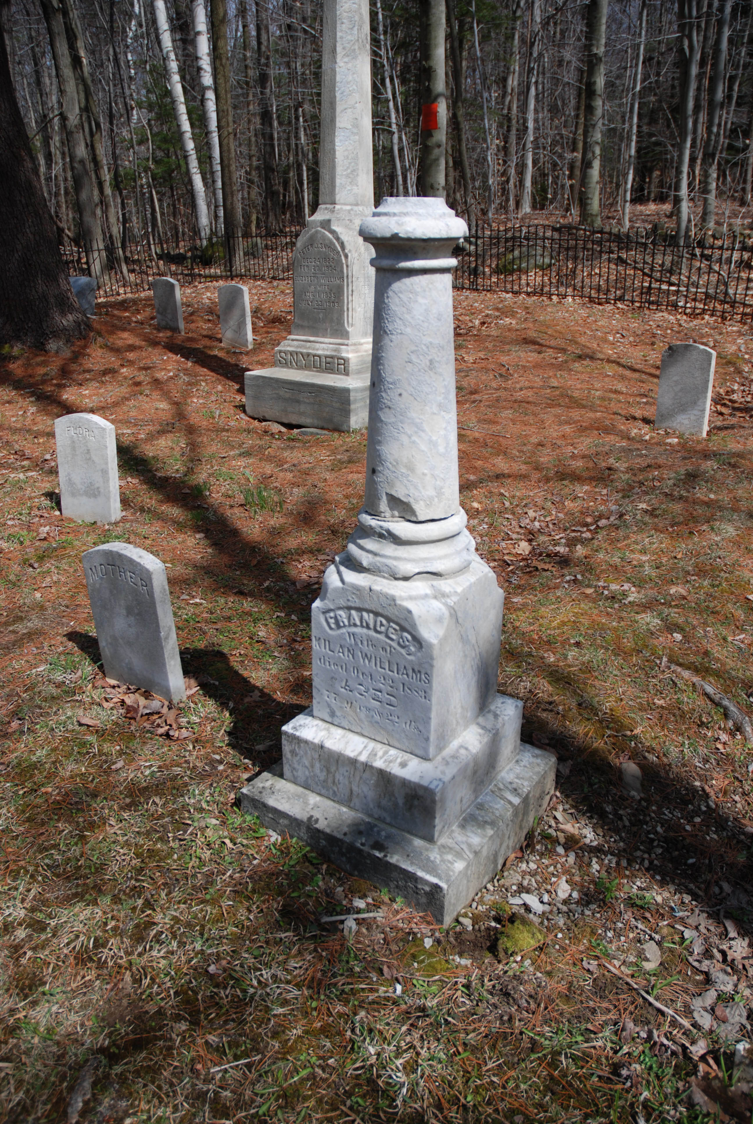
A visit to a historic cemetery can be a time of contemplation in a quiet natural setting. For example, Grafton Lakes State Park in the forests of the Rensselaer Plateau in the Saratoga/Capital Region, has four historic family cemeteries. The Old Snyder Cemetery is just above the Mill Pond and shadowed by the forest. The small cemetery, dating to the 19th century is surrounded by a decorative iron fence and features obelisks, and marble and bluestone gravestones.
At the historic preservation labs at Peebles Island State Park, a fractured gravestone from a historic family cemetery within Grafton Lakes State Park is reset.
Gravestones freshly cleaned by State Parks staffers shine at Grafton Lakes State Park.
The gravestones tell the story of life in 18th and 19th century New York. Some stones simply feature a name while others feature beautifully carved weeping willows or crosses. The Thomas West, Frances West and Hicks cemeteries are smaller and buried deeper in the Park. The cemeteries are marked by fieldstone walls or split rail fence.
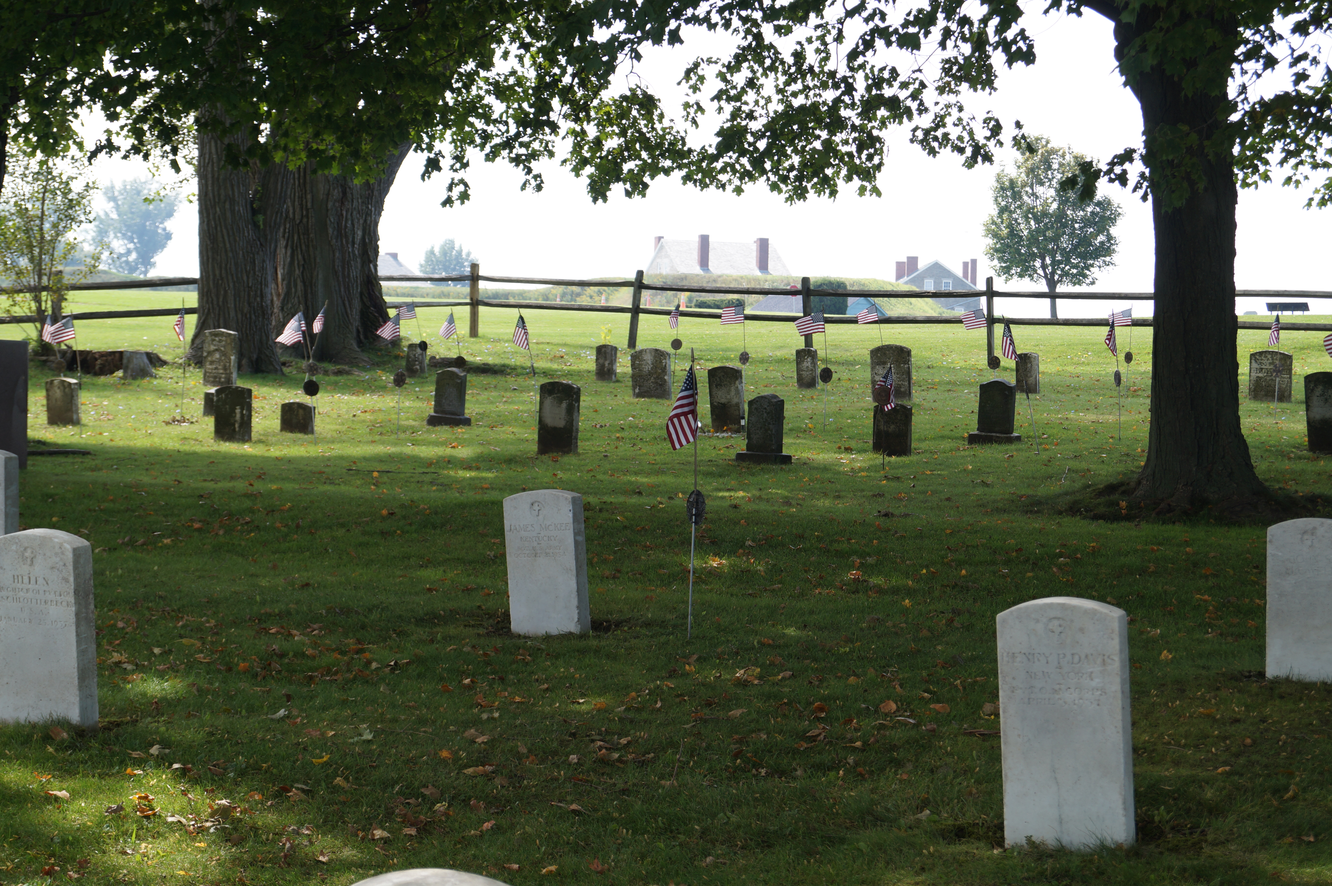
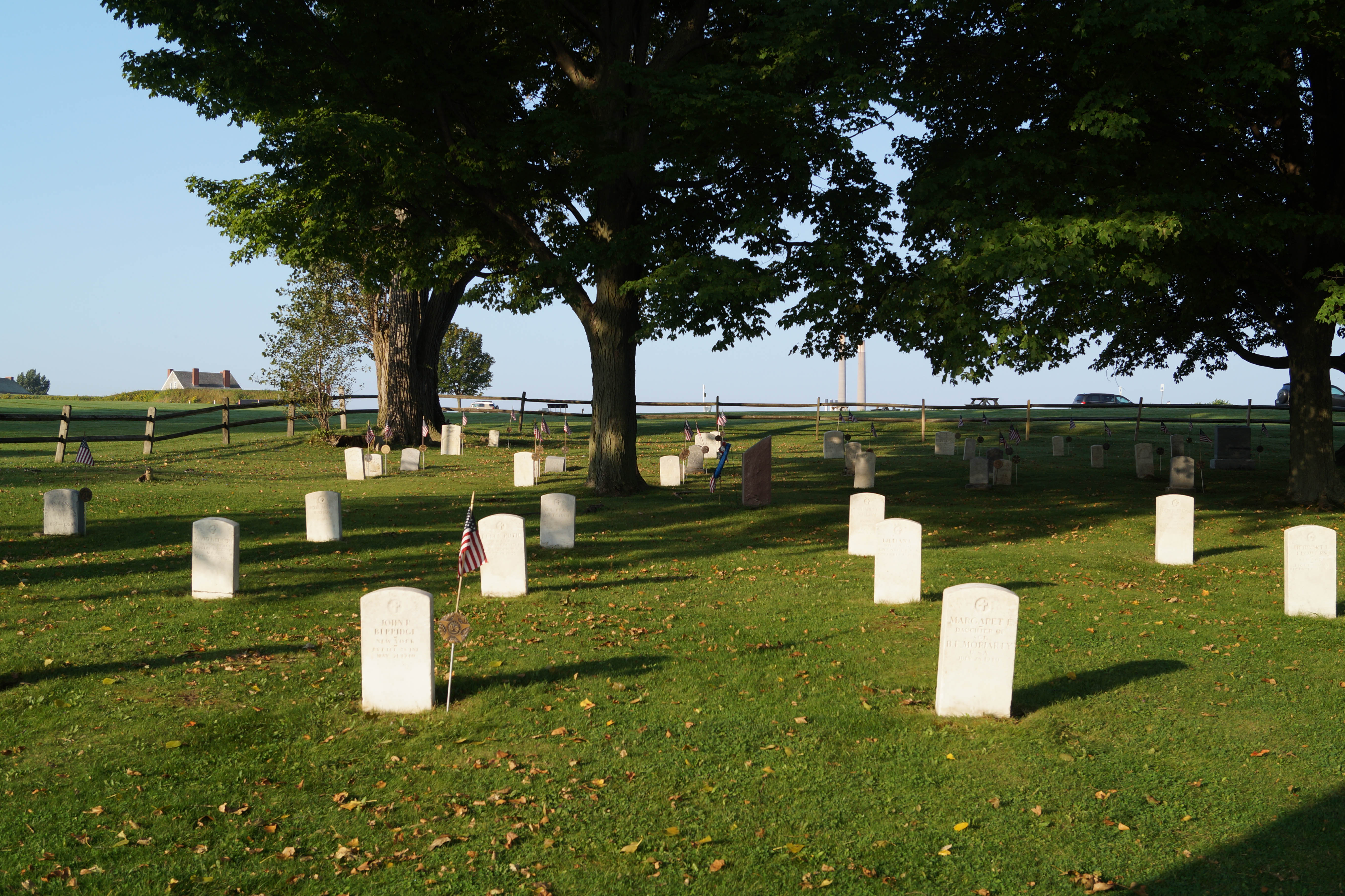
At the other end of the state, the 1812 Cemetery at the Old Fort Niagara State Historic Site, is the resting place of the fort’s soldiers and their families from the War of 1812 through the 1930s. This cemetery is shaded by mature oaks, pines and maple trees and overlooks the Niagara River. Traditional military tombstones are intermixed with large granite and marble memorials to the Unknown Soldiers who died during the campaigns of Western Expansion, the Revolutionary War and the war of 1812. The Victorian and Gothic gravestones feature finely detailed cannons, urns, flowers, shields and crosses.
State Parks conservator Heidi Miksch gently cleans the bronze plaque on a tombstone at Old Fort Ontario State Historic Site.
Gravestones at Old Fort Ontario during and after a cleaning session. Use the slider bar to compare pictures.
The Herkimer Home State Historic Site and Fort Ontario State Historic Site in central New York also feature military and local cemeteries. The Herkimer Home cemetery has large memorials flanked by cannons intermixed with delicate 18th-century marble gravestones and 19th-century zinc memorials, and includes the resting place of Revolutionary War General Nicholas Herkimer, who died of wounds after the Battle of Oriskany.
A member of the Excelsior Conservation Corps (ECC) cleans a gravestone at the Herkimer Home State Historic Site.
Back at the historic preservation labs at Peebles Island, an ECC member repairs a broken gravestone from Herkimer Home State Historic Site.
A map of the Herkimer Home cemetery created by Excelsior Conservation Corps members.
In Oswego at Fort Ontario, a small cemetery features 77 marble military tombstones of veterans from the French and Indian War to World War II. Inside the fort are fragile and rare gravestone from the 1700s.
Sonnenberg Gardens & Mansion State Historic Park in Canandaigua has a small pet cemetery under an old oak tree near the 19th century Victorian mansion. The cemetery is surrounded by a low iron fence and features large boulders carved with the names of family pets owned by Frederick and Mary Thompson, the estate’s former owners. A marble statue of a resting dog guards the small resting place.
Pet cemetery at Sonnenberg Gardens, where a statue of a reclining dog stands watch.
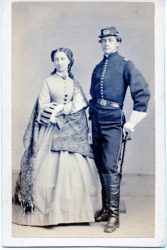
At Katonah’s John Jay Homestead State Historic Site, in the historic house’s Terrace Garden, there is a simple marker in the memory of Old Fred, a horse that served in the Civil War with Colonel William Jay II, with both rider and steed coming home safely at war’s end.
Its inscription reads: “In memory of Old Fred, who carried Colonel Jay through the Battles of Chancellorsville, Gettysburg, Peeble’s Farm & Appomattox, and who died at Bedford in May 1883, aged 28 years.”
The grave and historical marker for Old Fred, the faithful warhorse of Colonel William Jay II. At bottom, Colonel Jay is shown in uniform with his sister, Eleanor Jay Chapman.
So, a quiet October afternoon could be a perfect time to appreciate the hand carved stonework, and imagine the lives marked by the gravestones, which are another aspect our shared history being protected by New York State Parks.
Cover Shot: Members of the Excelsior Conservation Corps cleaning gravestones at the Herkimer Home State Historic Site. (All photos by NYS Parks)
Post by Erin E. Moroney, architectural conservator, Bureau of Historic Site & Park Services
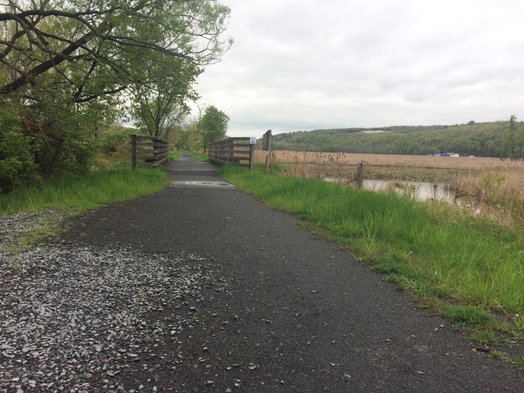
Home of the world-famous Finger Lakes, this region stretches from sandy shores and dramatic bluffs on Lake Ontario to the forests along the Pennsylvania border.
Covering Tioga, Chemung, Steuben, Schuyler, Tompkins Yates Seneca, Cayuga, Ontario, and Wayne counties, this diverse region includes 25 parks and other facilities, two historic sites and four golf courses that span terrain featuring deep clear lakes, spectacular gorges, abundant waterfalls, and fishing and boating opportunities galore.
With fall colors well under way, check out this map to see its progress in this region, as well as across New York State.
Maps for hiking trails and a variety of other useful information on State Parks, including those in the Finger Lakes, are now available on the NYS Parks Explorer app. The free app, which is available for use on Android and iOS devices, is easy to download, user friendly and allows patrons to have park information readily available.
As with all hikes, there are a few things to remember beyond carrying a mobile phone. Check the weather forecast before you go, and dress appropriately. Wear sturdy, yet comfortable shoes or boots, bring water and snacks, and perhaps carry a camera to capture what you see. Be aware of your surroundings and mindful of hikes on steep terrain or those that go near cliff tops. Having a small first-aid kit available in case of an emergency is never a bad idea.
Hiking poles are also useful and can transfer some of the stress of hiking from your knees and legs to your arms and back.
Trail maps are also available on each individual park website page at parks.ny.gov and at the main office of each park. Be sure to download maps ahead of time or carry a paper copy as a back up
In addition to the name and distance of each designated trail in a park, the maps include facilities such as parking, comfort stations, park offices, nature centers, campsites, and boat launches. To learn more about NYS Parks trails CLICK HERE.
Hikers should plan their route in advance, know how long a trail is and how long it ought to take to finish. Since daylight is not an unlimited resource, especially in the fall as days grow shorter, tossing a flashlight or headlamp into your backpack is a good form of insurance, should you unexpectedly find yourself on the trail as dusk approaches.
Parks facilities are carry-in, carry-out, so don’t leave trash behind. Follow Leave No Trace principles to keep trails clean for everyone.
Additionally, as incidents of tick-borne diseases surge in the state, it is always important to check yourself for ticks after being outside, even if it is only time spent in your own backyard.
Lastly, as the COVID-19 pandemic continues, remember to practice safe social distancing, particularly in parking lots and at trailheads, and use face coverings when a distance of six feet cannot be maintained. To learn more about important COVID safety guidelines, CLICK HERE.
Chemung County
Newtown Battlefield State Park, 2346 County Route 60, Elmira (607) 732-6067: This gem of a facility is worth a visit anytime of the year, but a view of the fall foliage from the overlook might just become a new annual tradition. Crisscrossed with 19 trails, nearly all well under a mile mile, this park offers a hiker a variety of routes without steep inclines. The park is named for the battle that took place in 1779 that was part of the American Revolution and contains a replica Native American village and large granite monument. The park also has a unique Civilian Conservation Corps history with many buildings that were constructed during their 1930’s tenure, still in use and looking great! This is the perfect park for those who want to hike through history.
An informational kiosk gives visitors insight to the Battle of Newtown.
The Catherine Valley Trail, c/o Watkins Glen State Park, P.O. Box 304, Watkins Glen (607) 535-4511: Stretching from the village of Watkins Glen on Seneca Lake to the village of Horseheads, this 12-mile compact stone-dust trail follows the course of Catherine Creek and utilizes abandoned railroad and canal towpath corridors. The gentle grades make it a perfect trail at any time of the year for walking, running, cycling, cross-country skiing or snowshoeing. The trail passes a mix of wetlands and woods in a glacially-carved valley.
The Catherine Valley Trail is a wide, gentle path for hikers and cyclists.
Ontario County
Ganondagan State Historic Site, 7000 County Road 41, Victor (585) 924-5848: The only New York State Historic Site dedicated to a Native American theme and the only Seneca town developed and interpreted in the United States, this woodland and meadow park features eight miles of hiking trails. Part of the site is a Bird Conservation Area, so binoculars and a field guide will help visitors identify the many species of birds found here. Formerly the site of 17th century Seneca town, the site now hosts the 17,300 square-foot Seneca Arts Culture Center and a full-sized Seneca bark longhouse, which tell the stories of the Haudenosaunee (Iroquois) contributions to art, culture and society. There are two signed interpretive trails that educate visitors about the significance of plant life, Haudenosaunee culture and history. A third trail just a mile away from the center, interprets the history and the importance of Fort Hill, a large palisaded granary.
Click on the slideshow above for images from Ganondagan State Historic Site, starting with the Earth is Our Mother Trail (1), the Trail of Peace (2), the Seneca Trail south of Boughton Hill Road (3), and the Trout Brook Trail Bridge (4).
Tompkins County
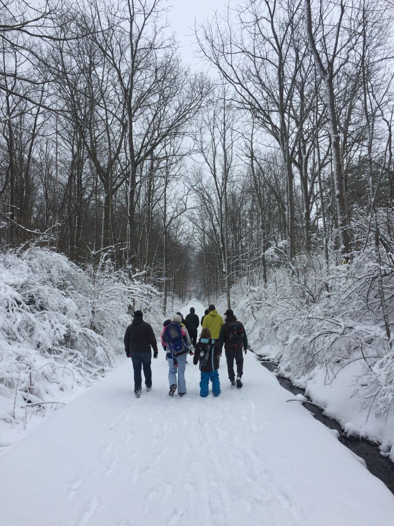
Black Diamond Trail, 1740 Taughannock Boulevard, Trumansburg (607) 387-6739: A former railroad bed, the 8.4-mile Black Diamond Trail (or BDT) is a year-round, multi-use stone-dust trail on the western shore of Cayuga Lake that stretches from Taughannock Falls State Park to the City of Ithaca. The former railroad track descends 400 feet from its northern trailhead at the State Park to its southern end at the Ithaca Children’s Garden where it seamlessly links up with the city’s Cayuga Waterfront Trail along the lake. Its gentle grades make it ideal for hiking, jogging, biking, snowshoeing and cross-country skiing. The trail is named after the rail line that operated on the site from 1896 to 1959, and is thought by some to have been one of the most lavish trains in the world.
The trail is also popular in winter for hiking, snowshoeing and cross-country skiing.
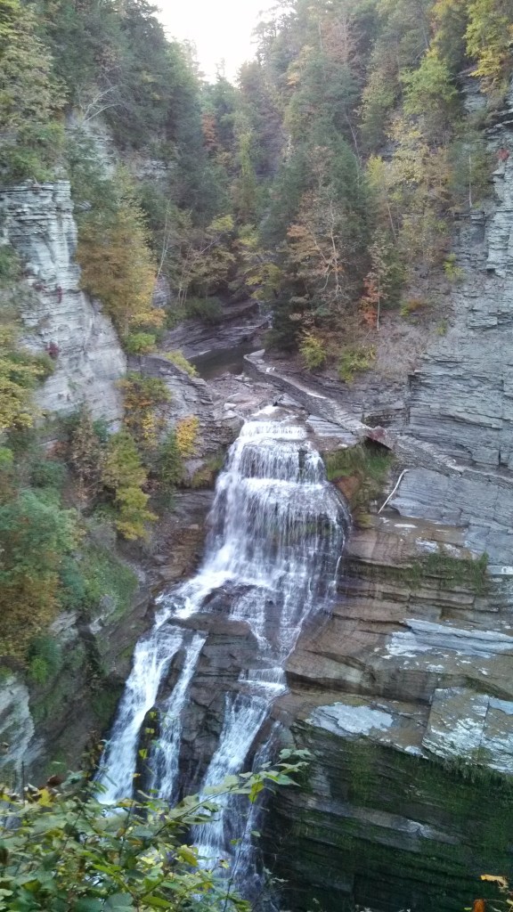
Robert H. Treman State Park, Upper Park Road, Newfield (607) 273-3440: With more more than ten miles of trails to experience, the one-mile upper loop along the rugged Enfield Gorge is spectacular any time of the year, but particularly when its foliage is ablaze. The ascents and descents here can be steep. Start in the parking lot by the Old Mill to begin a half-mile hike down the gorge trail to the 115-foot Lucifer Falls. After taking in the view near the lip of the falls, then descend a staircase along a sheer wall of stone hundreds of feet high that allows a full view of the falls before descending again through the woods to the crossover bridge to the cliff staircase/Rim Trail. Then climb the 222 beautiful stone steps of the Rim Trail for stunning views of the valley below _ and maybe to catch a breather. Continuing on the Rim Trail back to the Old Mill will complete the loop.
The dramatic Lucifer Falls plunges 115 feet at Robert H. Tremain State Park.
Tioga County
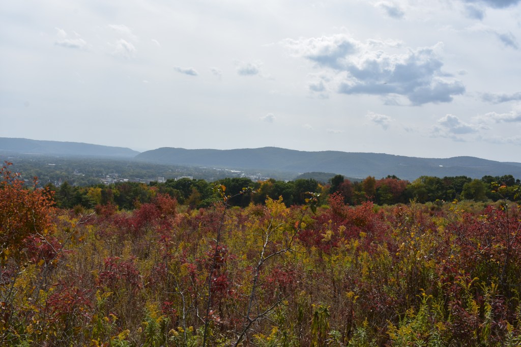
Two Rivers State Park Recreation Area, Banzhoff Road, Waverly (607) 732-6287: A five-minute drive from the village of Waverly near the Pennsylvania border, this park offers a beautiful hilltop vista of the Chemung and Susquehanna River valleys below to the small babbling brooks beginning their journey to the Chesapeake Bay. It contains 4.7 miles of hiking trails that descend from the forested hills to streams that feed the Waverly reservoir system. Mountain biking is also allowed on these trails, so cyclists and hikers need to stay alert to each other. Trails here connect to the village park of Waverly Glen.
While it may be best known for world-class boating and fishing, the Thousand Islands region of State Parks also offers miles of hiking trails along shorelines and through forests, stretching from Lake Ontario north along the St. Lawrence River and finally to the shores of Lake Champlain. Covering Lewis, Jefferson, St. Lawrence, Franklin, and Clinton…
Centered on the confluence of the Hudson and Mohawk Rivers, between the Adirondacks and the Catskills, the Saratoga/Capital Region of New York State Parks offers opportunities for both hikers and paddlers. Covering Albany, Schenectady, Rensselaer, Saratoga Washington, Schoharie, Montgomery and Fulton counties, the region includes a dozen state parks, as well as eight historic sites…
With summer now in full swing, hiking trails are calling from the Central Region of State Parks, which stretches from Lake Ontario to the Southern Tier and Pennsylvania border. The region includes glacial lakes, sandy beaches, segments of the historic Erie Canal, and dramatic waterfalls. Covering Broome, Chenango, Cortland, Delaware, Herkimer, Madison, Oneida, Onondaga, Oswego…
With autumn leaves now turned, hiking in the Palisades region of State Parks offers spectacular views of the Hudson Valley and the Catskills to go with a fascinating history that includes an outlaw’s lair, the state’s early iron industry, and a traitor’s secret meeting place. Located on the west side of the Hudson River, this…
With more than 2,000 miles of marked trails across New York, the State Parks have something for hikers of every ability. That includes the beautiful Taconic Region, located on the east side of the Hudson River and stretching through Columbia, Dutchess, Putnam and Westchester counties. Palatial estates, highland trails, Hudson River vistas and woodland campgrounds…
Such an inflammatory headline would doubtless draw more than a few clicks on social media today. In the 18th century, the Colonial American public got their information from the contemporary version of the internet – newspapers. Colonists might get some news from talking with neighbors or serving on local and state committees, but the major source of information was from the multitude of papers printed across the colonies and imported by ship from Europe.
Imagine then a colonist picking up the February 15, 1777 edition of the respected and reliable Philadelphia-based Durand’s Pennsylvania Packet and seeing the entire front page dominated by harrowing dispatches from London, under the headline “The IMPARTIAL CHRONICLE, or the INFALLIBLE INTELLIGENCER; upon the plan, and after the manner of, the NEW-YORK MERCURY.” Founded in 1771, the Pennsylvania Packet was widely read and by 1784, it became the first successful daily newspaper published in the United States. The Packet was an ancestor of the current Philadelphia Inquirer.
With the Declaration of Independence only about seven months old and blood already shed on battlefields, readers of The Packet were eager for news from the recently estranged Mother county. Imagine the shock when they read on its pages that King George III was ignoring rules of civilized warfare and preparing to send tens of thousands of brutish foreign mercenaries to invade the colony of New York.
These soldiers of fortune didn’t care about liberty, representation, or the rights of Englishmen (or women), they were lured only by gold, plunder, and foreign influence from malevolent despots. King George III, who had never ONCE visited a foreign court (he never even went to Scotland, and that was on the same bloody island…), according to the newspaper, was now entertaining troop offers from around the world in some kind of global outsourcing of villainy.
And the breathless accounts ranged from the reality of German mercenaries who were already fighting in the colonies on behalf of the British to the terrifying spectacles of an amphibious invasion of Japanese samurai on the Pacific Coast and rampaging war elephants being shipped over from an Asian potentate.
The news was shocking – but it was also absolutely fake. The whole thing was a hoax — a hit piece against His Majesty King George III — slipped into a very real colonial newspaper by William Livingston (1723-1790), the son of one of New York’s most powerful families.
Like any good purveyor of “fake news,” Livingston used some kernels of half-truth. German mercenaries were already fighting in America, but the IMPARTIAL CHRONICLE reported that thousands more depraved warriors were on their way from India, Japan, Central Europe, the Ottoman Empire, and Scandinavia — faraway places full of people who had been deemed “savage” by the racial classifications of 18th century America.
Livingston was the embodiment of the educated, upper-class, white male who dominated colonial America. Governor of New Jersey at this time, he was rich, and by rich, I mean “really rich.” His father, Philip, was, literally, Lord of the Manor as proprietor of a massive estate in modern-day Columbia County.
William was well connected to the elite. His brother, also Philip, was known throughout the Colonies as the “the signer” for signing the Declaration of the Independence; and his sister, Sarah, was married to Lord Stirling, one of George Washington’s most trusted generals. William’s daughter, also Sarah, was one of the most well-known and influential women of the entire Revolution — her marriage to John Jay created a partnership of intellectualism and effectiveness that rivaled John and Abigail Adams.
A young William Livingston was part of the powerful ruling class in Colonial New York. The portrait dates from approximately 1730, when William would have been about seven years old. (Photo Credit – John Jay Homestead State Historic Site.
William was a cousin to another famous and powerful Colonial New Yorker, Robert R. Livingston, who grew up near William at Clermont State Historic Site, and was a high-ranking member of New York State Government and the Committee of Five who wrote the Declaration of Independence. In that document, colonists included a list of grievances against King George III, including the charge he was “transporting large armies of foreign mercenaries [the so-called “Hessians” from the state of Hesse in Germany] to complete “the works of death, desolation and tyranny.”
George Washington had achieved a stunning victory over these hated Hessians in his famous crossing of the Delaware River into Trenton, N.J. in late December 1776, but support for the war overall was lagging early on as some Americans questioned whether reconciliation with England might be the best response. Just two months after Trenton, William Livingston used his well-known writing skills to inflame rebel resentment against the King and toward the cause of revolution and liberty.
It was the colonists’ fear of foreign mercenaries (especially the mislabeled and misunderstood German Hessians) that William was amplifying and preying upon in his 1777 IMPARTIAL CHRONICLE hoax.
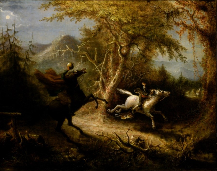
Hessians were scaring New Yorkers for decades after the end of the American Revolution. The “headless horseman” featured in the famous Washington Irving ghost story was of a decapitated Hessian soldier, as illustrated in this 1858 painting “The Headless Horseman Pursuing Ichabod Crane” by John Quidor. (Photo Credit – Smithsonian Museum of American Art.
Livingston was smart. He crafted his hoax in way that was obvious satire and clearly fake, at least to discerning readers, but was also outrageous enough to get people talking about it. His approach allowed him to provoke a laugh at the expense of King George III, all the while stoking primal fears of foreign mercenaries and a frontier war with Native Americans allied with those foreigners.
Livingston began his IMPARTIAL CHRONICLE piece by claiming the Emperor of India had offered King George III “five hundred Elephants out of his own stables” to dispatch against the rebellious Colonials but the King had politely refused because it would cost too much to feed them.
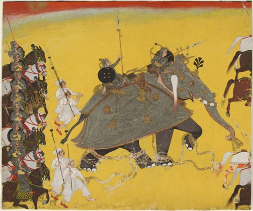
An 18th century depiction of an Indian war elephant carrying spear-wielding soldiers. The elephants were the armored tanks of their day and terrorized opposing troops. (Photo Credit- Philadelphia Museum of Art)
The IMPARTIAL CHRONICLE went on to claim, however, that King George’s advisors, mindful of a potential alliance opportunity with the Indian Emperor, recommended that the king offer his son the Prince of Wales in marriage to the potentate’s eldest daughter. The scheme failed because it was believed the 15-year-old prince could not “close with the overture” (so to speak) with the Indian Princess unless he submitted to circumcision; even that last bit had a racial subtext. Englishmen of that time considered circumcision a dangerous practice, only done by non-Christians — in short, it was 18th century code for barbaric.
In addition to the 500 Indian War Elephants, the IMPARTIAL CHRONICLE claimed offers of troops were pouring in from across the globe to form a gathering barbarian horde.
The King of Denmark was sending 4,000 elite warriors in reindeer-drawn sleds to fight Americans in the snow. In Persia (modern-day Iran), the king was sending 3,500 horse archers to join His Majesty’s light cavalry units. From the Hapsburgh monarchy in central Europe, 5,500 Hungarian Hussars, Pandurs, and Croats were being sent to “cut [Americans] down with their sabers” before their victims even saw them.
In perhaps the largest whopper of them all, Japan was going to amphibiously land 12,000 troops on the coast of California (yes, really, California) and march all the way to New York. The reason for the overland march was twofold, William explained to readers. First, it would save the Japanese fleet from a “circuitous voyage” around the southern tip of South America. Second, the Japanese would gather Native Warriors all the way from “the South Sea and the river Ohio” as allies by convincing the Indigenous Americans that “their ancestors having emigrated from Japan,” and so they should fight for the Japanese Emperor.
The humor is somewhat lost on us modern readers of course, but in the 18th century, it was outrageously funny, so much so that it even made George Washington offer up a LOL. Afterward, the general wrote to William (a personal friend of his): “I heartily thank you for the Impartial Chronicle: Fraught with the most poignant Satire, it afforded me real pleasure.” If you’ve ever read anything written by George Washington, you’d know that’s about as high as his praise gets.
Other bits of news from the IMPARTIAL CHRONICLE hoax were thankfully less about fear-mongering propaganda, and more about plain old mockery. An ad claimed that a runaway servant named “Common-Sense and Honesty” had left the palace of King George III, and offered a £5,000 reward (a considerable fortune at the time) for anyone who could bring him back:
Perhaps the best bit in the IMPARTIAL CHRONICLE was a “correction” which apologized for previously reporting “that the King and Queen were both with child” (the Queen was in fact pregnant at the time). The paper noted the lie apparently had been invented by Americans with “malicious hopes” the King would die in childbirth.
Tightly buttoned waistcoats bursting over a prominent belly were a way that 18th century men displayed their social status and power, but calling King George III pregnant was a low blow of particularly harsh mockery. (Photo Credit – Wikipedia Commons)
Speaking of the Queen, another salacious story in the IMPARTIAL CHRONICLE indicated she had vetoed a plan to offset the losses from the war and repopulate England. As the story went, a foreign Emperor, noting that the *ahem* “common mode of procreation” usually practiced in England was inadequate, offered to send five female concubines to every Member of Parliament and to provide “his Majesty himself with a score…of amiable blooming breeders.” Parliament, it was reported, had “gratefully accepted” but the offer was scuttled because “our most gracious Queen cannot be fully convinced of the necessity of the measure.”
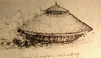
Another bit of “fake news” fabricated by William Livingston claimed that the British Navy, so dominant by sea, was converting some of its warships into land vessels by using ropes and pulleys, so the behemoths could chase Rebels in the countryside. Shown here is a design of a land fighting vessel by famed 16th century Renaissance inventor Leonardo da VInci .(Photo Credit – Wikipedia Commons)
So why did Livingston venture into the realm of fake news? Well, muck-raking and sensationalized journalism were already established New York traditions by 1777.
Robert Livingston, William’s own grandfather, once claimed in a newspaper account decades earlier that former New York Governor Edward Cornbury walked around daily in “womens cloths.” Newspaper publisher John Peter Zenger famously took it a step too far when he had the audacity to publish mean things about Colonial Governor William Crosby that were actually true (Governor Crosby had him arrested for libel, but Zenger was acquitted in one of America’s foundational cases for press freedom from government repression).
Maybe William Livingston did it to insult the King and those loyal to him. Maybe he did to instill a sense of camaraderie among Americans by creating an “Us versus Them” dynamic. Maybe he even did it to convince those on the fence about independence that today it might be Germans sticking bayonets in your belly, but tomorrow it could be War Elephants trampling your wife and children. Or maybe he did it to be funny (well, at least 18th century funny).
Before he was a General and Governor, Livingston was famous for his satirical writings and political commentary. Livingston’s well-known pen and wit weren’t only used against his enemies, either. A few months after his fake news operation, when William learned that the British had burned Kingston in October 1777, he feared for the safety of his brother Philip “the signer.” Philip was serving a term in the New York State Senate, which had relocated to Kingston and had been forced to evacuate just ahead of the British army taking the city.
Upon finally hearing his brother was okay, William sent a letter to Henry Laurens (father of John, from the musical Hamilton fame):
“If my Brother be with you, pray make him my Compliments, and tell him, that considering his size, I was under great apprehensions that he would not have been brisk enough to escape the Firing of Kingston. Sure I am that if any one had done him the kind office that Aeneas did Anchises of bearing him on his Shoulders to avoid the Conflagration, both the bearer & the burden, (or as the Merchants would say, both the Carrier & the freight) would have run the risque [risk] of perishing in the Flames. 5 February 1778.”
In other words, William was calling his little brother fat. A real card, huh?
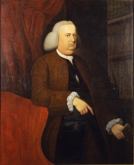
A portrait of the admittedly rotund Philip Livingston, shown here in a circa 1770 portrait by Abraham Delanoy. Again, showing of a prominent belly displayed that a man had enough wealth to eat well and often. (Photo Credit – Clermont State Historic Site)
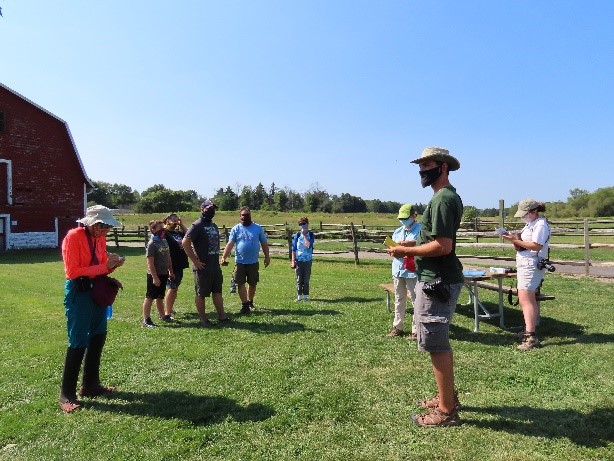
What is a BioBlitz? When I hear that word, images of scientists in white lab coats running madly about flash through my mind. Our first ever BioBlitz at Knox Farm State Park, while not so chaotic, certainly had people dashing about.
Unlike my visions, it was not a cadre of sprinting scientists in lab coats, but rather a gathering of researchers and volunteers clad in hiking boots, cargo pants and sun hats. With magnifiers and nets in hand, cameras and binoculars strung around their necks, these 32 intrepid investigators were ready to spread out. Their mission? Find and document as many living species as possible in the park – and do it in just two days
Participants gather for the BioBlitz at Knox Farm State Park. (Photo Credit – Claudia Rosen)
If this sounds like a hefty undertaking, it is. With 633 acres of grasslands, woods and wetlands, Knox is a large area to adequately survey in a short time. However, that is part of the fun of a BioBlitz. Since the word “blitz” is the German word for lightning, this event is about speed as well as efficiency.
These high-energy events are designed to bring together biologists, conservationists, hikers, naturalists, park goers and nature enthusiasts alike, so anyone can get involved. No expertise required… This is an opportunity to learn, explore and share all the incredible species that call our parks home. The best part is, when people spread out to tackle a larger area, the chances are better that someone will find something completely unexpected.
A view of the grasslands at Knox Farm.The team assigned to identify plant species goes to work. (Photo Credit – Claudia Rosen)
The stage set, so began the first ever Knox Farm State Park BioBlitz on the sunny weekend of August 22-23. Six field teams, each led by an expert, went on a search to survey targeted taxa such as birds, mammals, reptiles/amphibians, plants, invertebrates, and fungi. Guided hikes were led for each field team so participants could learn and share from other team members. BioBlitzers also had the option to tackle an assigned territory alone to help cover more of the park.
Eyes on the sky as the bird survey team identifies their targets. (Photo Credit – Claudia Rosen)
A light is used on a sheet to attract moths to be surveyed. (Photo Credit – Claudia Rosen)
With keen eyes, the group found and documented more than 400 species! This was well above the expected number given the tight deadline. In total, our community scientists recorded 179 species of plants, 164 invertebrate species, 49 species of fungi and lichen, 39 species of birds, six species of mammals, five reptile and amphibian species, and two species of fish.
One highlight was the discovery of a new species of butterfly for the park, the Harvester. An uncommon species, the Harvester butterfly has the distinction of having the only carnivorous caterpillar in NorthAmerica, feeding on the woolly aphids of beech and alder trees, making it a great discovery indeed.
The Harvester butterfly, which has the only carnivorous caterpillar species in North America.
The data gathered during our BioBlitz will be incorporated in our Parks biota databases, which can be used for determining park conservation and management decisions.
For those interested in learning more about the BioBlitz, check out the Knox Farm State Park BioBlitz event page and explore all of the incredible discoveries for yourself. Don’t forget, while this BioBlitz was an organized group event, you can have your own personal BioBlitz whenever and wherever you’d like. You can even have a BioBlitz in your own backyard! This is a great way to learn about local nature and discover the incredible diversity we have in our own neighborhoods.
Remember, before surveying any land you do not own, be sure to contact the landowner for permission, and make sure to have any necessary permits needed to collect specimens. Many bioblitzes rely solely on photographic records, and having smart phone or tablet can make record-keeping easier. At Knox Farm, we used the iNaturalist app.
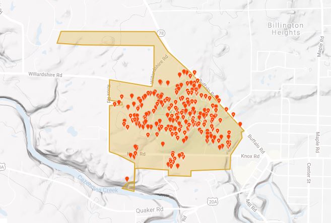
This map shows the species sightings recorded by the BioBlitz at Knox Farm State Park.
For more information on having your own BioBlitz, check out this 10 steps to BioBlitz guide.
For those interested in learning more about Knox Farm State Park, which is located about 20 miles southeast of Buffalo in Erie county, there are year-round guided hikes are offered through the Niagara Region Interpretive Programs Office. To help find your way around on your own, click HERE for a map.
See you at the next BioBlitz!
Cover Shot- BioBlitz participants practice COVID safety protocols.
Post by Matthew Nusstein, Environmental Educator – Niagara Region of New York State Parks
Learn about previous BioBlitzes at New York State Parks…
On May 3, 2014, over a hundred volunteers with scientific backgrounds gathered at Minnewaska State Park Preserve in Ulster County and Clark Reservation State Park in Onondaga county for two concurrent Bioblitzes, 24-hour inventories of the park’s biodiversity. Our objectives were to search the park for as many rare species and natural communities in the…
1 Park 70 professional scientific volunteers 365 acres Countless plants and animals Well, maybe not countless… In fact, on May 3rd and 4th nearly 70 volunteers with scientific backgrounds gathered at Clark Reservation State Park with one goal in mind: spend 24 hours searching for all the plants, animals, fungi, lichen, and even bacteria found…
The words John D. Rockefeller and “Do It Yourself” might not naturally come to mind in the same sentence.
But visitors to the Rockefeller State Park Preserve – the former Hudson Valley family estate of petroleum magnate John D. Rockfeller, who was one of the 20th century’s richest men – will see one of this state’s most ambitious DIY projects.
The preserve is part of the 3,000-acre the Rockefeller Pocantico Hills Estate Historic District, recently added to the National Register of Historic Places, which is honeycombed by more than 55 miles of historic “carriage” roads that gracefully showcase its woodlands, vistas and the river valley.
Near the start of the 20th century, many miles of these roads _ and the picturesque views each step of the way _ were envisioned and laid out on foot by “Old John D” as he was known by neighbors at the time. He passed along his passion for road building to his son, John Jr., who completed and enhanced his father’s vision for the extensive network into the 1930s.
As the head of the Standard Oil conglomerate, Rockefeller was fabulously wealthy, and could have hired any engineer he wished to create the road network for the Westchester Country country estate where he, and his brother William, were to each have luxurious mansions.
John D. Rockefeller St. (Photo Credit- Oscar White/Wikipedia Commons)
But Rockefeller knew what he wanted his roads look like and where they ought to be, so he did it himself, traipsing around the woods with his surveyor’s tools to get it just right.
And he wanted the roads to be suitable for travel in a horse and carriage, which is how he wished to tour the estate. That meant roads with crushed stone surfaces, gentle grades and good drainage to prevent erosion.
In the nominating form for listing the site on the State and National Historic Register, State Parks researcher William Krattinger located some of Rockefeller’s own words recalling his road work..
“I have spent many delightful hours studying the beautiful views, the trees and the final landscape effects of that very interesting section of the Hudson River … I had the advantage of knowing every foot of the land, all the big old trees were personal friends of mine, and with the views at any given point, I was perfectly familiar.”
“In a few days, I had worked out a plan so devised that the roads caught just the best views at just the angles where in driving up the hill, you came upon impressive outlooks and the ending was the final burst of river, hill, cloud and great sweep in country to crown the whole; and here I fixed my stakes to show where I suggested the roads should run.”
– Roberts, Ann Rockefeller (1990) Mr. Rockefeller’s Roads: The Untold Story of Acadia’s Carriage Roads & Their Creator
There are miles of carriage roads at Rockefeller State Park Preserve surveyed and laid out by industrialist John D Rockefeller Sr. at the turn of the 20th century. (Photo Credit- NYS Parks)
A contemporary newspaper account in the Dec. 31, 1904 edition of the Utica Journal also expressed admiration for Rockefeller’s skill as a surveyor and road builder:
“With only an assistant to carry the transit and hold the rod, the old man (Rockefeller was 65 at the time of the article) has trampled all over his vast estate on the Pocantico Hills and has made his own surveys for the huge park which he is laying out there.”
“More than this, he has shown himself to be an expert road builder. When all the roads he has mapped out are completed they will stretch for nearly 40 miles and “Old John D.,” as the whole countryside calls him, has planned every foot of them himself. Landscape gardeners and civil engineers alike agree that, whether from the viewpoint of artistic effect or mere utility, the work could not have been better done.”
The roads themselves, of course, were built by hired workers following the Rockefeller’s routes.
A carriage road passes along a meadow. (Photo Credit – NYS Parks)
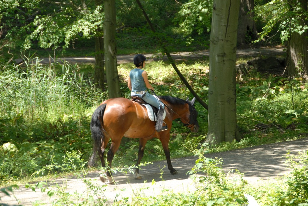
The carriage roads are a favorite of equestrians. (Photo Credit – NYS Parks)
Rockefeller’s vision for his estate was also different from that of many opulent estates of his day, in that he did not want an elaborately designed, geometrically landscaped estate of exotic or imported plants.
Rather, Rockefeller wanted to showcase the natural beauty of the land, sky and river valley.
As described by Bill Krattinger: “The outer estate landscape of the Pocantico Hills estate was not designed, in the formal sense, but was instead “culled back” to reveal or otherwise highlight what were deemed to be the most desirable existing features and views … it might more properly be defined as a refined or culled landscape, in that its creation was not so much a process of introducing new plant and tree material and adding or modifying topographic features, but instead one of honing the existing landscape’s natural features to bring to the forefront those characteristics which were deemed to be the most desirable and beautiful.”
Rockefeller’s work was picked up and continued by his son, John Jr., whose instincts for landscape design and road building were as sharp as his father’s, so much that John Jr. was bestowed with an honorary membership in the American Society of Landscape Architects in the late 1930s.
Long popular for walking, riding, jogging, and carriage driving, the trails lead through varied landscapes and past natural and historical features, such as Swan Lake, the Pocantico River with its wood and stone bridges, gurgling streams, colonial stone walls and rock outcroppings.
The Park Preserve occupies about 1,700 acres in this district, with the rest privately held.
So, come experience the beautiful carriage roads here at Rockefeller State Park Preserve as the fall leaves turn color, and as you take in the views, imagine one of the country’s richest men, happily tramping through his woods and envisioning what you now enjoy today.