Camping at our 100-plus campgrounds is the ultimate affordable getaway option, but it’s so much more than just a money saver. Camping connects you to nature and allows you to unplug in ways you just can’t replicate on a day trip. While some of our campgrounds are well-known statewide, others are unsung outside their immediate area, their natural beauty and ecological significance waiting to be discovered. As you plan your summer, get up to speed on camping guidance and consider these seven often-overlooked New York State Parks campgrounds for your next great stay.
Continue reading New York State Parks’ Best-Kept Secrets: Seven Campgrounds Worthy of Your SummerTag Archives: Newtown Battlefield State Park

Get Out and Explore… The Finger Lakes Region of New York State Parks
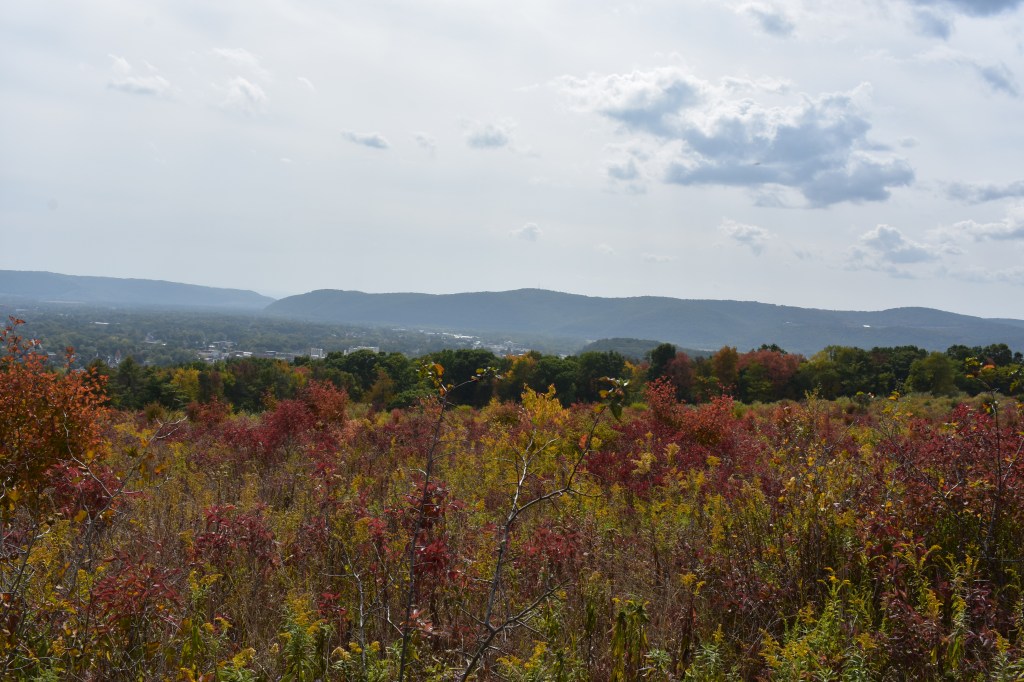
Home of the world-famous Finger Lakes, this region stretches from sandy shores and dramatic bluffs on Lake Ontario to the forests along the Pennsylvania border.
Covering Tioga, Chemung, Steuben, Schuyler, Tompkins Yates Seneca, Cayuga, Ontario, and Wayne counties, this diverse region includes 25 parks and other facilities, two historic sites and four golf courses that span terrain featuring deep clear lakes, spectacular gorges, abundant waterfalls, and fishing and boating opportunities galore.
With fall colors well under way, check out this map to see its progress in this region, as well as across New York State.
Maps for hiking trails and a variety of other useful information on State Parks, including those in the Finger Lakes, are now available on the NYS Parks Explorer app. The free app, which is available for use on Android and iOS devices, is easy to download, user friendly and allows patrons to have park information readily available.
As with all hikes, there are a few things to remember beyond carrying a mobile phone. Check the weather forecast before you go, and dress appropriately. Wear sturdy, yet comfortable shoes or boots, bring water and snacks, and perhaps carry a camera to capture what you see. Be aware of your surroundings and mindful of hikes on steep terrain or those that go near cliff tops. Having a small first-aid kit available in case of an emergency is never a bad idea.
Hiking poles are also useful and can transfer some of the stress of hiking from your knees and legs to your arms and back.
Trail maps are also available on each individual park website page at parks.ny.gov and at the main office of each park. Be sure to download maps ahead of time or carry a paper copy as a back up
In addition to the name and distance of each designated trail in a park, the maps include facilities such as parking, comfort stations, park offices, nature centers, campsites, and boat launches. To learn more about NYS Parks trails CLICK HERE.
Hikers should plan their route in advance, know how long a trail is and how long it ought to take to finish. Since daylight is not an unlimited resource, especially in the fall as days grow shorter, tossing a flashlight or headlamp into your backpack is a good form of insurance, should you unexpectedly find yourself on the trail as dusk approaches.
Parks facilities are carry-in, carry-out, so don’t leave trash behind. Follow Leave No Trace principles to keep trails clean for everyone.
Additionally, as incidents of tick-borne diseases surge in the state, it is always important to check yourself for ticks after being outside, even if it is only time spent in your own backyard.
Lastly, as the COVID-19 pandemic continues, remember to practice safe social distancing, particularly in parking lots and at trailheads, and use face coverings when a distance of six feet cannot be maintained. To learn more about important COVID safety guidelines, CLICK HERE.
Chemung County
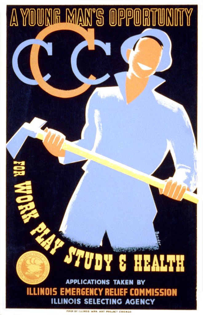
Newtown Battlefield State Park, 2346 County Route 60, Elmira (607) 732-6067: This gem of a facility is worth a visit anytime of the year, but a view of the fall foliage from the overlook might just become a new annual tradition. Crisscrossed with 19 trails, nearly all well under a mile mile, this park offers a hiker a variety of routes without steep inclines. The park is named for the battle that took place in 1779 that was part of the American Revolution and contains a replica Native American village and large granite monument. The park also has a unique Civilian Conservation Corps history with many buildings that were constructed during their 1930’s tenure, still in use and looking great! This is the perfect park for those who want to hike through history.
Find a trail map here…

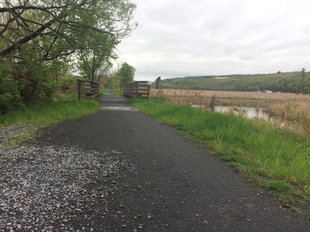
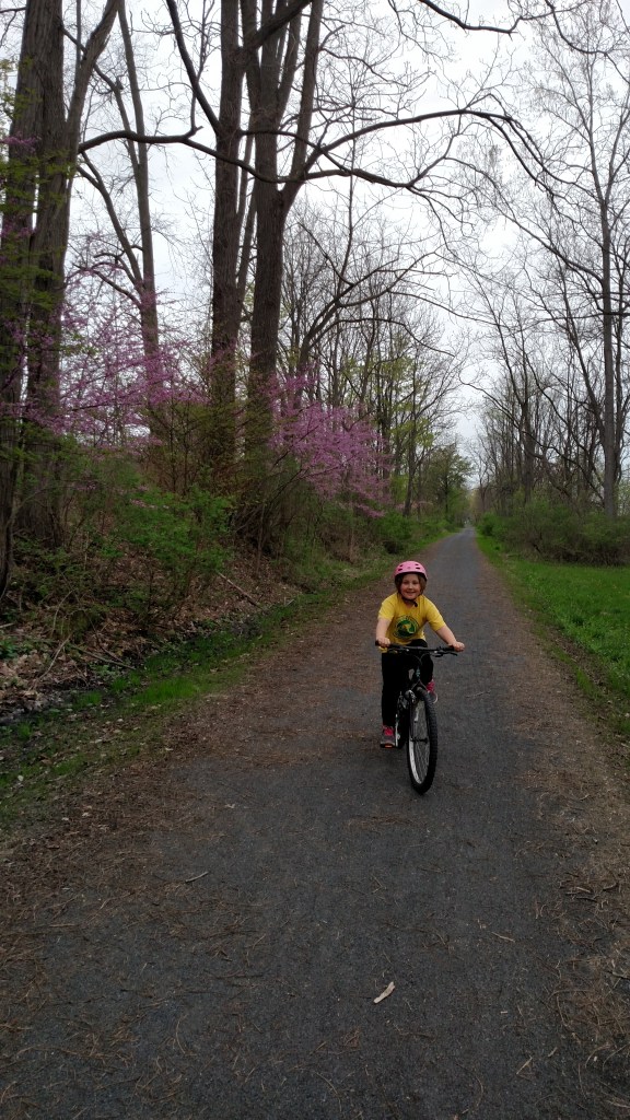
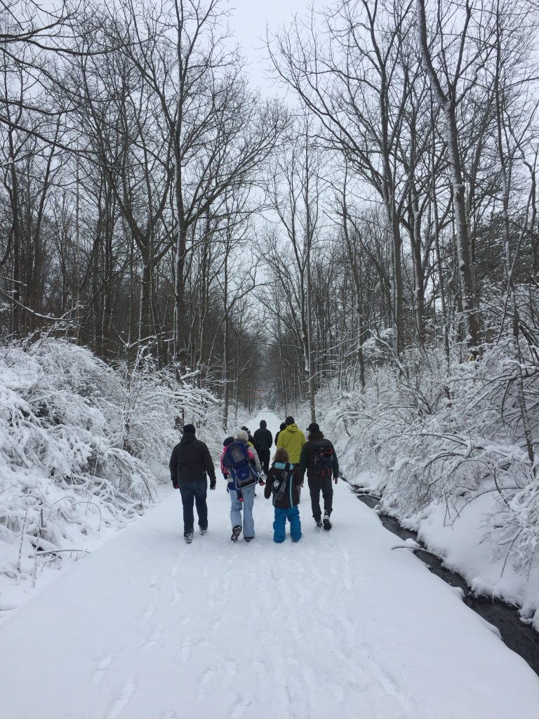
The Catherine Valley Trail, c/o Watkins Glen State Park, P.O. Box 304, Watkins Glen (607) 535-4511: Stretching from the village of Watkins Glen on Seneca Lake to the village of Horseheads, this 12-mile compact stone-dust trail follows the course of Catherine Creek and utilizes abandoned railroad and canal towpath corridors. The gentle grades make it a perfect trail at any time of the year for walking, running, cycling, cross-country skiing or snowshoeing. The trail passes a mix of wetlands and woods in a glacially-carved valley.
Find a trail map here…
Ontario County
Ganondagan State Historic Site, 7000 County Road 41, Victor (585) 924-5848: The only New York State Historic Site dedicated to a Native American theme and the only Seneca town developed and interpreted in the United States, this woodland and meadow park features eight miles of hiking trails. Part of the site is a Bird Conservation Area, so binoculars and a field guide will help visitors identify the many species of birds found here. Formerly the site of 17th century Seneca town, the site now hosts the 17,300 square-foot Seneca Arts Culture Center and a full-sized Seneca bark longhouse, which tell the stories of the Haudenosaunee (Iroquois) contributions to art, culture and society. There are two signed interpretive trails that educate visitors about the significance of plant life, Haudenosaunee culture and history. A third trail just a mile away from the center, interprets the history and the importance of Fort Hill, a large palisaded granary.
Find a trail map here…


Click on the slideshow above for images from Ganondagan State Historic Site, starting with the Earth is Our Mother Trail (1), the Trail of Peace (2), the Seneca Trail south of Boughton Hill Road (3), and the Trout Brook Trail Bridge (4).
Tompkins County
Black Diamond Trail, 1740 Taughannock Boulevard, Trumansburg (607) 387-6739: A former railroad bed, the 8.4-mile Black Diamond Trail (or BDT) is a year-round, multi-use stone-dust trail on the western shore of Cayuga Lake that stretches from Taughannock Falls State Park to the City of Ithaca. The former railroad track descends 400 feet from its northern trailhead at the State Park to its southern end at the Ithaca Children’s Garden where it seamlessly links up with the city’s Cayuga Waterfront Trail along the lake. Its gentle grades make it ideal for hiking, jogging, biking, snowshoeing and cross-country skiing. The trail is named after the rail line that operated on the site from 1896 to 1959, and is thought by some to have been one of the most lavish trains in the world.
Find a trail map here…
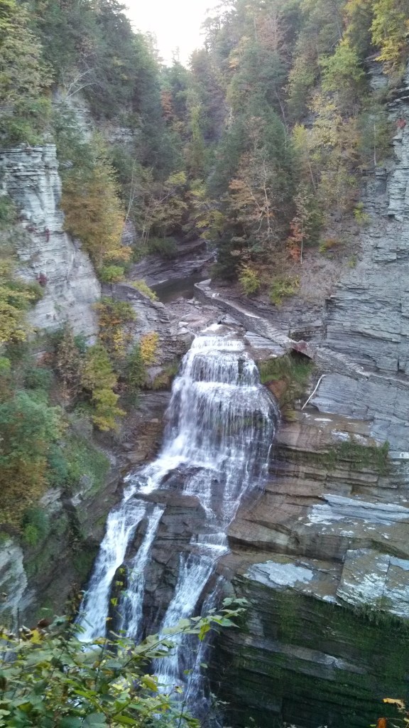
Robert H. Treman State Park, Upper Park Road, Newfield (607) 273-3440: With more more than ten miles of trails to experience, the one-mile upper loop along the rugged Enfield Gorge is spectacular any time of the year, but particularly when its foliage is ablaze. The ascents and descents here can be steep. Start in the parking lot by the Old Mill to begin a half-mile hike down the gorge trail to the 115-foot Lucifer Falls. After taking in the view near the lip of the falls, then descend a staircase along a sheer wall of stone hundreds of feet high that allows a full view of the falls before descending again through the woods to the crossover bridge to the cliff staircase/Rim Trail. Then climb the 222 beautiful stone steps of the Rim Trail for stunning views of the valley below _ and maybe to catch a breather. Continuing on the Rim Trail back to the Old Mill will complete the loop.
Find a trail map here…

Tioga County
Two Rivers State Park Recreation Area, Banzhoff Road, Waverly (607) 732-6287: A five-minute drive from the village of Waverly near the Pennsylvania border, this park offers a beautiful hilltop vista of the Chemung and Susquehanna River valleys below to the small babbling brooks beginning their journey to the Chesapeake Bay. It contains 4.7 miles of hiking trails that descend from the forested hills to streams that feed the Waverly reservoir system. Mountain biking is also allowed on these trails, so cyclists and hikers need to stay alert to each other. Trails here connect to the village park of Waverly Glen.
Find a trail map here…
Cover Shot- Lucifer Falls at Robert H. Treman State Park. All photos by NYS Parks.
And learn about great hikes in other State Parks regions in previous posts from the “Get Out and Explore…” series. See you out there!

Get out And Explore … The Thousand Islands Region of New York State Parks
While it may be best known for world-class boating and fishing, the Thousand Islands region of State Parks also offers miles of hiking trails along shorelines and through forests, stretching from Lake Ontario north along the St. Lawrence River and finally to the shores of Lake Champlain. Covering Lewis, Jefferson, St. Lawrence, Franklin, and Clinton…

Get out And Explore … The Saratoga/Capital Region of New York State Parks
Centered on the confluence of the Hudson and Mohawk Rivers, between the Adirondacks and the Catskills, the Saratoga/Capital Region of New York State Parks offers opportunities for both hikers and paddlers. Covering Albany, Schenectady, Rensselaer, Saratoga Washington, Schoharie, Montgomery and Fulton counties, the region includes a dozen state parks, as well as eight historic sites…

Get Out And Explore … The Central Region of New York State Parks
With summer now in full swing, hiking trails are calling from the Central Region of State Parks, which stretches from Lake Ontario to the Southern Tier and Pennsylvania border. The region includes glacial lakes, sandy beaches, segments of the historic Erie Canal, and dramatic waterfalls. Covering Broome, Chenango, Cortland, Delaware, Herkimer, Madison, Oneida, Onondaga, Oswego…

Get Out and Explore … The Palisades Region
With autumn leaves now turned, hiking in the Palisades region of State Parks offers spectacular views of the Hudson Valley and the Catskills to go with a fascinating history that includes an outlaw’s lair, the state’s early iron industry, and a traitor’s secret meeting place. Located on the west side of the Hudson River, this…

Get out and explore … the Taconic Region of State parks
With more than 2,000 miles of marked trails across New York, the State Parks have something for hikers of every ability. That includes the beautiful Taconic Region, located on the east side of the Hudson River and stretching through Columbia, Dutchess, Putnam and Westchester counties. Palatial estates, highland trails, Hudson River vistas and woodland campgrounds…

A Legacy of Strength
During the 1930s when racial segregation and Jim Crow held sway over much of America, there was a Depression-era federal public works unit where African-Americans, not whites, were in command. And it was here in New York State Parks.
To combat rampant unemployment among young men, President Franklin Roosevelt had created the Civilian Conservation Corps (CCC) in 1933 to perform public works projects.
The struggles of the 1930’s reached beyond the economic depression. Major environmental issues plagued the nation as well. The impact of poor farming practices, deforestation, and destructive pests were just a few of the things destroying thousands of acres of usable land. Across the nation, the CCC immediately put its companies to work solving these two major crises at once.
While discrimination based on ‘race, color, or creed,’ was against Roosevelt’s founding policy, that was to exist almost only on paper. When the first CCC companies formed, racial segregation was part of the process. After two years of operation, this practice became official policy in 1935 when CCC Director Robert Fechner insisted on complete segregation of whites and colored enrollees. The only exception allowed was if a company was formed in an area of the country with a small African American population.
Enrollees from big cities and small towns all over New York found themselves at Camp Dix, New Jersey, with thousands of other men who were desperate for work. Upon arrival, men were assigned to a 200-man company, although many colored companies numbered less than 100. Each company was given a number, and a lowercase ‘c’ was added for ‘Colored’ where needed. And policy dictated that those in charge of all companies were white Army officers.
Men from New York quickly filled slots in several ‘Colored’ companies forming at Camp Dix. As these companies moved around the country, they were trained on the job by local professionals who were also white. Pressure from Congress, the National Urban League, and the National Association for the Advancement of Colored People (NAACP) began immediately for African American officers and professionals to work with African American companies, but it would be several years before things changed.
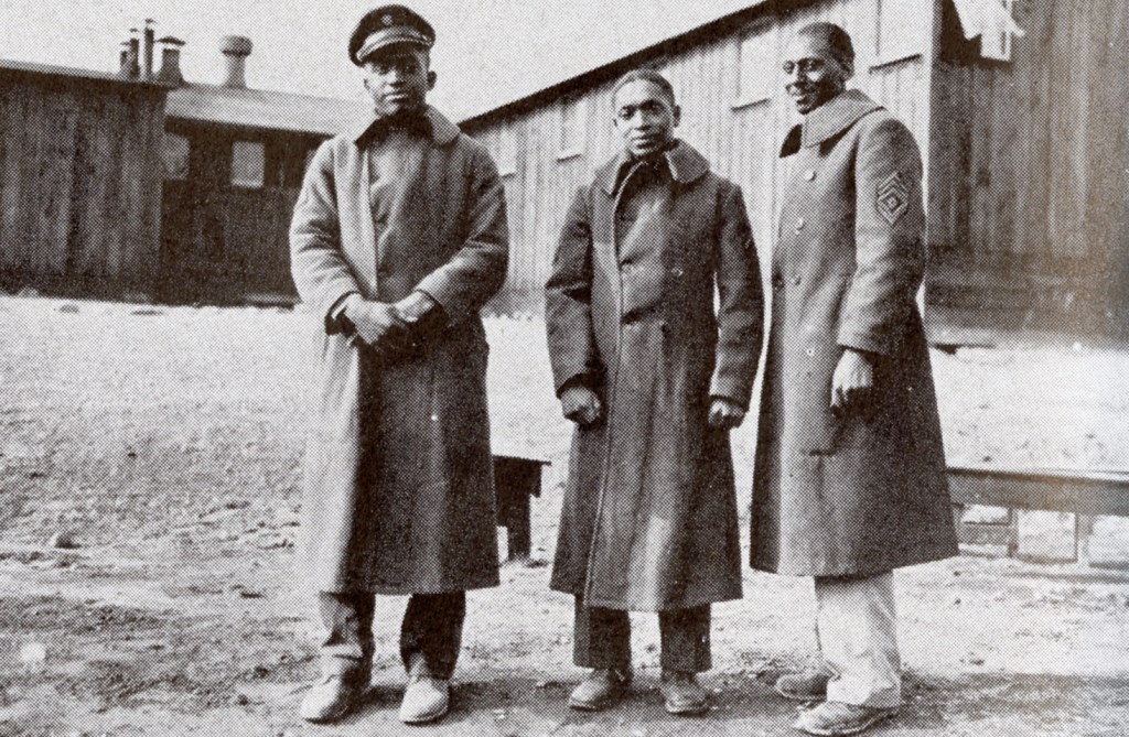

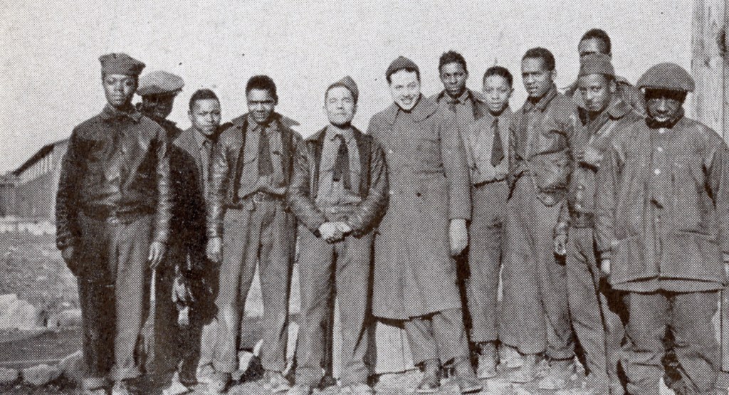


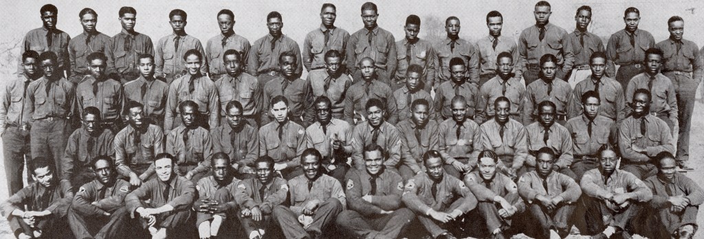
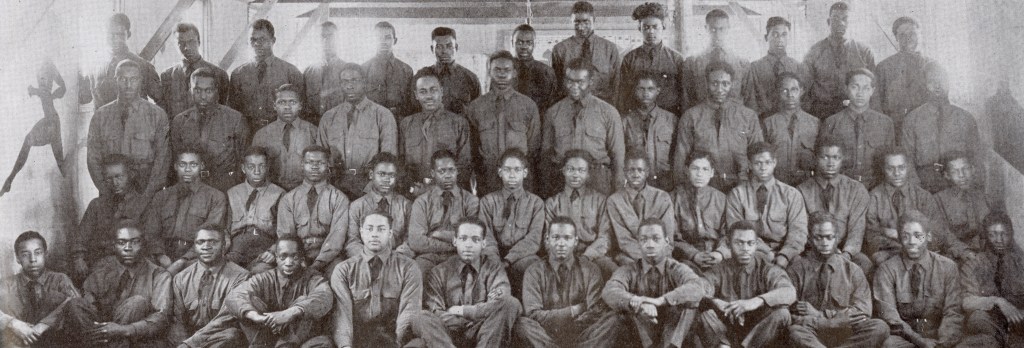
Click on this slideshow of the men of the Civilian Conservation Corps “Colored” companies from New York State.
By the fall of 1933, colored companies from Fort Dix including 246-c, 247-c, and 1245-c were formed and immediately sent out. Company 246-c was shipped by train to Chelan, Washington State, to fight fast-moving forest fires. Their next mission took them across the country to Yorktown, Virginia, to excavate colonial buildings and reconstruct two historic sites — the Moore House and the White Swan Tavern, both of which still stand today.
From Virginia, the men of 246-c headed back to New York to the Orange County town of Wawayanda to begin working on the Wallkill Flood Control Project, a ten-mile-long canal designed to change the direction of the river and stem seasonal flooding.
Company 247-c headed to Idaho to build roads and fire trails and plant hundreds of trees in the Lake Pend Oreille Forest. They later went south to work as archaeologists at the Yorktown Battlefields collecting pottery chards and other bits before returning to New York. Company 1287-c fought forest fires in Idaho, built roads in Virginia, then moved into New York, joining the other companies for the Wallkill project.
Company 1245-c headed out in 1934 to create fire breaks, build truck trails, plant trees and dig wells before heading to the Wallkill. Company 3210-c and 3211-c, formed in 1935, went directly to the Wallkill project, with 3211-c later heading a few miles north to build roads.
Health care and food services were year-round jobs as well with the CCC, and often these were the first positions filled by young African American men. During the early years of the program, African Americans could be found as cooks and health orderlies but rarely as the head chef, doctor, or dentist.
Initially, trained African American officers in the U.S. Reserved Army were totally ignored, then slowly as more pressure from members of Congress and other groups continued, they began filling positions as medical officers, working alongside African American orderlies and chaplains. By 1936, such outside pressure forced Fechner to set-up a “demonstration camp” in Gettysburg, Pennsylvania, where a Colored company would be managed by African American commanding officers. If the experiment worked, other companies could be switched over.


While the Gettysburg effort was successful, only one other CCC company ever saw the change to Colored officers _ 1252-c in New York State. Initially stationed at the Newtown Battlefield Reservation outside of Elmira, Chemung County starting in 1935, this company had started with white officers like all the rest. But in June 1939, colored officers were quietly brought in to run the unit.
The work of the men of Company 1251-c is still visible at Newtown Battlefield State Park, where they built the picnic pavilion and concession stand, sports fields, stone tables, and wooden bridges, as well as planted trees and plants, and added or graded topsoil.


Such work was only part of an average day for company members. Improving the education of enrollees was also part of the CCC’s mission. Civilian Educational Advisors (CEA) were local educators who were stationed at the various sites.
Classes were held regularly and for many of the colored companies stationed in New York the classes were taught by African American men. Reading and writing went hand in hand with Spanish, French, Mathematics, and Negro History. Recreational pursuits included bands, sports teams, and company newsletters.
Although hugely successful, the CCC came to an end in 1942 as the nation joined the Second World War. By then, more than two million men had gone into the program. Read more about New York’s history in the program in the Parks Blog post below…

Civilian Conservation Corps in New York State Parks
When Franklin Delano Roosevelt (FDR) became president in 1933, the entire nation was in a state of turmoil never seen before or since. It was the height of the Great Depression: unemployment was at 25%, croplands were failing, and millions of families were going hungry. As governor of New York State, FDR had implemented the…
Even in the face of economic hardship and ecological stress, racism and segregation had dogged the program each step of the way. CCC Director Robert Fechner’s insistence on racial inequality plagued the CCC in spite of constant pressure from the White House, Congress, and other groups striving to create a more equitable environment in the country.
The work done by the men in New York’s colored companies of the CCC continues to enrich the lives of New Yorkers everyday. Theirs is a legacy of strength we can all draw from.
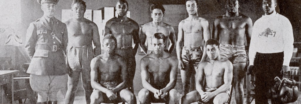
Cover Shot: Company 246-c. All photographs from state Bureau of Historic Sites
Post by Lavada Nahon, Interpreter of African American History, state Bureau of Historic Sites
At Gilbert Lake State Park, Otsego County, other companies of the CCC constructed cabins, trails, roads, dams, and erosion control structures between 1933 and 1941. The park is also home to the New York State Civilian Conservation Corps Museum, which displays photographs and artifacts from the days of the CCC.