

As a New York State Park Ranger, every day is different. You can never be quite sure what you may encounter, or who you may cross paths with, but each day offers an opportunity to make an impact on the experience that visitors have when coming to enjoy New York State Parks. Below are some of the many stories from Park Rangers across the state about their experience working in parks this summer, in their own words!
Continue reading Park Rangers Share Tales from the FieldTag Archives: Harriman State Park

“A curious mix of dignity and devil-may-care:” Memories of Ruby Jolliffe, Palisades Group Camp Director
The story of New York State Parks and Historic Sites is not just one of properties, but of people. During our Centennial year, we introduced you to some of them. In this new series, we take our scrapbook of memories down from the shelf and open it to share their stories in more detail.
She was “the hand that lit a thousand campfires.” Distinctive and almost prim in her hat, starched shirt, knickers, spectacles, and close-cropped hair, she had a zest for life. That zest saw her take a toboggan run at 70 miles per hour, throw a birthday party for a dog, and befriend some of the era’s most powerful people. She combined a knack for building relationships, an insistence on the highest standards, and a deep belief in her mission to build her program into a powerhouse that touched hundreds of thousands of lives. She was Ruby Jolliffe, and her 28-year tenure as Group Camp Director in the Palisades region continues to leave an impression more than 75 years after her retirement.


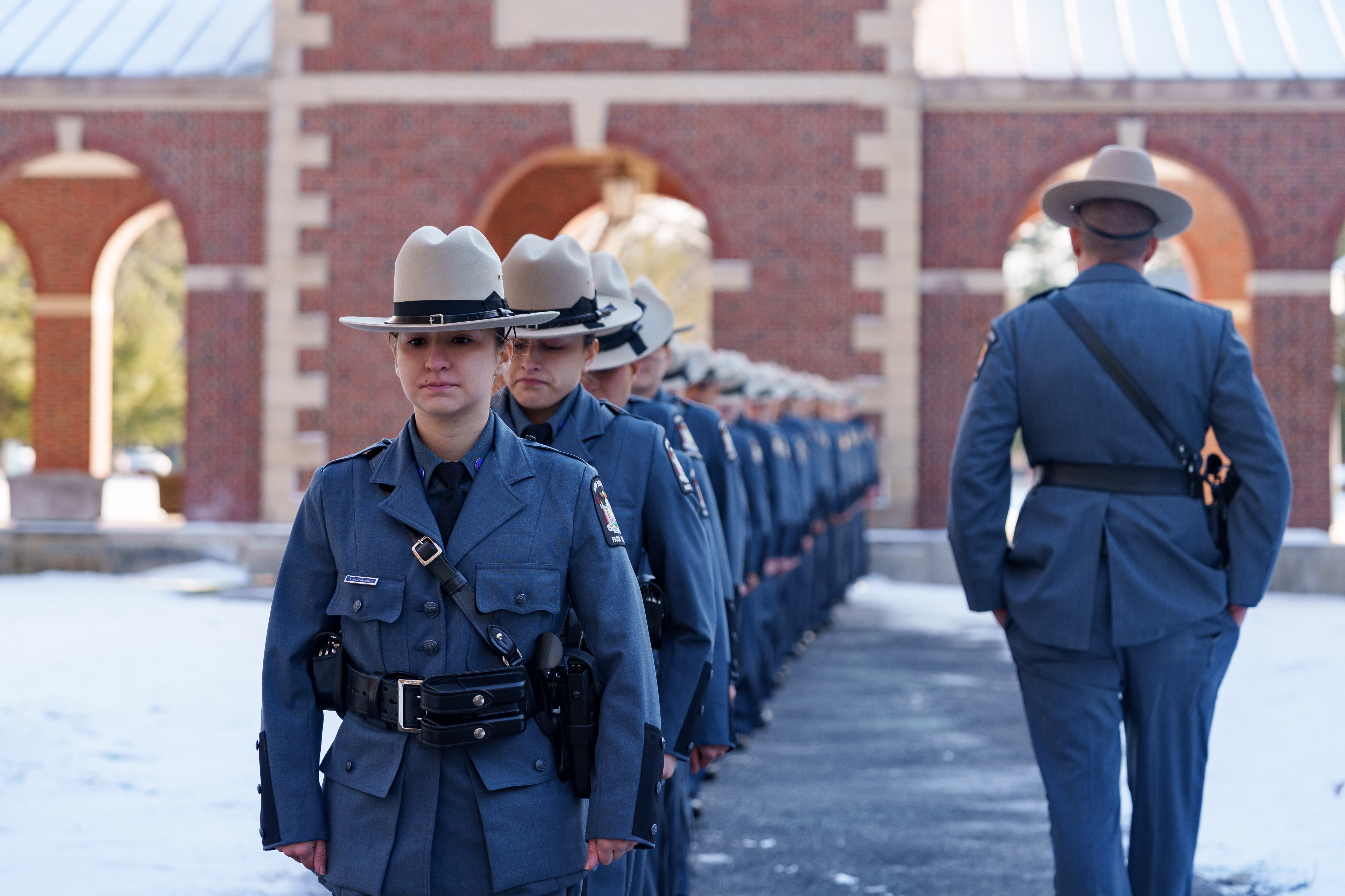
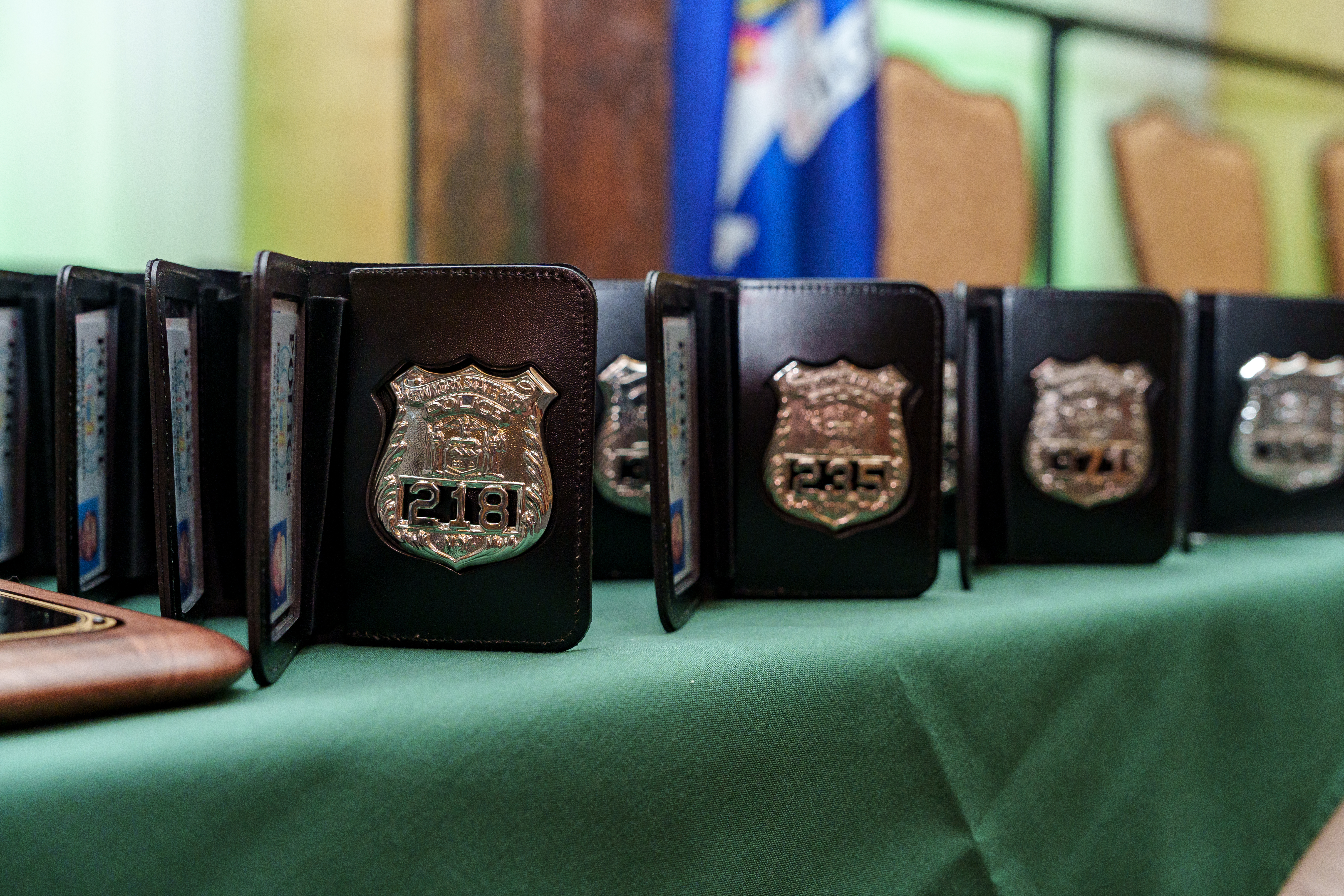
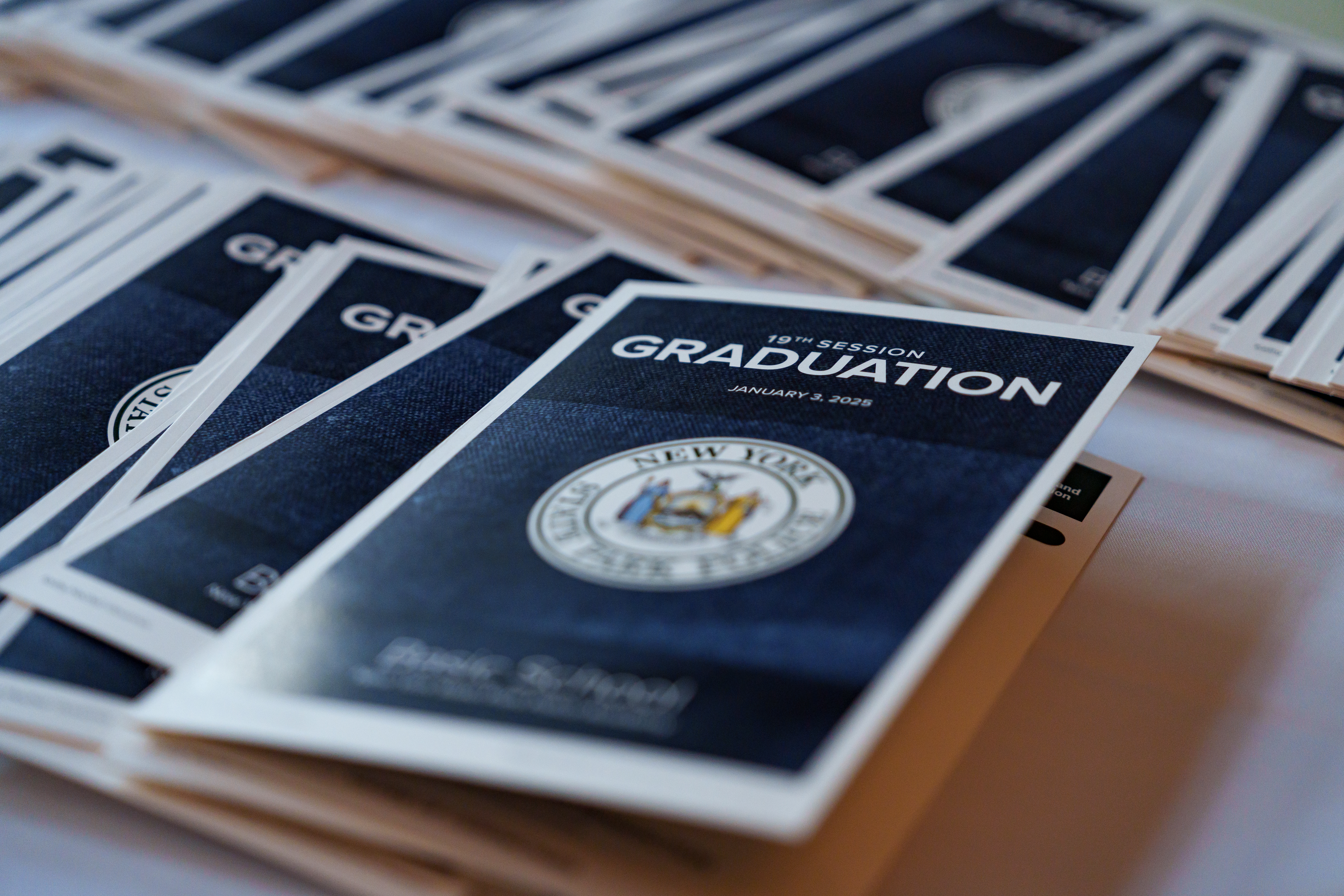
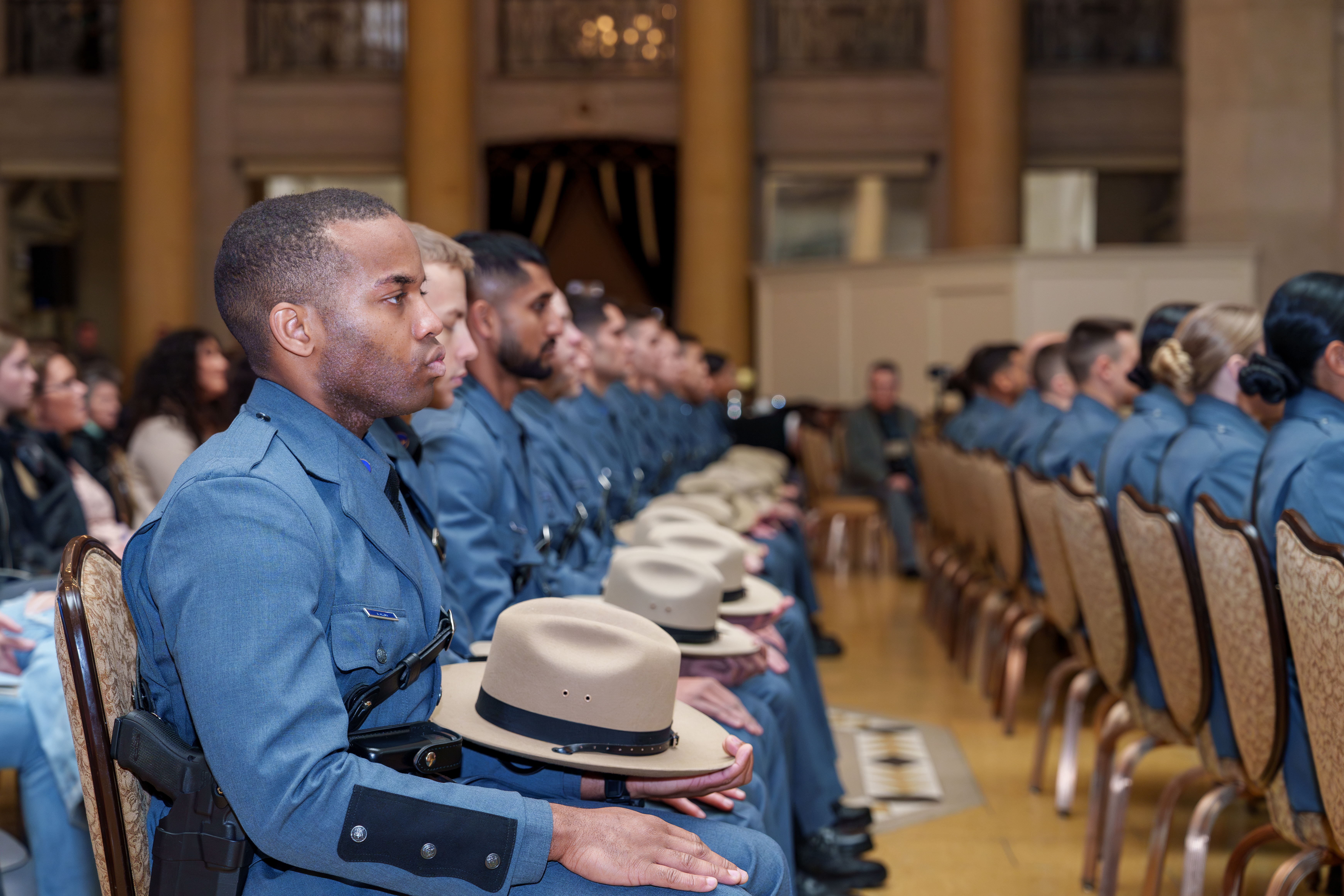
Park Police Team Keeps Growing
It happened on January 3, 2025. The New York State Office of Parks, Recreation and Historic Preservation achieved something never done before – two graduations in less than one calendar year and the first summertime academy session. The agency continues the rebuild of one of the oldest police forces in the state, and are proud to welcome four new officers whose career paths began in other roles in the agency.


A New Outdoor Aesthetic: New York’s Postwar Park Architecture
Many buildings and features built for New York state parks during the 1930s mimicked the natural environment. In the period after World War II, this rustic style started sharing space with more modern designs.
One of the busiest construction periods of the New York State Parks system was during the 1950s and 1960s, when park planners were expecting to welcome record numbers of visitors. You can learn more about that history in our Blazing a Trail timeline project. But, for a deeper dive into the architecture leading up to that era, keep reading…
Continue reading A New Outdoor Aesthetic: New York’s Postwar Park Architecture
Behind The Scenes of Commissioner Kulleseid’s Barnstorming Centennial Launch Tour
In 2024, New York State Parks and Historic Sites will celebrate our Centennial, commemorating the 100th anniversary of the founding of our parks and sites system. While we have incredible public properties older than the 100-year-old system, the Centennial celebrates the vital legislation that allowed us to build and expand our network of parks and sites, forging the system we know and love today.
As OPRHP Commissioner, I am reminded every day of the immense pride and enjoyment New Yorkers take in our facilities. To prepare New York State residents and visitors from around the world for the exciting year ahead, I recently embarked on a two-day journey to showcase the breadth of our parks and sites system, highlighting various activities and partnerships that make our system so unique.
During the launch tour, a small group of staff and I made ten stops – at Olana State Historic Site, Walkway Over the Hudson State Historic Park, Harriman State Park, Jones Beach State Park, Old Fort Niagara State Historic Site, Niagara Falls State Park, Ganondagan State Historic Site, Green Lakes State Park and Saratoga Spa State Park – where I enjoyed biking, ziplining, firing a cannon, swimming with lifeguards, kayaking, lighting Niagara Falls for its evening illumination, and more! I was also pleased to have special guests join us all along the way at tour-stop events, and to have the chance to connect with many of our amazing staff members and supporters as well.
Continue reading Behind The Scenes of Commissioner Kulleseid’s Barnstorming Centennial Launch Tour