Get Out and Explore … The Niagara Region of New York State Parks

Home of the awe-inspiring and world famous Niagara Falls, this region stretches from the shores of Lake Ontario to the shores of Lake Erie, encompassing sand dunes and waterfalls, old growth forests and reclaimed agricultural lands, grasslands and gorges, urban and rural greenspaces, rivers and wetlands.

Covering Niagara and Erie counties, this diverse region includes 18 parks, two historic sites, and many miles of hiking trails, as well as several Bird Conservation Areas, an Internationally Significant Important Bird Area, and a Ramsar designation for the Niagara River as a wetland of global significance.

To start, any successful hike starts with a good map. Maps for hiking trails and a variety of other useful information on State Parks, including those in the Niagara region and other regions, are now available on the NYS Parks Explorer app. The free app, which is available for use on Android and iOS devices, is easy to download, user friendly and allows patrons to have park information readily available every State Parks facility across the state.

Trail maps are also available on each individual park website page at parks.ny.gov and at the main office of each park. Links to maps are also included in the trail descriptions in this post. Be sure to download maps ahead of time to your phone or tablet, and maybe even carry a paper copy as a back up to aid your hike.

As with all hikes, there are a few things to remember beyond carrying a mobile phone. Check the weather forecast before you go, and dress appropriately. Wear sturdy, yet comfortable shoes or boots, bring enough water and snacks, and perhaps carry a camera to capture what you see. Be mindful of wildlife and give it appropriate space, particularly in areas marked as protected, such as for shorebird nesting.

Always be aware of your surroundings and mindful of hikes on steep terrain or those that go near cliff tops. Having a small first-aid kit available in case of an emergency is never a bad idea.

Hiking poles are also useful on longer hikes and can transfer some of the stress of hiking from your knees and legs to your arms and back.

Hikers should plan their route in advance, know how long a trail is and how long it ought to take to finish. If weather conditions change for the worse, be prepared to turn back. Don’t let a desire to reach a specific destination make you press on. Since daylight is not an unlimited resource, even in summer when days are longer, tossing a flashlight or headlamp into your backpack is a good form of insurance, should you unexpectedly find yourself on the trail as dusk approaches.

State Park facilities are carry-in, carry-out, so don’t leave trash behind. Follow Leave No Trace principles to keep trails clean for everyone.

Additionally, as incidents of tick-borne diseases surge in the state, it is always important to check yourself for ticks after being outside, even if it is only time spent in your own backyard.

Lastly, as the COVID-19 pandemic continues, remember to practice safe social distancing, particularly in parking lots and at trailheads, and use face coverings when a distance of six feet cannot be maintained, even if you have been vaccinated. To learn more about important COVID safety guidelines, click HERE.

Erie County


Buffalo Harbor State Park, 1111 Fuhrmann Blvd., Buffalo, (716) 822-1207 – The only state park in the city of Buffalo, this park is located within Buffalo’s Outer Harbor area and covers about 190 acres on the shoreline of Lake Erie. It has a nautical themed playground for the kids and slips for up to 1,000 boats.

The Shoreline Trail along the waterfront is a multi-use trail for walkers, runners, cyclists, and people of all ages and abilities. Visitors can enjoy the brisk breeze coming off the lake on a hot summer day while watching kites and gulls soar high above, see the sailboats, kayaks, and motorboats gliding across the waves, and witness stunning sunsets.

This trail is particularly important for its connection to a larger trail system. The Shoreline Trail connects all the way through Niagara Falls to Fort Niagara State Park, and also links to the Empire State Trail, the  750-mile trail from Buffalo east to Albany and New York City, and north to the Champlain Valley and Adirondacks.

The Gateway to the trails at Buffalo Harbor allows access to a larger trail network, including the new Empire State Trail. The park’s trails are paved to provide universal access to those of differing abilities. (Photo courtesy of Niagara Region Interpretive Office)

Evangola State Park, 10191 Old Lake Shore Road, Irving, (716) 549-1802 – Located 24 miles west of Buffalo, this Lake Erie shoreline park has more than five miles of trails within its 733 acres of forest, marsh, meadows and vernal pools.

Starting behind the Evangola Nature Center, the half-mile Rim Trail traverses high bluffs with picturesque views of Lake Erie. During summer, trail hikers experience a leafy canopy overhead and a moss green carpet trailside, while enjoying cooling lake breezes and the the sound of waves crashing far below. Belted-Kingfishers, Bald Eagles and a variety of gulls can often be spotted soaring above the water here.

During the winter, the park’s plentiful lake-effect snow provides cross-country skiers and snowshoers with a chance to glimpse unique ice formations and spot artic ducks found here seasonally. The trail is a place to watch a sunset, catch a cool breeze or see the power of a storm rolling in across the lake.

A storm blows in from across the lake as seen from the Rim Trail, while below, in winter shoreline vegetation and ice for intricate formations. (Photos courtesy of Niagara Regional Interpretive Office)

Find a trail map here.

Knox Farm State Park, 437 Buffalo Road, East Aurora, (716) 652-0786 – Covering 633 acres, this park is the former country estate of Seymour H. Knox, a Buffalo businessman who co-founded the F. W. Woolworth stores. He purchased the property in 1890s to train standardbreds and carriage horses. Primarily grasslands that are home to a variety of grassland bird species, the site includes some woodlots and wetlands.

The park contains about seven miles of trails, including the Library Trail, which is reached directly from the parking lot. It leads into a field active in summer ith bobolinks, a grassland bird related to blackbirds and orioles. From there, the trails leads to a small woodlot with towering sugar maple trees and a small library in the woods.

Find a trail map here.

Niagara County


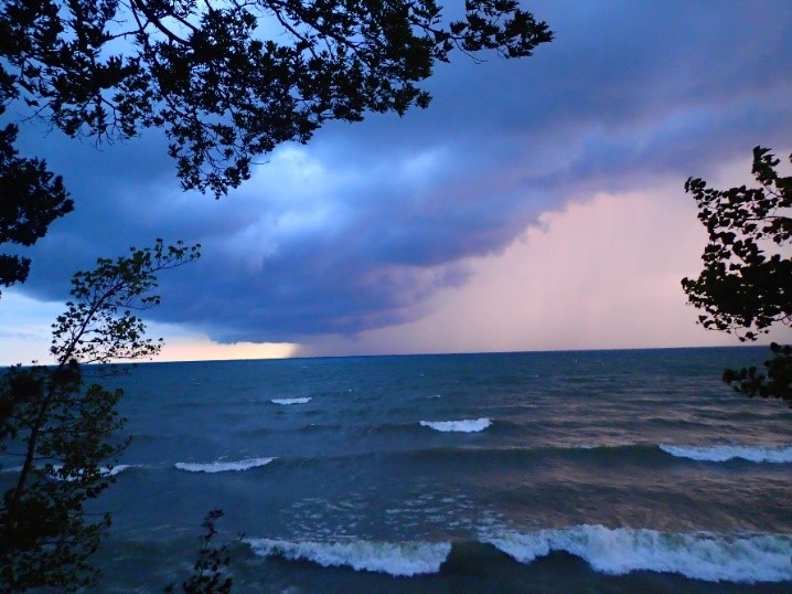
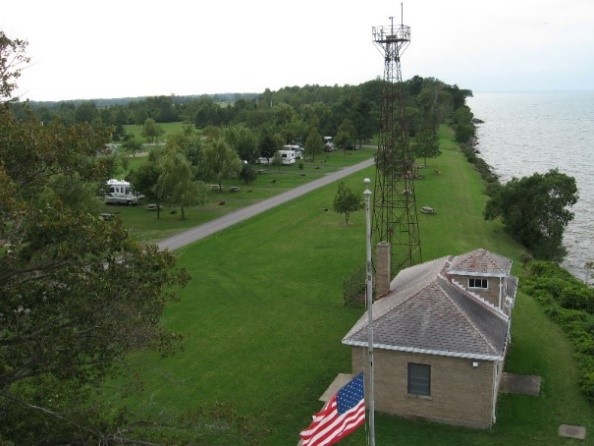
Golden Hill State Park, 9691 Lower Lake Road, Barker, (716) 795-3885 – This park contains Thirty Mile Point Lighthouse, built in 1875 to warn ships of a rocky shoal and shifting sandbar in Lake Ontario. There were several shipwrecks in the vicinity; the most famous being the HMS Ontario, a British warship that sank Halloween night in 1780. An active light until 1958, today the upstairs cottage is rented year-round and the foghorn building is now a visitors’ center with displays on the lighthouse and local maritime history.

There are three trails at Golden Hill, with the likely favorite being the scenic Red Trail which travels along the lakeshore and leads to Golden Hill Creek. Along the creek is an oak grove with trees up to 300 years old. Bald eagles are known to frequent this area, as well as great blue herons and wintering waterfowl. After crossing the creek on the footbridge, the trail branches off – east to the marina or west along the creek with stands of apple, beech and hop hornbeam trees.

The Red Trail travels along the lakeshore for continuing inland along Golden Hill Creek. (Photo Courtesy of Niagara Region Interpretive Office)

Find a trail map here.

Wilson Tuscarora State Park, 9691 Lower Lake Road, Barker, (716) 795-3885 – Established in 1965, the park on Lake Ontario encompasses 476 acres bordered by the east and west branches of Twelve Mile Creek. It has approximately seven miles of trails.

Nestled along the east branch of Twelve Mile Creek is the one-mile Interpretive Trail, which moves through several habitats, including wetlands, successional fields (a field transitioning to a forest), shrub lands, and ending in a mature beech-hemlock forest. This trail is best known for its spring wildflowers – notably white trillium, New York’s largest flowered trillium – that appear on the forest floor in May.

White trillium are found on the forest floor starting in May. (Photo courtesy of Niagara Region Interpretive Office)
The Interpretive Trail along Twelve Mile Creek, where pileated woodpeckers can be spotted. (Photo courtesy of Niagara Region Interpretive Office)

Find a trail map here.

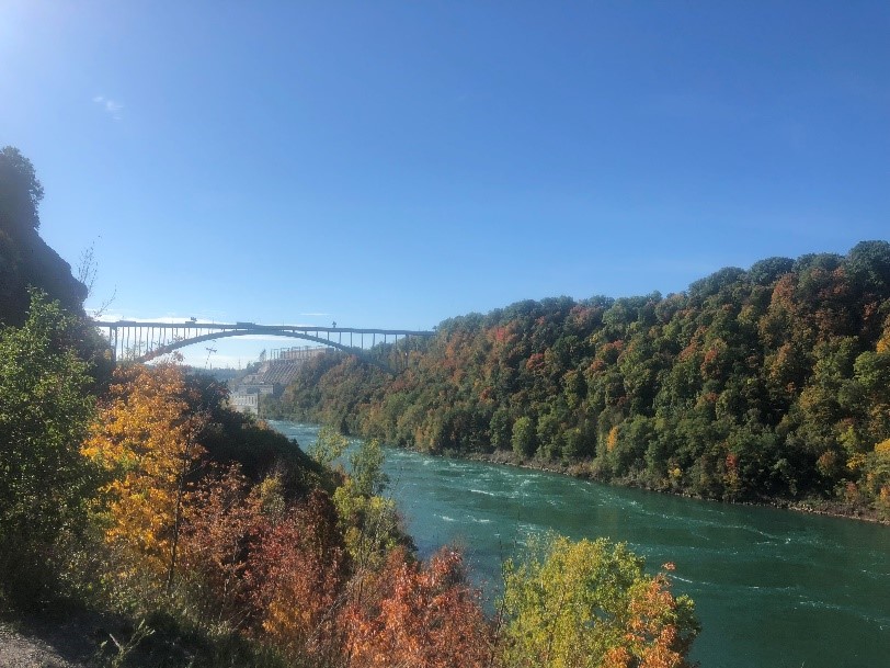
Earl W. Brydges Artpark State Park, 450 South 4th Street, Lewiston, (716) 754-7766 – Founded to promote the visual and performing arts, this park is on the lower Niagara River below the world famous falls. It contains two trails that are a part of the Niagara Gorge Trail System.

Trail 7, also called the Artpark Gorge Trail, takes a path through the Niagara Gorge, providing views of the Lewiston-Queenston Bridge, the New York Power Authority, and the vibrant blue green waters swirling in the lower Niagara River. Along this trail are seen fossils from the era of the Silurian Sea, before the time of the dinosaurs. After a climb around boulders and a waterfall view, a set of stairs leads down to the river’s edge to Trail 8, which is popular with fishermen who seek the river’s salmon or lake trout.

A view of the Lewiston-Queenstown Bridge from Trail 7 in Artpark. Below, a New York Power Authority hydropower plant is visible from the trail. (Photos courtesy of Niagara Regional Interpretive Office)

If the stairs are not taken, the trail traverses a shale slide and woods before emerging in a flourishing grassland ecosystem that connects to Trail 2 heading toward Devils Hole State Park.

Find a trail map here.

Get Out and Explore Other Regions in New York State Parks


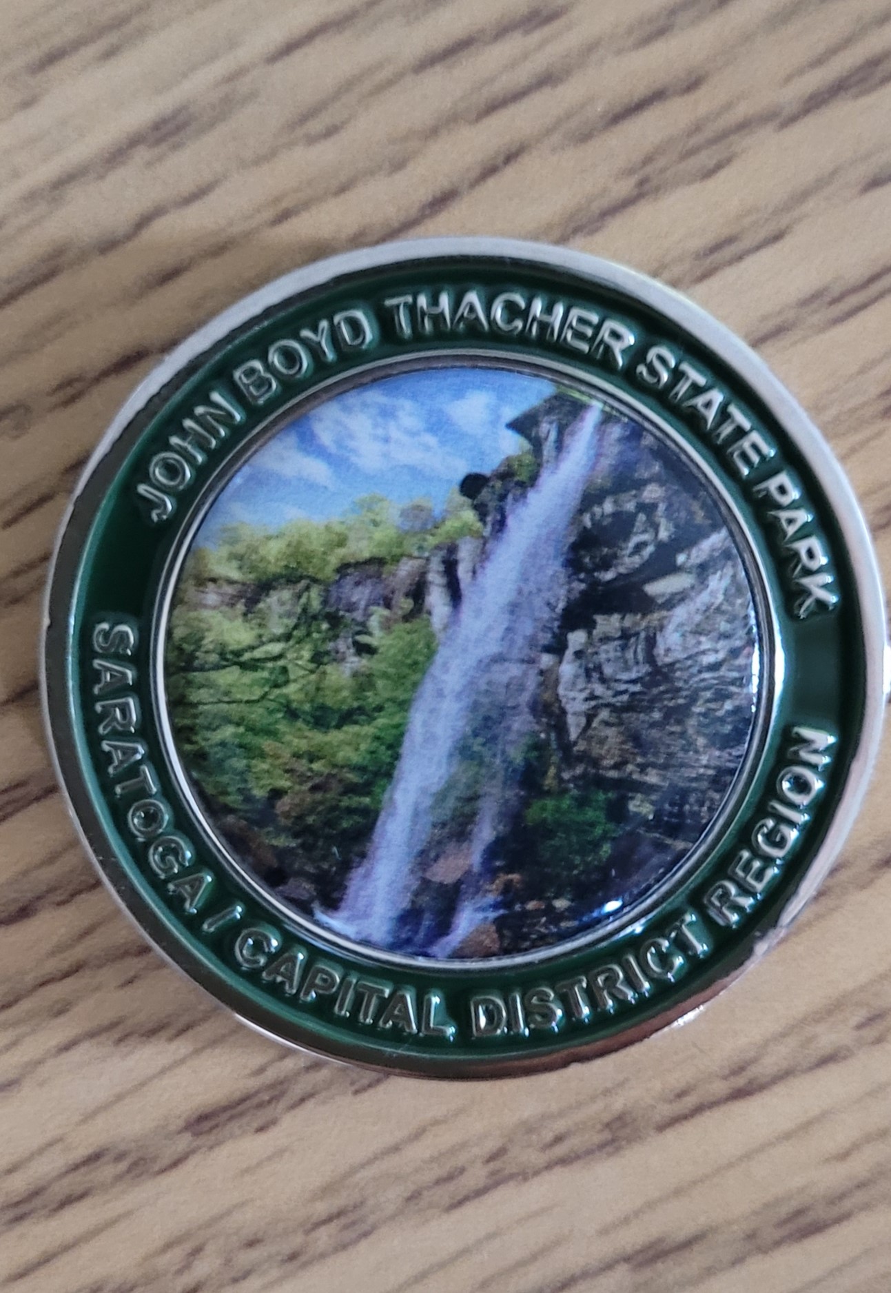
The “Get Out and Explore …” series outlines staff-recommended hikes in State Parks across the regions of New York, including GeneseeFinger LakesLong Island, Central, Palisades, Taconic, Saratoga/Capital and Thousand Islands.

Cover Shot – Thirty Mile Point Lighthouse at Golden Hill State Park.

Seek and You Might Find: Geocaching In NYS Parks

I am not stealthy. This is not new information, but I didn’t realize how sloppy I was at sneaking around until I tried geocaching—a worldwide game of locating some of millions of little hidden stashes.

This outdoor activity relies on the use of Global Positioning System (GPS) technology, where participants place caches of trinkets, also known as “hides,” in various places, and record locations with GPS coordinates to the website geocaching.com. Cache-seekers then use those coordinates with their own GPS devices to locate the caches, and can take some trinkets and leave some of their own for subsequent seekers to find.

And there are a lot of little hidden treasures out there. For example, the website above indicates there are more than 2,800 caches hidden around the Albany region.

On my first go at it, I found myself lifting low-lying tree limbs and creeping around bushes in search of tiny containers along a busy section of the Empire State Trail, the new 750-mile multi-use trail that connects New York City to the Canadian border, and Albany to Buffalo. While I was doing this, a woman in an SUV noticed me and I could tell I was acting a bit too suspicious for her taste. She stopped her car, watched me, and didn’t continue driving until I left that section of sidewalk.

After this inauspicious start, I was in awe of more experienced hobbyists, known as geocachers or cachers. After examining the map on the official geocaching app, it turned out there was a cache hidden close to my home. Strangers had been snooping around the area to try to find it and I hadn’t even noticed them! Luckily, the 2021 New York State Geocache Challenge is here this summer, so I will have plenty of time to hone my skills.

Volunteers and New York State Park workers have concealed more than 230 geocaches with items like stickers, toy cars, and figurines in 56 State Parks and Historic Sites in Central New York, the Saratoga-Capital Region, and the Hudson Valley. Adventurers who find at least 45 caches (at least 35 in a specific region, and up to 10 in either of the other two regions) will receive a geocache challenge geocoin representing the primary region.

The obverse of the geocoin for the Saratoga Capital Region.

The geocoins are trackables, each with a unique identifying number that can be activated online and then tracked as coins are located, reported and moved to new locations by subsequent geocachers.

So far, the geocoin that has traveled the furthest from a State Park is from the 2015  Saratoga-Capital District Region Geocache Challenge. Now settled outside Salt Lake City, Utah, the token (TB6Y60Y) has so far trekked 160,500 miles to such places as the Mediterranean island of Malta, Germany, the Kapaleeshwarar Temple in India, Japan, Israel, and nearly three hundred other places.

Some geocachers are nearly as well-traveled. Larry Eaton is the Saratoga-Capital region’s geocache volunteer coordinator and during his two decades, he has logged about 17,500 caches, with about 1,500 of those found in State Parks. Though this seems like a daunting number to some, Larry knows cachers who have found hundreds of thousands of caches.

Eaton and his companion, Sadie, out on the trail.

But most geocachers start with smaller beginnings. David Brooks is the education manager at the Schoharie Crossing State Historic Site and serves as the park’s liaison for this year’s Saratoga-Capital District Regional Geocache Challenge. As more geocaches came to his site, he became more interested in the hobby. He decided to try it with his son after being inspired by a volunteer at his historic site named Barbara, who used the hobby to spend more time with her son.

When putting out caches in the historic site, Brooks likes mixing the environment and history of Schoharie Crossing, which focuses on the history of the Erie Canal. One year, he and Barbara put created an innovative cache that involved a small boat on a pulley system.

Some geocachers take pride in creating such clever hiding places. Eaton said once a geocacher in the Capital Region built a replica of the Tin Man from The Wizard of Oz out of an old furnace and hid a cache inside of it. There are also different kinds of caches for folks to get creative with, including puzzle caches and different types of challenge caches that require specific skills and tasks to obtain.

A cleverly disguised cache made from an owl decoy.

All the State Parks geocaches that are part of the challenges are free to find and access, though there may be fees to enter the parks. To participate, you can download the pick up a passport in person from a park or historic site or find it on their website.

For passports, click on the name each region involved to download a PDF, which outlines which Parks contain the geocaches: Central, Saratoga-Capital and Taconic.

To find the caches, download the Geocaching app or follow the coordinates of the caches listed on the Geocaching.com website. When you find a cache, stamp your passport with the stamp inside each cache the turn it in to the state park indicated on the passport. Remember to leave the stamp behind for others that come after you. The challenge runs through November 11, 2021.

Stay on or near trails, take care not to trample vegetation, put everything back as you found it.

And please, don’t set up your own geocaches without checking with your Park manager first. State Park rules require that any geocaches in State Parks must be approved beforehand and follow rules to protect sensitive environmental or historic areas and public safety. Keep it safe, keep it fun! Happy seeking!


Cover shot – The reverse side of the 2021 New York State Parks Geocache Challenge. All photos by NYS Parks.

Post by Jessica Andreone, Environmental Educator, Central Region of New York State Parks.

State Parks Trails for All: Measuring Accessibility

For people with differing levels of physical ability, it can be difficult to know in advance whether a hiking trail might be too steep, too narrow, too soft, or otherwise not suitable.

Here at State Parks, we are working to help address that through something called the Universal Trail Assessment Process (UTAP). Developed in the 1990s by a Nevada-based company specializing in aiding differently abled people to engage in recreation, UTAP is a system of objective measurements taken at specific intervals along an unpaved trail to form an accurate picture of its difficulty, in terms of grade, width, surface firmness and cover.

UTAP is the creation of Beneficial Designs, whose founder Peter Axelson suffered a spinal injury in the mid-1970s. Axelson later went on to become a championship alpine adaptive skier and founded his company to design and fabricate adaptive recreational equipment for people with mobility impairments. The company also develops accessibility standards for ski areas, amusement parks, playgrounds and other outdoor recreation environments.

Parks is entering our third year of the UTAP program, having measured more than 19 miles of trails at 17 different State Parks in 2019 and 2020. It is a time consuming process done on foot with several hand tools, with measurements taken at least every 100 feet. That has meant nearly 1,200 individual measurement points have been recorded so far!

So if any hikers encounter Parks staff carrying a clinometer (a protractor-like device used to measure grade), a hand-held roller wheel (used to measure distance), a level, and a hand-held GPS unit (used to record locations), they have seen the UTAP process in action.

The trail measuring tools under the Universal Trail Assessment Program. (Photo credit – Beneficial Design)
Student Conservation Association member Tyler Stempsey measures trail accessibility at the Olana State Historic Site. (Photo credit – NYS Parks)

This year, a new wheeled “buggy” is being acquired by State Parks that will carry a laptop computer to make measurement recording faster. With the buggy, an entire mile of trail can be measured in about an hour, a big improvement over doing everything manually.

This work is being supported by a Recreational Trail Program (RTP) grant from 2019, with the project currently scheduled to run through 2022.

These thousands of measurements are meant to identify which Parks trails meet what is called Recreational Trail Accessibility Standards (RTAS), which State Parks adopted from the United States Access Board standards and United States Forest Service standards Trail Accessibility Guidelines. These standards set requirements for maximum trail steepness, width, surfaces, passing space, resting areas, trailheads, gates, and signage.

With such measurements, Parks will be able to publicize trails that already comply with RTAS and prioritize trail improvement projects that would increase trail compliance with RTAS.

A sample is shown here of how measurements and surface conditions developed through UTAP can be represented visually. This shows a steep pitch across a trail, called a cross slope, that results in a soft, damp trail surface with mud, a situation which would render that trail out of compliance with the RTAS requirements.

So far, trails identified as meeting these standards include the Upper Falls Lookout Trail at Letchworth State Park and the Awosting Falls Connector Trail at Minnewaska State Park Preserve.

There are also several trails that are close to meeting RTAS with minor modifications including: the Bog Trail at Chenango Valley State Park, the Beacon Hill Trail at Minnewaska State Park, the Bike Path at Schodack Island State Park, and the Green Lakes and Round Lakes Trail at Green Lakes State Park.

This map shows trails in State Park showing where UTAP measurements have been made. (Photo Credit – NYS Parks)

Work is currently under way to improve the Green Lakes trails (park is #3 on the map above) so it meets standards.

More information on the UTAP assessment process and standards specific to State Parks and the trails examined so far, as well as an interactive version the above map, can be found here.

Once the measurement data is compiled and finalized, Parks will be able to provide a listing of accessible trails, as well as focus future improvement efforts on trails close to meeting accessibility standards.

The data we are collecting will also allow Parks to create detailed trail access information signs, which would provide visitors at trailheads with vital information such as slope, surface cover, distance, clearance, and elevation gains.

An example of a trail sign based on measurements of grade and cross slope taken under the UTAP system. (Photo Credit – Beneficial Designs)

The goal of the UTAP program is to make Parks trails more inclusive to all, regardless of ability. If you have a favorite trail that could be assessed for accessibility, let us know in the comments!


Cover Shot – Parks staffer Sean Heaton assesses trails at Minekill State Park in Schoharie County. (Photo Credit – NYS Parks)

Post by Victoria Roberts, GIS/Accessible Trails Technician, NYS Parks