Tag Archives: kayaking

Celebrate a Centennial At Allegany State Park 1921-2021

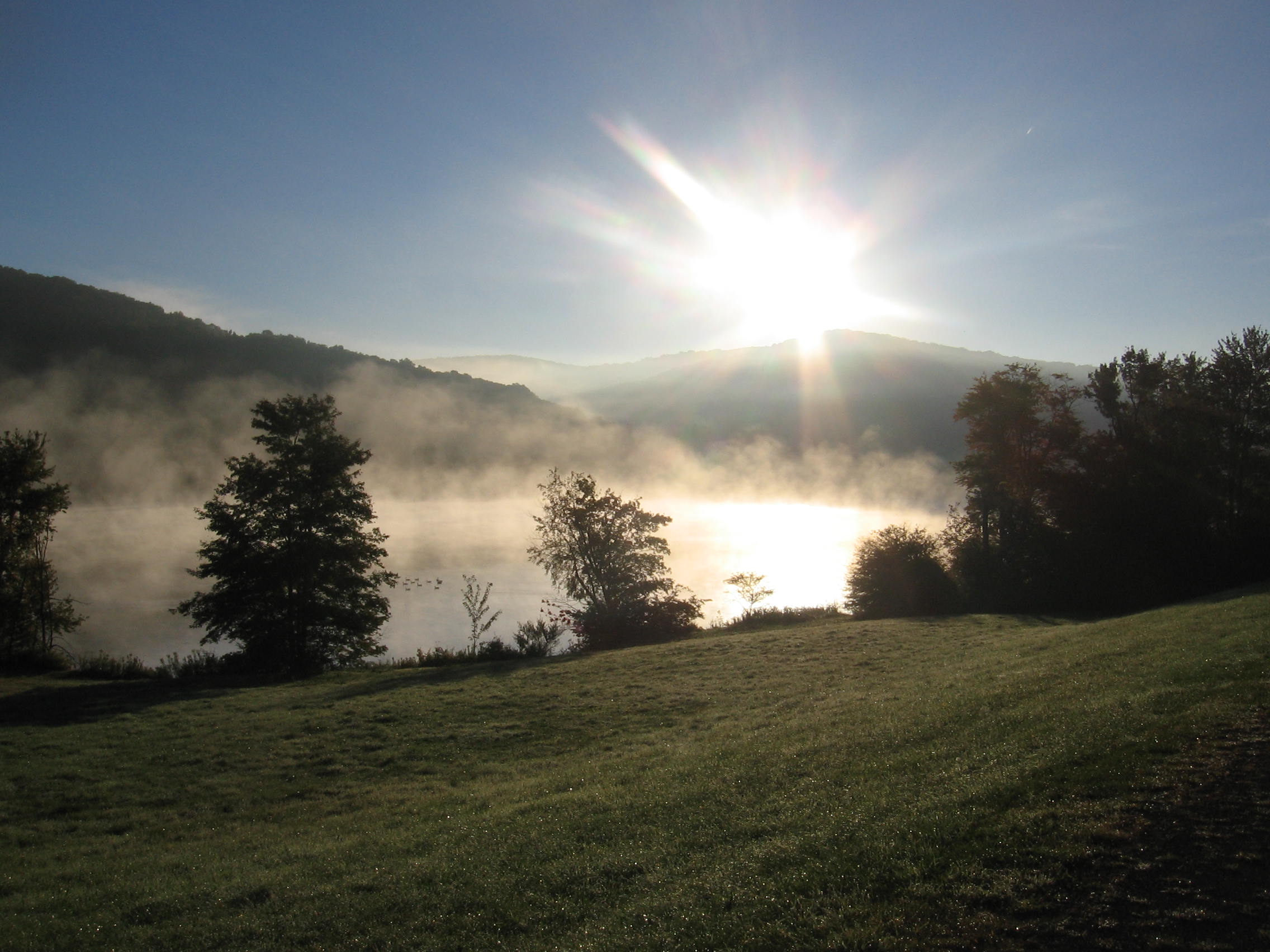
A century ago this week, thousands of people flocked by car and even horse carriage to remote, wild and forested hills in southwestern New York’s Cattaraugus County, near the border with Pennsylvania, to celebrate the opening of a new State Park.

According to a contemporary account in the local Salamanca Republican-Press newspaper, the visitors to the new Allegany State Park used a roadway that had been quickly built over the bed of a former lumbering railway in the region, which also had been part of the state’s 19th century gas and petroleum industry. With people coming in from as far as Buffalo, parking was quickly filled and some people walked a great distance to reach the dedication site, located near an old lumber camp.

Enjoying a picnic of sandwiches, doughnuts, cookies, coffee, iced tea and “milk in unlimited quantities” as reported by the newspaper, the crowd listened as Albert T. Fancher, a former state senator from the region and chairman of the new park’s commission, vowed that Allegany was poised to quickly grow, with areas nearby suitable for creation of a man-made lake and game preserve.

Another speaker, Franklin Moon, dean of the state college of forestry, said the creation of public parks like Allegany were the best remedy for “national irritability,” as he reflected some of the trepidation in the U.S. over the then-recent rise of Bolshevism in Russia.

Some of the Opening Day crowd at Allegany State Park on July 30, 1921.

Today, Allegany State Park welcomes more than 1,500,000 visitors a year to explore western New York’s premier wilderness playground, created thanks to the vision of Fancher, a petroleum industry executive who was a political force in Cattaraugus County for several decades, as well as Hamilton Ward, a Spanish-American War veteran who later founded the Erie County Park Commission and became New York State Attorney General, and Chauncey Hamlin, president of the American Association of Museums and founder of the Buffalo Museum of Science.

Fancher became the park’s first director until his death nine years later in 1930. Fancher’s original cabin, where he stayed at the park with his wife, is still there. Hamlin supported the creation of a science camp at the park.

Starting out in 1921 with about 7,100 acres purchased for $35,800 (equivalent to about a half-million dollars today, or about $70 an acre), Allegany State Park has grown over the years to encompass more than 64,800 acres and includes rare remaining portions of old growth forest with trees more than 100 years old that were left undisturbed during the area’s lumbering and petroleum boom that ran from the early 19th century to the 1920s. Park naturalists have mapped more than 5,200 acres of old growth forests of hemlocks and hardwoods, with the majority of that in the Big Basin area. Some experts believe this is the state’s largest contiguous track of old growth outside the Adirondacks.

Given the uncertainty of planning during the pandemic, the park is not holding a mass gathering like was done in 1921, but is hosting a virtual celebration on July 30th 2021 that will include a library of digital content. The park is also offering a summer series of interpretive programs highlighting the park’s history.

The virtual celebration and other digital content can be viewed HERE starting noon on July 30, 2021.

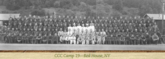
Additionally, a set of four self-guided interpretive booklets are for sale at the park which guide visitors to 100 points of interest within the park, and includes topics of interest such as early European settlement, the petroleum and lumbering industries, early ski facilities in the state, and the work of Civilian Conservation Corps crews during the Great Depression.

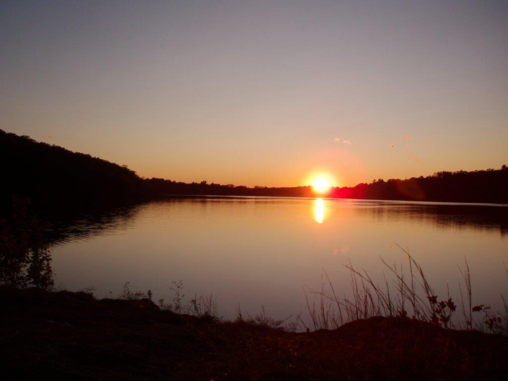
Now New York’s largest State Park, Allegany has a wide variety of recreational resources certain to foster tranquility and soothe any irritability. Due to its size, this sprawling park is divided into two distinct areas – Red House and Quaker Run. Red House has 133 campsites, 130 cabins, 16 full-service cottages, two group camps, five miles of paved bike paths, many miles of hiking and horse trails, and swimming at man-made Red House Lake, with boat rentals. Its historic Tudor-style administration building, completed in 1928, includes a museum of park natural history

A canoeist paddles past the park’s historic Administration Building.

One of the new cabins at Allegany State Park.

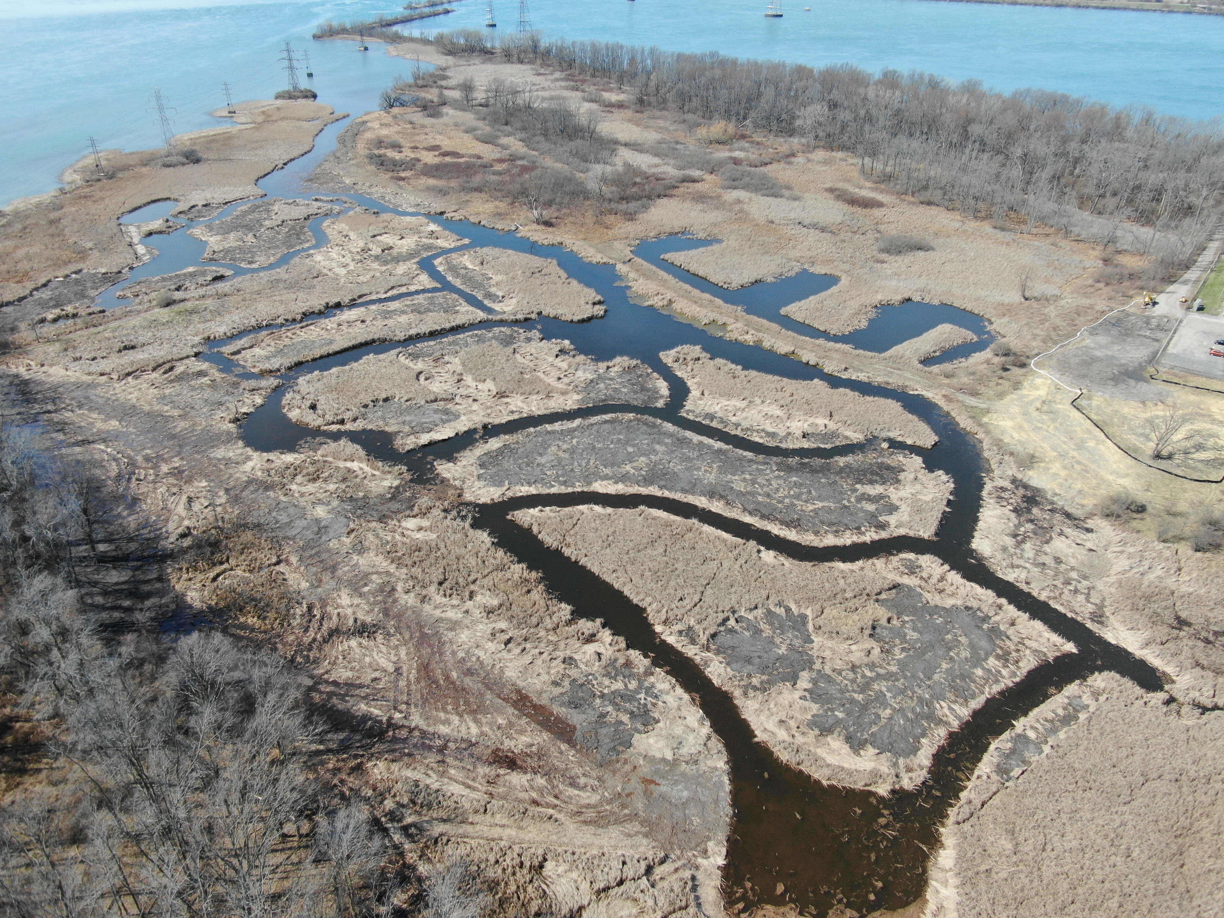
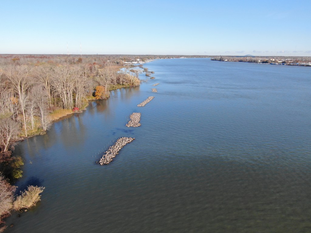
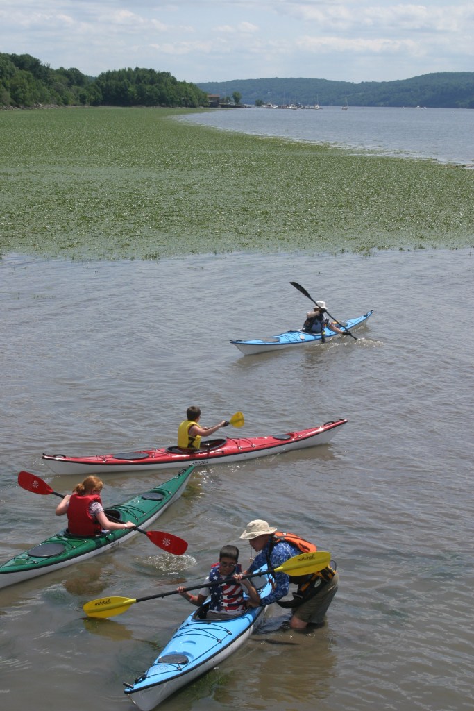
The Quaker Run Area has two lakes, 189 campsites, 230 cabins, 37 full-service cottages, two group camps, many miles of hiking trails and horse trails, swimming at Quaker Lake, a boat launch at the Allegheny Reservoir, which has 91 miles of shoreline and is popular for boating, fishing, kayaking and waterskiing. Named for Quaker missionaries and settlers who came to the area in 1798 at the invitation of Seneca Chief Cornplanter to assist with agriculture and education.

The new bathhouse at Quaker Lake.
A fishing pier on Quaker Lake.

Hikers have a wide variety of trails to choose from, with some highlights including:

  • Located on the park’s Quaker Run side, the Blacksnake Mountain Trail is one of the oldest trails in the park with a unique history. Parts of the trail follow the 1888 section of A&K Railroad (Allegheny & Kinzua), which is evident in the gentle slope on the north side of the three-mile loop. In 1933, the professors of the Allegany School of Natural History, also known as “the School in the Forest”, (located near Science Lake) mapped out a hiking trail they officially named the “Nature Hiking Trail” to conduct their field studies with their students.  It was later renamed “Blacksnake Mountain Hiking Trail” in 1980 after Governor Blacksnake, an Iroquois Indian chief for the Seneca Nation of Indians, who allied with the United States in the War of 1812. The trail crosses several streams with new bridges, and a short steep climb leads to mature black cherry trees estimated to be between 100 and 130 years old. Cucumber magnolia, tulip trees and hemlock are other trees of interest along the way. This is a favorite trail for spring wildflower lovers. Trillium, Dutchmen’s breeches, squirrel corn, and spring beauties are just a few of the ephemerals that announce the changing of the seasons. Near the top of the trail, look for a granite milestone marker which represents the border of New York and Pennsylvania, where you can put a foot in each state.
  • Bear Paw Hiking Trail is named after a style of snowshoe used by Native Americans and was originally designed as an interpretive snowshoe trail in 2015 by park naturalists. The 2.4-mile trail starts at the rear of the Summit Area parking lot. Look for brown numbered markers which highlight unique flora such as ground cedar, various hardwoods, and lowbush blueberries. Halfway along Bear Paw, at the end of the loop, hikers will be treated to the masterfully built Stone Tower, an Allegany State Park landmark, constructed by the Civilian Conservation Corps in 1934. The tower offers beautiful views of large open valleys, the city of Salamanca and Red House Lake. The second half of the trail traverses the south side of the ridge, through beech and maple forests and into a meadow. Depending on the time of the year, hikers may get to sample low bush blueberries or wintergreen growing in this area. The last section has a short, steep incline that adds a bit of challenge. Bear Paw ends at the Summit Warming hut.
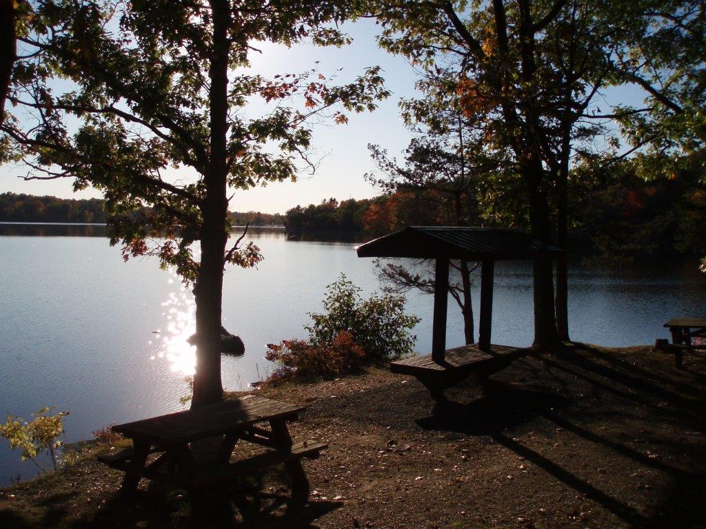
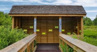
  • The 5.2-mile Robert C. Hoag Bicycle Path is named after the former Seneca Nation President and was dedicated in June 1990. Starting at the Red House entrance of the park, the path passes old apple trees and large stands of spruce and Scotch pine, along with many varieties of hardwoods, shrubs and wildflowers. The most used part of the path is around Red House Lake, where a 3.4-mile trail offers the potential to spot such wildlife as beaver, muskrat, great blue heron, and many species of waterfowl. Spurs off the trail lead to the Red House Wetland Interpretive Complex, Beehunter Cabin Trail and Camp Allegany. Several benches are located along the way to relax and enjoy the surrounding beauty.
  • Work on the new Quaker Multi Use Trail began in the summer of 2020 between the Taft cabin and the Quaker General Store. The second phase is in the final design stages and will continue the trail to Quaker Lake Beach.  Once complete, the trail will offer five miles of accessible paths winding though woodlands and fields along ASP Route 3 and Quaker Lake, including several scenic crossings of Quaker Run.

For birdwatchers, Allegany State Park contains a Bird Conservation Area, which provides breeding and migratory stopover habitat for forest-interior species such as Swainson’s Thrush, Blackburnian Warbler, and Scarlet Tanager. Of the 75 neotropical migratory songbird species that breed in New York, 64 have been observed within the park. The park supports a large breeding population of Osprey and one of the largest breeding concentrations of Cerulean Warblers found in New York, both of which are state species of special concern. The BCA also provides habitat for other state-listed species, including Bald Eagle (threatened), Northern Goshawk, Red-shouldered Hawk, Cooper’s Hawk, and Sharp-shinned Hawk (all species of special concern). Find a map of the BCA here.

A birdwatching blind in one of the park’s wetland areas.

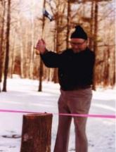
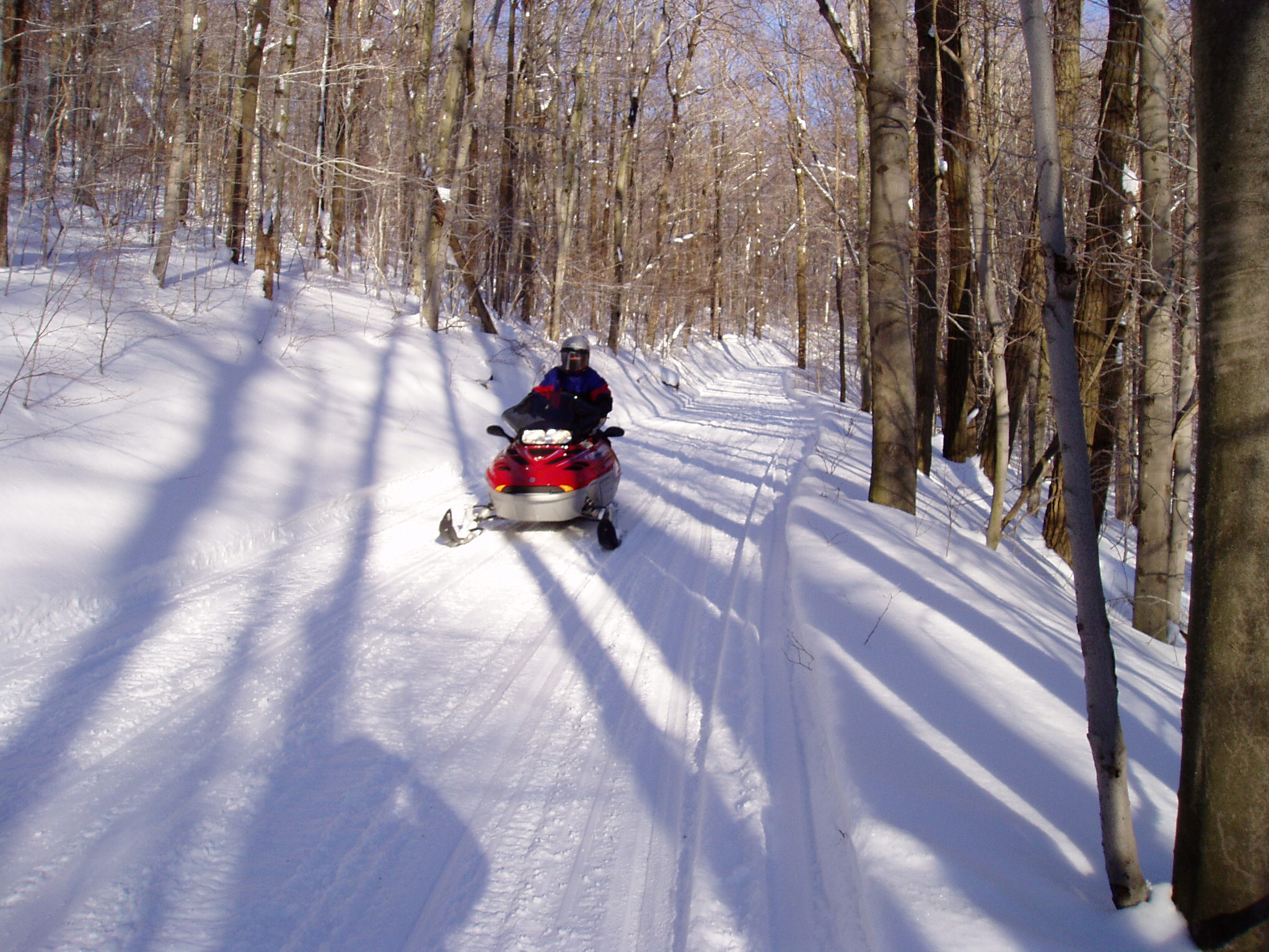
During the winter, the Art Roscoe Cross Country Ski Area boasts 26 miles of groomed cross-country ski trails. The area is named for an early park forester and ski advocate who later became assistant park manager and worked there from 1928 to 1968, earning the nickname “Father of Skiing” in western New York. For other winter sports enthusiasts, the Quaker Run and Red House areas also have a combined 90 miles of snowmobile trails.

Art Roscoe uses an axe to cut the ribbon to open up the new cross country ski trail network in 1972.
With 90 miles of snowmobile trails, Allegany State Park is popular with sledders.

Allegany also was the site of numerous fire towers, where observers would watch for signs of wildfires in the forests. One of those 60-foot towers, built in 1926 at the 2,365-foot summit of South Mountain, was restored and reopened to the public in 2006, and now offers a spectacular view of Red House Lake and the surrounding area.

The fire tower at the South Mountain summit offers panoramic views of the region.

For another gorgeous view, the Stone Tower, built between 1933-1934 by crews from the Civilian Conservation Corps, stands at 2,250 feet and overlooks the city of Salamanca. On a clear day, the view can stretch for up to 20 miles.

CCC crews also helped establish the park as a regional center for skiing, building a downhill ski center and two ski jumps, which allowed for competitions that would draw thousands of spectators through the 1970s, when the jumps were closed.

Top, one of the Civilian Conservation Corps crews stationed at Allegany State Park. Below, the Stone Tower that was among the projects built by CCC members.

Allegany also has a unique geological and natural history compared to elsewhere in the state. The park is part of a geological region called the Salamanca Re-entrant, which is the only area in New York that was never reached by glaciers during the last Ice Age some 12,000 years ago. This gives the region its distinctive soils, topography, surficial geology, and flora and fauna.

The well-known “Thunder Rocks” in the park’s Red House area may appear to casual observers to be some of the massive boulders scattered throughout much of the state by  Ice Age glaciers but this unusual “rock city” is actually bits of ancient inland seabed created some 400 million years ago, and revealed through geological uplift and erosion.

Thunder Rocks are sections of an ancient inland seabed that has been exposed through geological uplift and erosion.

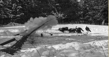
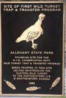
Wild turkeys, now widespread throughout New York, owe that comeback to Allegany State Park, the Regional Park Commission, and the Conservation Department. These birds were largely absent from the state by the beginning of the 20th century, due to overhunting and habitat loss, but in the 1940s, a small population of birds had come into the park, likely from Pennsylvania to the south. From the 1950s to the mid-70s, wild turkeys in the park were live trapped by wildlife officials, who used net-firing cannons to safely capture the birds, which were then taken to the Catskills, Adirondacks and elsewhere in New York state to reestablish the birds in the wild. Some turkeys were even sent to other states in the Northeast and to Canada as part of wildlife restoration efforts there.

All this only begins to scratch the surface of the park’s fascinating history and what it has to offer. So, in honor of the venerable park’s centennial and its next century to come, plan a visit to explore. Interactive maps of  Allegany State Park can be found here and here.

Above, wildlife managers fire a net from a cannon to trap wild turkeys as part of restoration efforts in New York and throughout the Northeast. A plaque now marks the location of the first efforts.

Cover Shot – A colorized historic postcard of Thunder Rocks in Allegany State Park. All photos by NYS Parks.

Post by Brian Nearing, Deputy Public Information Officer, NYS Parks

Early morning mist rises from Quaker Lake.

State Parks Strengthens Niagara River Island Ecosystem

Just upriver in Erie County from Niagara Falls State Park lies New York State’s third largest island. Home to more than 20,000 people and split by Interstate-190, Grand Island is 28 square miles and divides the Niagara River into east and west branches.

Industry and commerce dominated this river and its shoreline for more than a century, leaving a legacy of water pollution, fish unsafe to eat, and loss of wildlife habitat so extreme that in 1987 the U.S. Environmental Protection Agency (EPA) declared the entire 36-mile river an Area of Concern.

That federal listing set the stage for years of remediation efforts by New York State to clean up the river and shoreline. And now, it has led to State Parks, working with several partners, to begin the next chapter in healing the river – the restoration of several wetland areas of habitat along Grand Island critical for many fish and bird species that rely on the river for survival.

Grand Island is in the Niagara River between Buffalo and Niagara Falls.

These projects focus on two State Parks on the island – the 895-acre Buckhorn Island State Park on the northern tip, a nature preserve which has some of the island’s best remaining marshland wildlife habitat, and the more-developed, 950-acre Beaver Island State Park on the southern tip.

With funding support from the EPA under a plan finalized in 2018, Parks staff have finished two habitat restoration projects at Grand Island and two more are under way this season.

At Beaver Island in the south, offshore rocky reefs have been added in the river to an area called East River Marsh to protect the shoreline from further erosion caused by boat wakes and wind. Thousands of native plants have been planted by hand to provide important habitat for fish and other wildlife.

In the north, Buckhorn Island has one of the largest remaining cattail marshes on the Niagara River. At a place called Burnt Ship Creek, contractors hired by Parks have created open water channels and “potholes” in the marsh to provide pathways needed for fish such as Northern Pike to feed and spawn. The new open spaces also allow sheltered nesting sites for such secretive marsh birds as the threatened Least Bittern, which prompted the conservation group Ducks Unlimited to partner with State Parks for this restoration project.

Habitat restoration projects on Grand Island by New York State Parks and other entities are shown on this map. Buckhorn Island State Park is at the northern tip of the island, and Beaver Island State Park is at the southern tip.
Completed habitat restoration project at Burnt Ship Creek at the northern tip of Grand island near Buckhorn Island State Park.

This season, parks crews are working at a place called Grass Island, which is not actually an island at all, but rather an area of shallow water filled with cattails and other aquatic plants, both above the water and submerged. Sometimes also called Sunken Island, Grass Island is just east of Buckhorn Island State Park across from the city of Niagara Falls.

In addition to cattails and other plants visible above the water, Grass Island is also made up of many acres of submerged plants, predominantly a species known as water celery or American eel grass. This plant provides food and cover for several types of fish, including the Muskellunge, the state’s largest freshwater sportfish, which spawns among the eel grass each spring. The Upper Niagara River is one of state’s most important habitats for this fish.

Above the water, many species of waterfowl and marsh birds use the island for nesting, feeding and nighttime cover. Pied-billed Grebes, a threatened species in New York, nest and raise chicks there in the summer. During the fall migration of Purple Martins, the birds will roost in the cattails by the thousands.

Grass island, as seen in a drone photograph. On the above map, Grass Island is at the top right of Grand Island.

Together, Grass Island forms a 20-acre ecosystem designated as a protected wetland by the state Department of Environmental Conservation (DEC). While Grass Island provides some of the most important habitat in the Niagara River above the falls, this area has been steadily shrinking in recent decades due to wave erosion caused by boat wakes or wind. Between 2007 to 2018, Grass Island shrank by more than a third, losing an estimated 1.5 acres of its above-water vegetation.

Use the slider bar to show the decreasing size of Grass Island. The left image is from September 2018, while the right image was taken in August 2007.

This season at Grass Island, Parks contractors are constructing underwater rock reefs similar to those successfully constructed at East River Marsh. Once the reefs are finished, crews will add submerged tree trunks with the roots still attached (called rootwads) to provide underwater structure needed for good fish habitat. Also, large numbers of native wetland plants will be planted behind the protective rock reefs to expand the area with dense vegetation.

Also this summer, similar rock reefs, rootwads, woody material, and native plantings will be installed along the shoreline at Buckhorn Island State Park to restore and protect coastal wetlands. And finally, another similar project is in the works for the shoreline along the new West River Shoreline Trail at Buckhorn.

These projects join other ongoing conservation efforts at Grand Island being done by DEC, and the Buffalo-Niagara Waterkeeper, a not-for-profit conservation group. Find a FAQ on the projects here.

Buckhorn Island State Park is also a listed Bird Conservation Area, with its marsh providing important nesting habitat for threatened species such as Least Bittern, Northern Harrier and Sedge Wren. The marsh serves as a feeding, resting and breeding area for ducks, coots, moorhens, and rails. Common Tern find suitable habitat for foraging here. Additional birds of interest include a variety of species of ducks, herons, coots, moorhens, and rails. Spring and fall migrations along the Niagara River corridor can bring large numbers of gulls to this site.

Some of the birds of Grand Island known to be in the Bird Conservation Area.

Gorge-ous Gulls of the Niagara in Winter

The Niagara River is well-known as an international destination for its tremendous waterfalls, which form spectacular ice formations during the winter. Perhaps a lesser known fact, however, is that the river is also a critical haven for migrating birds during this time of the year. Gulls, in particular, are a common sight along the Niagara,…


Together, these wetland restoration projects at Grand Island aim to maintain and strengthen this urban island ecosystem in a river that fuels the spectacular waterfalls only a few miles away that draw millions of visitors each year.

If a visit to Niagara Falls is in the works, consider also making a trip to Buckhorn Island State Park and Beaver Island State Park, both of which have car-top boat launch sites, to see this part of Niagara River and witness some of the efforts to help restore it. Please remember that these are sensitive ecological areas and habitats for secretive wildlife, so be respectful and take care when visiting these special places.

As always, whenever hiking, or in this instance, more likely paddling, consider “Leave No Trace” principles to minimize your impact on the environment. Learn more on how to practice “Leave No Trace” by clicking on this previous post in the NYS Parks Blog.

Beaver Island State Park: This park has a half-mile sandy beach for swimming, adjacent 80-slip marina with both seasonal and transient boat slips, fishing access, car-top boat launch, multiple canoe/kayak launches, about four miles of bike and nature trails, nature center, playgrounds, picnic areas, athletic fields, horseshoe pits, an 18 hole championship disc golf course, an 18-hole championship golf course. In winter, visitors can snowmobile by permit, cross-country ski, snowshoe, sled or ice fish. Waterfowl hunting is allowed in-season by permit.

Also located in the park is the River Lea house and museum, home to the Grand Island Historical Society and built by William Cleveland Allen, cousin to Grover Cleveland who visited the family farm on several occasions.

Buckhorn Island State Park: For a wilder experience, try this less visited park, which is a nature preserve of marsh, meadows and woods that mark the last vestige of once vast marshlands and meadows that bordered the Niagara River. There are nearly two miles of nature trails for hiking, biking, and cross-country skiing. The preserve includes two launches for kayaks and canoes. There is ongoing restoration to re-establish wetland cover and water levels and increase the diversity of native flora and fauna. This effort aims to increase public access with more non-intrusive trails, overlooks and bird watching blinds.


Cover shot: A work barge involved in habitat restoration at Grass Island. All photos courtesy of NYS Parks.

Post by David Spiering, Great Lakes Habitat Restoration Coordinator, NYS Parks

Targeting a Watery Invader at Lake Taghkanic

Thanks to a “hands-on” kayak mission against invasive water chestnut this summer at Lake Taghkanic State Park, this popular lake ought to be clearer of these aquatic invaders for next paddling season.

And timing is critical in dealing with water chestnuts, floating plants which can rapidly spread to create dense patches that can clog a lake, damage the native ecosystem and make it hard for canoeists and kayakers to paddle.

Water chestnut (Trapa natans) is one of the several Aquatic Invasive Species (AIS) that are monitored in hopes of reducing abundances in state waterbodies. Widespread in the state, water chestnut is now found in 43 counties.

The aquatic invasive water chestnut can be found in 43 countries across the state. Counties shaded green are known to be infested. (Photo Credit – NYS Department of Environmental Conservation)

Invasive species, like water chestnuts, are organisms that are non-native to an area, typically causing harm to human health, the economy, and the environment. If left unchecked, AIS can spread quickly from one body of water to another, threatening biodiversity and potentially impeding recreational opportunities.

The key to battling the an infestation discovered this season at Lake Taghkanic in Columbia County was to remove hundreds of plants before going to seed. Water chestnuts are annuals, and thus must reseed themselves each year to propagate.

Anyone who has been out along a shoreline and came across a strong, spiny, star-shaped brown nut-like “fruit” or seed pods has found a water chestnut nut. Bearing four sharp spines or points, each nut contains a single seed that can produce 10 to 15 stems.

Anchored to the water bottom, the plants have submerged, feathery brownish leaves on stems that can grow up to 15 feet long. On the water’s surface, these stems come to an end with a floating rosette, or circular arrangement of leaves. The leaves are triangular shaped with toothed edges.

These clusters can float on the surface due to buoyancy bladders connected to the leaf stems, forming dense floating mats that can be nearly impenetrable. Each rosette produces about 20 of the hard nut-like fruits in the late summer and early fall which, after dropping from the plant to the water bottom, lay in sediment over the winter to sprout in the spring

You can imagine the concern when water chestnut showed up in Lake Taghkanic State Park, a park focused on boating, swimming, water sports and beach activities. Controlling water chestnut at the park was vital to support these recreational opportunities as well as the native fauna of the lake, including one rare species known there.

Due to the fast-growing nature of water chestnut, it is important to control newly introduced infestations as soon as possible, also known as “early detection, rapid response” (EDRR). If left unchecked, patches of water chestnuts can spread prolifically.

A map of Lake Taghkanic, showing the area of water chestnut infestation highlighted in green. (Photo Credit – NYS Parks)


Water chestnut is an invasive species of high concern for many waterbodies in New York State, having potential ecological, economic and health impacts. The plant can form dense mats on the water’s surface, greatly impacting the organisms below. These layered mats can block sun and oxygen from submerged plants, resulting in a die back of native species and fish populations. Recreation is also inhibited by dense patches of water chestnuts, making it difficult to swim, boat, kayak, or fish. The spiny nuts often drift to shore, creating an additional hazard for pets and people to step on.

Effective control of water chestnut depends largely on preventing seed formation. By manually removing the plants in mid-summer before mature seeds can drop, managers can halt such potential reproduction.

At Lake Taghkanic, staff from the Office of Parks, Recreation and Historical Preservation, state Department of Environmental Protection, and Capital Region Partnership for Regional Invasive Species Management (PRISM) worked to rapidly respond to the infestation. This team of ten individuals were well-versed in the control of invasive species, and several team members had prior experience manually removing water chestnut.

Held July 16, the pull was led by Matt Brincka (NYS Parks Invasive Biologist), with other participants including Falon Neske (NYS Parks), Lindsey DeLuna (NYS Parks), Lauren Gallagher (NYS Parks), Rebecca Ferry (NYS Parks), Kristopher Williams (Capital Region PRISM), Lauren Mercier (PRISM), Lauren Henderson (PRISM), Steven Pearson (DEC), and Catherine McGlynn (DEC).

The team navigated to the water chestnut infestation in kayaks, maintaining social distancing and wearing face coverings when necessary. When manually pulling water chestnut plants, it’s important to reach as far down the stem as possible to pull the root system from the bottom sediment.

At Lake Taghkanic, water chestnut was mixed in among lily pads, presenting a challenge to pulling by hand from kayaks. (Photo credit – NYS DEC)

Once pulled, the water chestnuts were collected in garbage bags, drained, and weighed. Within a day, more than 100 pounds, or from 300 to 400 plants were removed! The information was recorded for upload to iMapInvasives so that the infestation of water chestnuts can be tracked.

iMapInvasives and You Can Too!

You may have heard the name iMapInvasives before, but if you have not been exposed to this magnificent mapping tool, I recommend you check it out! iMapInvasives, New York State’s online invasive species database, could be compared to a modern-day hero. A robust and helpful resource- thanks to its devoted observers. Citizen Scientists, Educators, Students…

Afterward, the team also surveyed the 3.7 mile lakeshore to ensure there were no other visible water chestnuts. Parks staff developed a control plan that will include monitoring and hand-pulling at Lake Taghkanic annually in order to deplete the seed bank (seeds can remain viable for several years at the bottom) and keep the problem at bay.

Over the years, NY State Parks has organized and participated in several invasive species pulls, additionally having a seasonally staffed AIS Strike Team and Boat Steward program. Reader more about these programs in the posts below.

Selkirk Shores State Park has been one focus area for State Parks staff in efforts to control a water chestnut infestation. In 2015, about 240 bags of water chestnut were removed there, visibly reducing the biomass by 40 percent. During the 2016 season, another 12.5 tons were pulled out. This removal resulted in a decrease in abundance of water chestnut during from 2017 through this year, further maintaining the value of this State Park.

Prompt invasive species responses, such as water chestnut pulls, work towards ensuring recreational enjoyment and preserving natural ecosystems in our parks. Early detections of invasive species are often reported by patrons.

The next paddling season may be months away, but remember: If you believe you have found a new population of an invasive species at a State Park, tell a park staff member or reporting it in iMapInvasives will ensure that swift eradication action is taken.

Protecting Our Waterways

You may have seen them in a park near you, these super heroes and heroines in disguise. Since 2008, New York State Parks have deployed Invasive Species Strike Teams. These Strike Teams conduct invasive species surveys and manually remove non-native invasive plants in areas of significance. The goal is to protect native plant and animal…

Protect Our Waters: Don’t Pick Up Hitchhikers!

Now that summer is here, when you head to the boat launch for a day on the water, you will often run into a friendly face in a blue vest. These are Boat Stewards! Boat Stewards are educators who share their knowledge of invasive species and how to prevent boats from spreading such species into…

Cover shot: Members of the removal team spread out in kayaks on Lake Taghkanic.

Post by Lauren Gallagher, State Parks Water Quality Unit

Get out and explore … the Taconic Region of State parks

With more than 2,000 miles of marked trails across New York, the State Parks have something for hikers of every ability. That includes the beautiful Taconic Region, located on the east side of the Hudson River and stretching through Columbia, Dutchess, Putnam and Westchester counties.

Palatial estates, highland trails, Hudson River vistas and woodland campgrounds define some of the exceptional treasures to be found in a region with 14 parks and eight historic sites.

If you are new to hiking or have not yet explored hikes in this region, named for the Taconic Mountain range that runs north-to-south along the state border with Connecticut, Massachusetts and Vermont, here are some suggestions to start you out.

As with all hikes, there are few things to remember beyond carrying a mobile phone. Wear sturdy yet comfortable shoes or boots, bring water and snacks, and perhaps carry a camera, to capture what you see. Be mindful of hikes on steep terrain or that go near cliff tops. Having a small first-aid kit available in case of emergency is never a bad idea.

Hiking poles are useful, and can transfer some of the stress of hiking from your knees and legs to your arms and back. And use a trail map, which is available online at each park website at https://parks.ny.gov/ and at the main office at each park. Check the park’s individual website to see if its maps can be downloaded to your iOS Apple or Android device.

These maps include Park facilities such as parking, park offices, nature centers, campsites, and boat launches in addition to the location, name and distance of each designated trail in the park. For some facilities, data is available as a Google Earth KML file or a map is available to download to your iOS Apple and Android mobile devices in the free PDF-Maps app. Learn more

It never hurts to know how long a trail is and how long it ought to take to finish it. Since daylight is not an unlimited resource, tossing a flashlight or headlamp into your backpack is a good form of insurance, should you unexpectedly find yourself on the trail as dusk approaches.

Westchester County

Rockefeller State Park Preserve, 125 Phelps Way, Pleasantville,  (914) 631-1470: With 55 miles of crushed stone carriage roads that crisscross the former country estates of petroleum tycoons John D. Rockefeller and William Rockefeller, the preserve offers a wide variety of hikes for any ability, with the carriage trails offering a consistent, predictable surface. After parking at the preserve office, follow the markers for Brother’s Path, a 1.1-mile loop around scenic Swan Lake. Heading south on the Brother’s Path, there a connection on the right to the .9-mile Overlook Path, a gentle climb and a good place to spot Eastern Bluebirds and get a beautiful view of Swan Lake. The preserve is home to more than 180 different species of birds and 120 different species of native bees.

Maps here

Rockefeller State Park Preserve in Pleasantville.

Franklin D. Roosevelt State Park, 2957 Crompond Road, Yorktown Heights, (914) 245-4434 : This is a short hike in the woods on level terrain leaving to a small pond. From the parking lot for the swimming pool, take the white-marked trail, turning onto the blue-marked, 1.2-mile trail for Crom Pond. At the end, turn around, or continue on the orange-marked, .7-mile Mohansic Trailway through more woods before turning around.

Maps here

Franklin D. Roosevelt State Park in Yorktown Heights.

Putnam County

Fahnestock State Park, 1498 Route 301, Carmel,  (845) 225-7207: Hike, sunbathe and swim all at one location. Start at the Canopus Beach Parking Lot, where you can pick up the blue blazed AT Connector Trail from the north corner of Canopus Beach. A short 0.3-mile hike passing along the edge of Canopus lake will lead you to the famous Appalachian Trail. Turn right and take the white blazed AT trail northbound. A steep section of trail will lead you to a beautiful viewpoint over Upper and Lower Canopus lakes. Continue north and after one mile on the AT turn right and head south onto another blue blazed AT connector trail. A rolling 0.75-mile hike will lead you back to the Canopus Beach Parking Lot and all the other activities.

Maps here

The view from the South Taconic Trail, looking toward Mount Brace, at Taconic State Park in Millerton/Copake Falls.

Mills Norrie State Park, 9 Old Post Road, Staatsburg, (845) 889-4646: This park has a very scenic hike along the Hudson River. Turn onto Norrie Point Way and follow signs for the Marina, where you find signs for the White Trail. If you brought a kayak or canoe, you can put it into the river there. The White Trail is approximately two miles long and and leads to Staatsburgh State Historic Site, the elegant 65-room country mansion of Ogden Mills and his wife Ruth Livingston Mills. You can choose to take the White Trail back along the river, or the Blue Trail. Along this wooded trail you can view the historic Hoyt House and Carriage Barns. While at Staatsburgh, catch a view of the 148-year-old Esopus Meadows Lighthouse on the river. If you plan to visit by boat, the Mills Norrie State Park marina has 145 boat slips.

Maps here

Kayaking on the Hudson River in Mills Norrie State Park.

Columbia County

Lake Taghkanic State Park, 1528 Route 82, Ancram, (518) 851-3631: Start at the parking lot at the swimming beach, and pick up the white-marked Lakeview Trail, which goes about 5 miles around the lake but is not a loop. It can be hiked as an out-and-back by going either north or south on the trail, which is mostly level and good for all abilities.

Maps here

Picnic tables along the trail at Lake Taghkanic State Park.

There is a full list of activities this month at State Parks and Historic Sites in the Taconic Region. It can be found here

Keep an eye on the NY Parks Blog in coming weeks as we explore hikes in the ten other State Parks regions… Do you have a favorite to share?

Adventure Awaits At Allegany

What’s your idea of adventure? Is it something exotic like scuba diving, mountain climbing or bungee jumping? Perhaps something quieter, such as camping under the stars or exploring a stream in search for brook trout? Adventures can be big or small, but they all push us out of our comfort zones as we learn about new activities and exciting areas of our world.

Allegany State Park, known as the “Wilderness Playground of Western New York” is one such place where adventure abounds. With 65,000 acres of pristine forests, miles of trails, serene lakes and natural beauty everywhere, it’s hard not to find an activity to enjoy.

The Outdoor Adventure Series hosted by the Environmental Education and Recreation Department offers informative, hands-on, free clinics for all those want to be adventurous souls. Each program is led by an outdoor enthusiast who shares their knowledge and passion of their favorite activity. They bring their gear, suggest what you may need to get started and then let you try your hand at fly fishing, paddle boarding or geocaching.

Allegany State Park hosts several unique events throughout the year, such as Geobash, one of the biggest geocaching events around;  Raccoon Rally, a bike festival featuring both  road and mountain bike races  and the Art Roscoe Loppet cross country ski race. The Adventure series promotes these events by hosting a program about the sport or activity in the same month as the event to give people the chance to try a new sport or volunteer at the event. Remember it’s about getting people out, trying something new.

Maybe you’d like to have an adventure without many people around. Quiet water activities such as kayaking, fly fishing and paddle boarding are things anyone can do at any age.  Local shops such as Sportsman Outlet in Bradford, PA provide kayaks to try. Not only will they help you decide what kind of kayak you might like, they also advise you what gear you should take with you to be safe on the water, such as a life vest.  Adventure Bound on the Fly in Ellicottville, NY, introduces one of the newest sports – paddle boarding, and one of the most graceful – fly fishing to young and old giving all a chance to paddle on Quaker Lake or cast with finesse.

If it’s the woods that calls your name, programs such as mountain biking, cross country skiing, backpacking or camping might be more to your taste. Just Riding Along out of Bradford, PA, offers all kinds of mountain bikes – fat bikes, fast bikes and bikes with all the bells and whistles.  Find dirt on the Art Roscoe trails which become tracked cross country ski trails when the snow flies in December. The Allegany Nordic Patrol not only keeps skiers safe during the winter, but they help educate winter enthusiasts about the joys of gliding and sliding on skis through a winter wonderland of snow cover trees.

Camping has always been a favorite activity since the park was first founded in 1921. The first adventurous souls camped in old WWI tents on platforms. Today the education staff pulls out tents, hammocks, and backpacks of all shapes and sizes for even the youngest of explorers to get out in the woods. Staff also answers questions such as what to take, how to pack, and what to do if you see a bear – all important things to know when going out in the woods of Allegany.

The Outdoor Adventure Series covers a wide range of interesting activities for every season, from photographing fall colors, to snowshoeing under a full moon, to fishing for native trout, and paddling on a warm summer night watching the sun set across a lake.

No matter what you try, I agree with Amelia Earhart: “Adventure is worthwhile in itself”.

Be sure to check out the last two programs this year:

Wednesday, November 1, 2017 – 5:00- 7:00 – Summit Warming Hut – Night Hike- What’s in your Pack? Night hike on Bear Paw trail following a short program on the 10 essentials we should carry in our packs. Bring a flashlight or head lamp.

Wednesday, December 6, 2017 -5:00- 6:30 – Summit Warming Hut – Prepare for Cross Country Ski Season – Allegany Nordic will discuss everything you need to know about cross country skiing, from equipment selection to proper clothing.

These programs are open to the public and weather dependent. For more information, visit the Allegany State Park Facebook page or contact the Environmental Education Department at 716-354- 9101 ext. 236.

Post by Adele Wellman, State Parks