Humans aren’t the only species of animals that enjoy state parks. Park staff will occasionally find clues of what animals may live there, such as scat, a chewed branch, or a feather. But we don’t always get to watch out for wildlife to stroll on by, especially in remote parts of parks. The best tool for this job is a game camera. Park staff use these camera traps to ‘capture’ these animals in a safe, respectful way.
Park educators from across New York have put together a snapshot of what we’ve discovered. Now, you too can witness and enjoy some of our favorite remarkable wildlife encounters taking place here at our parks when humans are not present.
When quizzed about some of their best loved hikes in State Parks, our staff had to choose from amongst the hundreds of miles of hiking trails along shorelines, through mountains and open fields, overlooking lakes, rivers and gorges, and meandering through old growth forests.
Here are some of their favorites. (Note: trail maps can be found at each park’s website)
Mike’s favorite: Mine Kill State Park, located in the scenic and historic Schoharie Valley, is about an hour southwest of Albany. The park boasts almost 10 miles of trails, the most well-known being definitely the five-mile section of the Long Path. The Long Path (LP) is a 358 mile-long hiking trail running from New York City to John Boyd Thacher State Park just south of Albany. This particular section of the LP was designated as a National Recreation Trail by the Department of the Interior (National Park Service) in 2014 due to its unique flora and fauna, diverse history and incredible scenery. Along this stretch of trail, a hiker may wander past active bald eagle nests, the picturesque Mine Kill and Schoharie Creek, the historic Lansing Manor and its namesake, the 80-foot high Mine Kill Falls.
Pausing along the Schoharie Creek at Mine Kill State Park, photo by State Parks
Nancy’s favorite: The Indian Ladder Trail (0.40 miles long) in Thacher State Park near Albany is like a hike through geological history. You get an up close look at the 1,200 foot high limestone escarpment as you climb metal staircases to start (and end) your hike along the bottom of the escarpment. Layers of limestone, sandstone, and shale, lifted and eroded by wind, water, and other elements, formed the escarpment over 100 million years ago. Prehistoric people used nearby areas as hunting camps, possibly as early as 6,000 B.C. Native Americans traversed the escarpment via footpaths and logs (acting as ladders) between the Mohawk/Hudson and Schoharie Valleys, hence the name ‘Indian Ladder’ Trail. Along the hike, you can see waterfalls (if it’s not too dry a season), marine fossils, small caves, and stand near the crowns of mature trees growing below the escarpment. Best of all are the views from the Indian Ladder Trail, and the Escarpment Trail above, of surrounding valleys, the urban landscape, and further in the distance, the Adirondack Mountains of New York and the Green Mountains of Vermont.
A mother and daughter travel through time along the Indian Ladder Trail at Thacher State Park, photo by State Parks
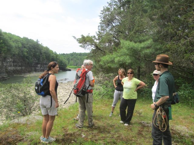
Nick’s favorite hikes at Minnewaska State Park Preserve in the Hudson Valley include the Lake Minnewaska Carriage Road, a two-mile gentle loop trail around the glacially formed Lake Minnewaska. It’s an historic carriage road left over from a Victorian Era mountain resort. This hike features many views of Lake Minnewaska, a peak at the Catskill Mountains from several spots, and views of the greater Hudson Valley. This hike is popular due to the lake (people love water!), the ease of access, and the rock perches and cliffs that overlook the lake and Hudson Valley.
A couple on Red Carriageway around Lake Minnewaska, adjacent to the parking area in New York’s Minnewaska State Park Preserve, photo by State Parks
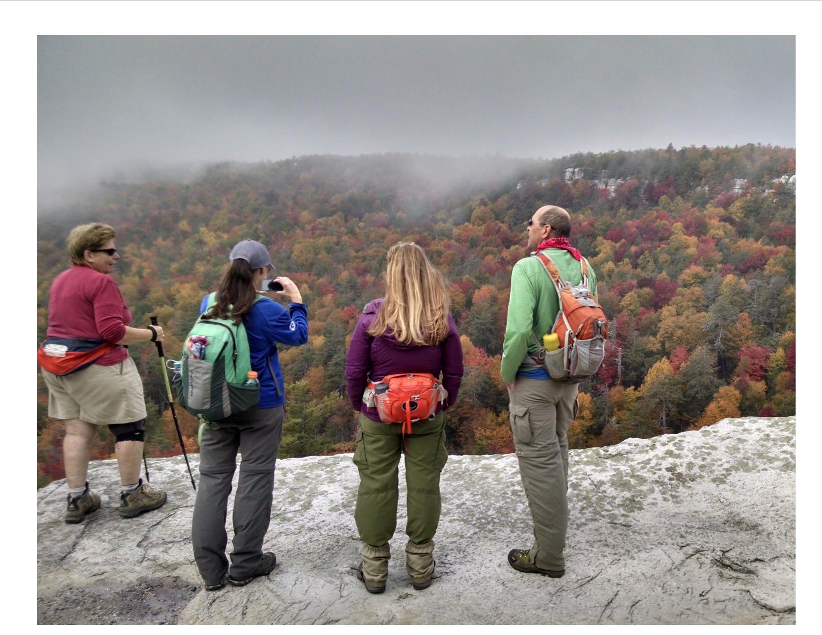
Nick’s other favorite hike is Gertrude’s Nose Trail, an approximately seven mile hike on a mixture of historic carriage roads and footpaths traversing some of the most rugged terrain in Minnewaska State Park Preserve. These footpaths are loaded with evidence (signs) of the last glacial event, featuring glacial polish, glacial erratics (large rocks deposited by glaciers), chatter marks (any of a series of grooves, pits, and scratches on the surface of a rock, usually made by the movement of a glacier(from Dictionary.com)), sharp cliffs and massive talus blocks (rock debris below a cliff face). This hike is very popular mainly because this cliff edge trail gives panoramic views of the Shawangunk Mountains along the way.
A foggy, fall day along the Gertrude’s Nose Footpath, photo by Duane Kolaya
Tom’s favorites: Green Lake and Round Lake Trails, located in Green Lakes State Park, are favorite hikes near Syracuse. They follow around the shores of these two glacial meromictic lakes. Meromictic lakes are lakes where there is no mixing of surface and bottom waters and they remain thermally (temperature) and chemically stratified (in layers) throughout the year. Other unique features of the lakes include their brilliant blue green appearance and the presence of “thrombolitic microbiolite marl reefs.” This basically means that a living organism is creating a rock out of material in the water. More specifically a cyanobacteria or algae is taking calcium compounds that entered the lake with groundwater seeping through the surrounding limestone bedrock and making it into a solid as part of cellular respiration. The United States Department of Interior designated Round Lake as a National Natural Landmark in 1975.
Green and Round Lake Trails are generally flat, 8-10 feet wide, and easy hiking trails. The full loop, including both trails, is approximately three miles long with benches located periodically for resting and enjoying the scenery. A swimming beach, playground and boat rentals are located at the north end of Green Lake. These trails are part of a 17-mile trail system in the park that also takes you through or to old growth forest, wetlands, grassland bird habitat, cliff edge overlooks, camping areas, a golf course, and connects to the 36-mile Old Erie Canal State Historic Park.
Strolling on the Green Lake Trail at Green Lakes State Park, photo by State Parks
Nicole’s favorite: As the largest State Park in the Long Island region, hiking at Connetquot River State Park Preserve can feel secluded even in the middle of densely populated Long Island. The beautiful scenery and diversity of life within the park make it her favorite hiking spot. Starting from the parking lot, the Greenbelt Trail (indicated by the white and yellow blazes) takes you directly to the fish hatchery, where you can get up close and personal with trout being raised. From there, the Red Trail can take you back along the Connetquot River to Main Pond. The Red Trail merges with the Blue Trail at the pond and the hike ends at the historic Grist Mill and Main House. Then it’s a short distance down the road back to the parking lot. This loop is a little over two miles but flat and even throughout, making it perfect for all age groups. Don’t forget to check in with the Nature Center at the Main House on the way out to find out about all of the amazing programs they have there.
Traveling along the Greenbelt Trail at Connetquot State Park Preserve, photo by State Parks
Molly recommends hiking at Wellesley Island State Park in the Thousand Islands Region. A favorite is to start at the Minna Anthony Common Nature Center and hike along the Eel Bay Trail (1.1 miles) to the Narrows Trail (0.45 miles). From there you can head back the same way or follow along another trail to loop back to the Nature Center. Sitting on the exposed granite outcroppings and watching the St. Lawrence River Eel Bay and passing glacial potholes are highlights of this hike. The Narrows is a narrow water passageway located between Wellesley Island and Murray Isle connecting South and Eel Bays. Along the Narrows Trail you can watch boats pass through the channel and see a variety of birds while picnicking on an open rock area. These trails are generally easy hiking but have some steeper rock climbing areas. Don’t forget to check out the Nature Center!
Checking out the trail map at Wellesley Island State Park, photo by State Parks
FORCES stewards Nick and Adriana recommend two hikes in the Finger Lakes Region.
Buttermilk Falls State Park is a located in the heart of the Finger Lakes to the south of Cayuga Lake and has much to offer avid hikers, families, and visitors to the area. Hike the Rim and Gorge Trails together for a 1.5-mile loop, or hike each separately. Starting either trail from the lower parking lot will require a strenuous uphill walk (Rim Trail) or climbing of a long staircase (Gorge Trail). The Gorge Trail has much to offer and you will encounter many waterfalls, and beautiful rock formations along the 0.65 mile trek up the gorge. Mosses, liverworts, and ferns coat entirety of the gorge, providing a vivid green walk that is topped by a hemlock hardwood forest along the ridge. As you come out of the gorge, you will cross a bridge to take the 0.82-mile Rim Trail back to the parking area. This walk takes you through a beautiful hemlock hardwood forest filled with eastern hemlock, chestnut oak, and witch hazel, along with many other species. This loop can be done in about an hour, but more time may be needed for taking in all the sights along the way. Hiking these two trails as a loop is a relatively easy hike after you complete the initial stairs, or uphill climb.
Along the trail at Buttermilk Falls State Park, photo by State Parks
The Upper Loop in Robert H. Treman State Park is a one mile round trip on sections of the Gorge and Rim Trails. The trail is situated above Treman Gorge and offers spectacular views of the many waterfalls including the 115-foot Lucifer Falls. The trail begins at the upper section of the park (the Old Mill Parking area) at the entrance to the Gorge Trail and takes visitors through the upper gorge. The trail highlights the scenic beauty of the gorge, amazing rock formations, stone bridges, and the many water features along Enfield Creek through the ravine. The trail takes you to the top of Lucifer Falls and then down the side. At the bottom is a wooden bridge over the stream that will take you to the Rim Trail and the second portion of the hike. This begins with a climb up the “Cliff Staircase” – it is the most difficult section of the loop but it also offers some of the best views in the park. At the top is an overlook of Lucifer Falls and then a moderate downhill slope back to the upper parking lot. Multiple overlooks from high vantage points make the trail perfect for photo ops and for viewing the gorge below. Although the hike is short, some visitors may find to be strenuous due to the elevation change and the many staircases.
Visitors pause at Robert H. Treman, photo by State Parks
This weekend, try one of these hikes or find your own ‘best-loved hike’ in a park near you.